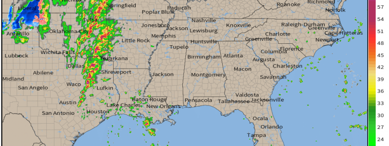
Significant Severe Weather Possible Today
Yesterday, Armando covered today’s expected severe weather nicely in his blog. Today I’m merely going to give a few last minute updates with the most current data before the event begins.
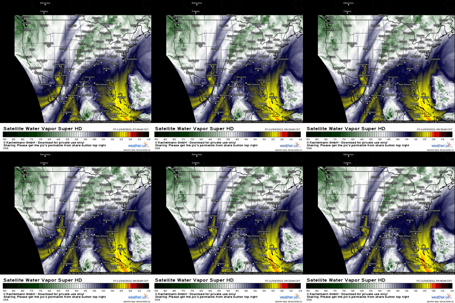
The trough in question is easily visible on the water vapor loop this morning. We can see it digging and then taking on a more neutral tilt over western Texas. Additionally, we can clearly see the moisture transport out in front of it. The stage is being set for severe weather.
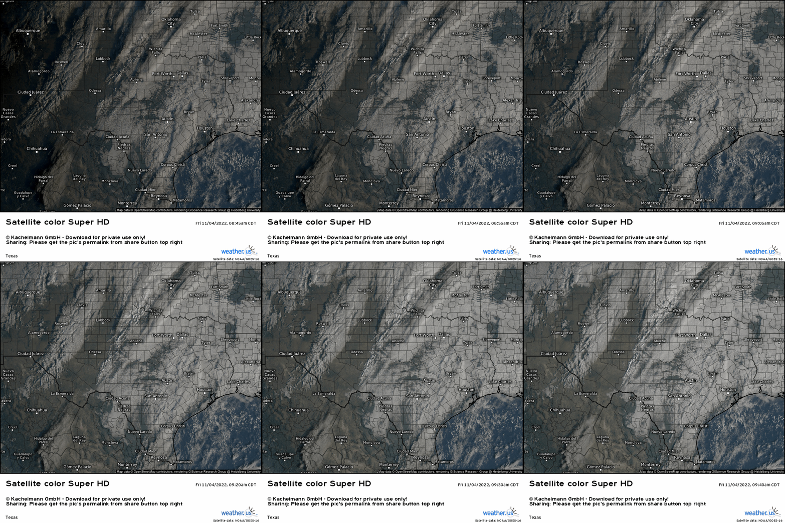
Additionally, if we hop on over the visible satellite view, broken cloud cover is present over the area in question. This means destabilization is likely underway.
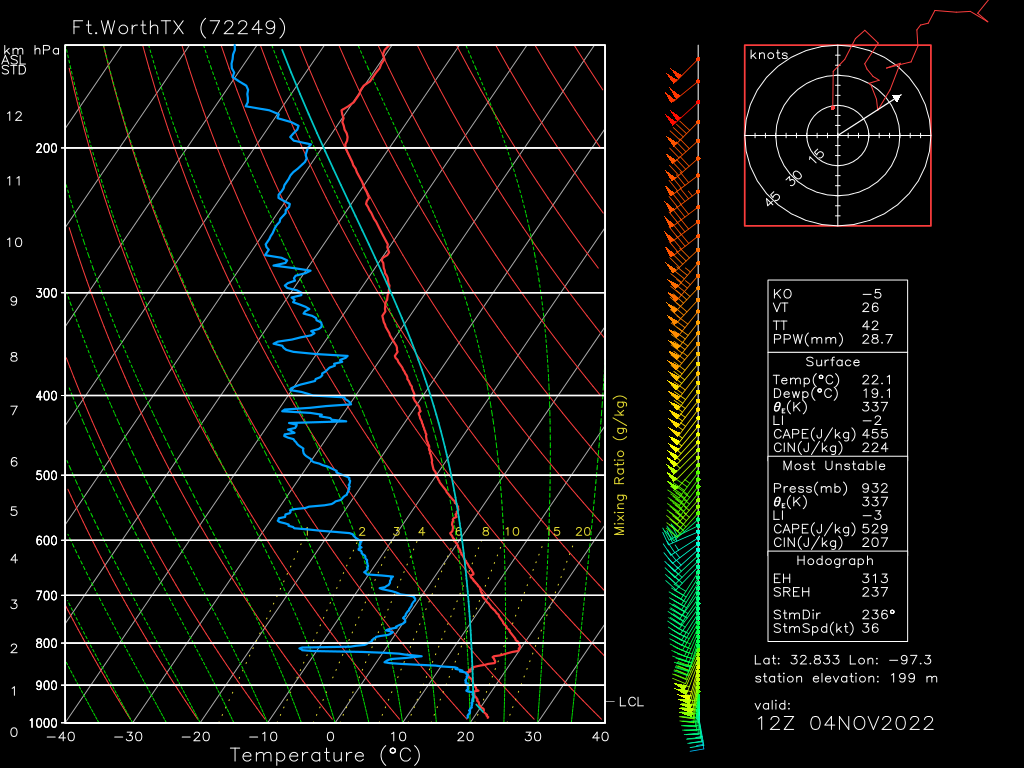
An observed sounding from the Dallas/Fort Worth this morning, valid at 12z, shows a stout cap in place. The broken cloud cover will allow for daytime heating to slowly chip away at the cap. Additionally, moisture streaming in from the SSW will aid in eroding the cap as well.
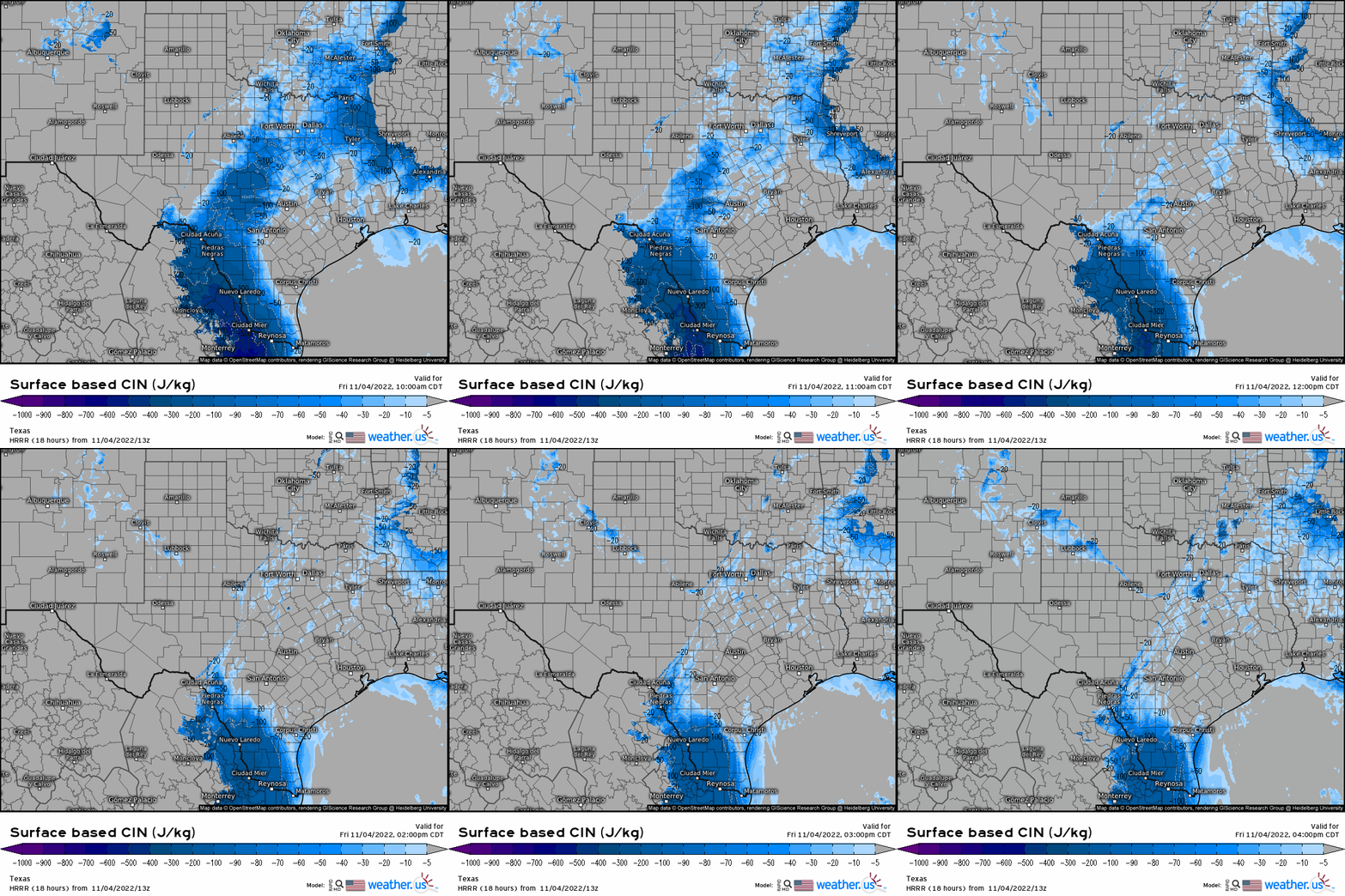
Models generally suggest that, with heating, moisture, and the approach of the front, the cap will erode by mid-afternoon.
Going back to the sounding for a moment, if we take a look at the wind profile, we can see winds backing from the SE at the surface. Good directional shear is already in place. As the low-level jet cranks up throughout the day and a mid-level jet streak approaches, speed shear will also be extremely favorable.
In simple terms: the atmosphere is in a good position to produce some significant severe weather later.
I spent some time doing my own analysis based off the HRRR this morning. In my opinion, due to the placement of the 500 mb jet streak, placement of the LLJ and it’s jet streak at 850 mb, location of the best instability, and the overall deep layer shear profile, I would surmise that the best chances for significant severe weather exist in a line from Fort Worth to Austin, generally east of the I-35 corridor, and then northeastward toward the AR/TX/LA border. This more or less lines up with the SPC outlook as well.
Now, that’s not to say no one else in the surrounding areas will see severe weather. That’s not how it works. I’m just pointing out that this area is where the highest quality ingredients overlap and potential is greater.
Everyone in Eastern Texas, Eastern Oklahoma, Southeast Kansas, Southwest Missouri, Arkansas, and Louisiana should be weather aware today as you all have at least some ingredients for severe weather. Often, mesoscale features that aren’t easily predicted can enhance the threat for smaller areas. So, if you live in the aforementioned regions, you’re on deck and need to be prepared.

Convective initiation is expected as we slide into the afternoon hours. All hazards are on the table.
Discrete supercells that form in the open warm sector ahead of the convective line will bring the most potent threat – damaging winds, large hail, and strong tornadoes. However, the convective line, or QLCS, may also pack a punch as it moves into more favorable ingredients. The threat will persist into the after-dark hours further east, but is expected to diminish some as it encounters more stable air further east.
Simply put:
Be weather aware today in this region. If your area is under any color on the SPC map, you have some risk of severe weather and need to be prepared. Have a plan to shelter ready to go in case you need it and have multiple ways to receive warnings. Keep an eye on the forecast from your local NWS and tune in to your local broadcast meteorologists for up-to-date info. They’ve got you today.
Stay safe!


