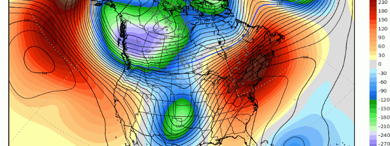
An Anomalous Height Dipole For The U.S.
It’s certainly one thing to see an anomalous ridge prevail across one region of the U.S.; however, it’s another thing when a ridge-trough pattern form an anomalous dipole within the same domain (i.e. west coast to east coast). We’ve seen the pattern change of trough west, ridge east since the last ten days of October. This appears to continue through early November. The ridge west, trough east has overall been very persistent, so a “break” was certainly welcomed for more important reasons such as getting precipitation out in the west! Heading into this weekend, we’re going to likely see this height-dipole peak in intensity approaching both equally greater than two standard deviations in terms of magnitude. At 500mb, you can see how anomalous the trough is out across the Pacific NW Sunday into Monday, while equally as impressive is the mid-level ridge off the Southern New England coast!
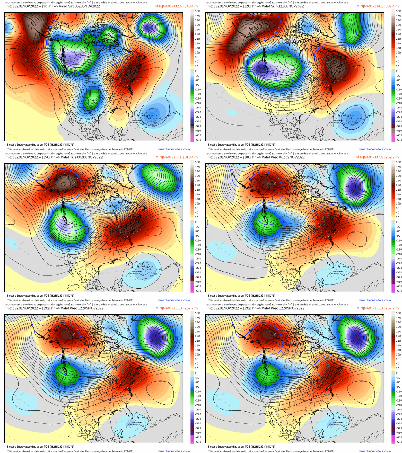
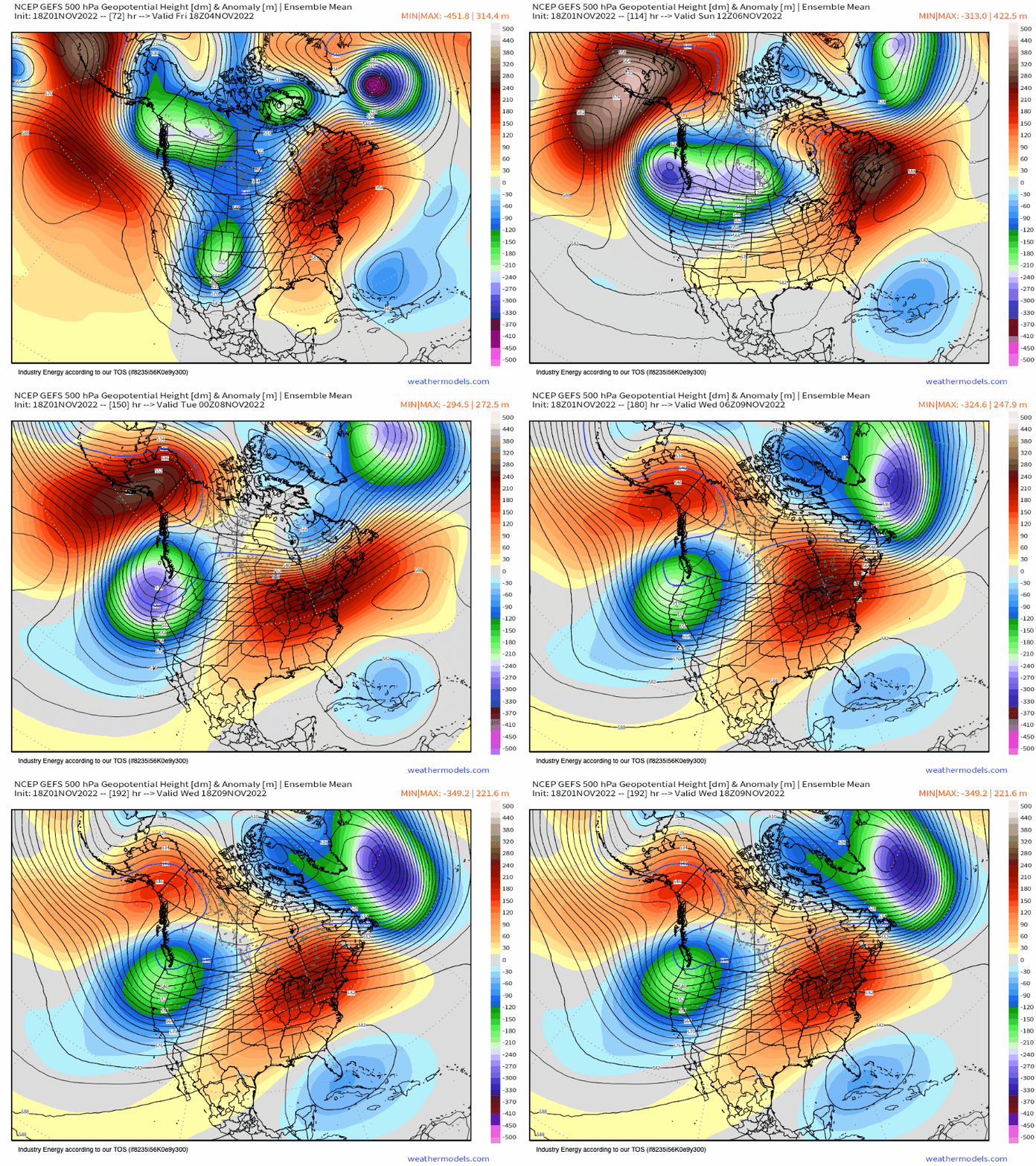
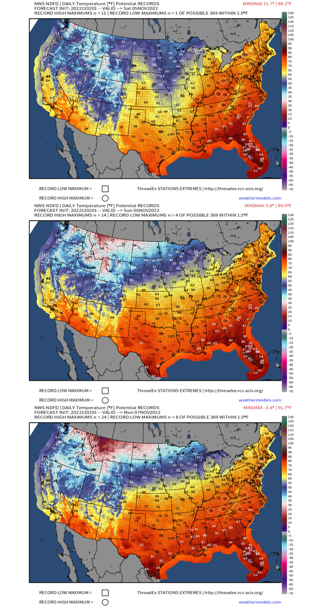
The anomalous trough and ridge will render record temperatures for their respective regions with record highs likely from the Ohio River Valley and into the Northeast, while daily record high’s (in terms of how cold they’ll actually be) will fall across the West Coast from Northern California on north. This is bound to occur this weekend and into early next week.
At 850mb, this looks even more impressive. Across British Columbia and into the Pacific NW, we’re going to see below average temperature anomalies exceeded 3 standard deviations from average. This type of pattern by the way will bring the first “big snow” of the season to the higher mountain ranges of the Intermountain West and West Coast, while also bringing in much needed precipitation! On the flip-side, greater than or equal to near 2 standard deviations will be seen with the positive heights, east of the Great Lakes and Ohio River Valley.
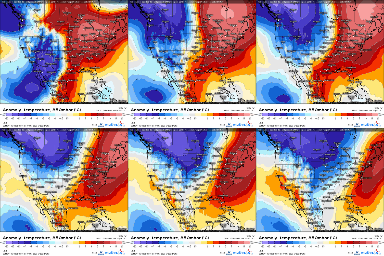
Don’t be fooled as this pattern won’t hold for much longer, but we’re going to see a “step-down” process unfold gradually as we progress deeper into November and we’ll see this current pattern moderate. Nonetheless, it’s going to be quite anomalous this weekend from the top of the atmosphere to the bottom in terms of heights and temperatures!


