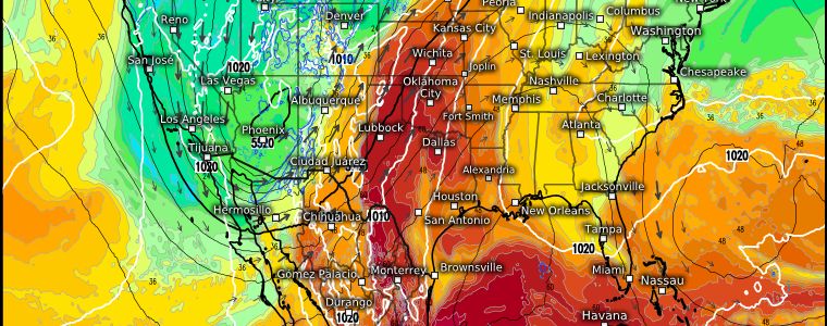
Second Severe Season In Full Swing
Severe weather lovers/chasers, this forecast is for you!
…And those who have severe weather anxiety, don’t worry, I’ve got you too.
I’ve been cautiously watching this potential set-up for about a week now. I’m confident enough in the possibilities to write about it in today’s blog. The set-up I’m referencing is a potential multi-day severe weather event.
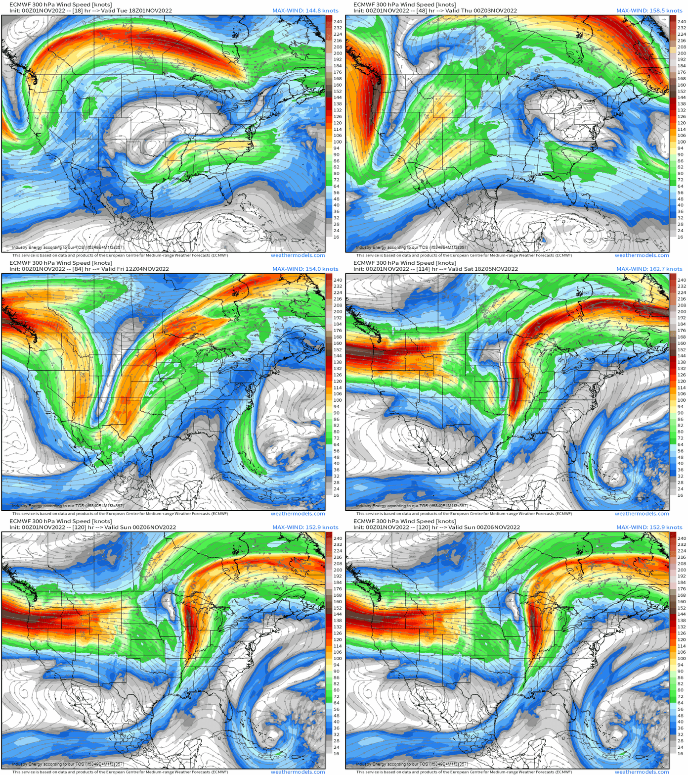
A trough coming ashore in the Northwest will amplify, digging deep into the Southwest as it moves slowly eastward later this week. It has the potential to provide us with two days (Thursday and Friday) of severe weather. Depending upon its evolution and available ingredients, a third day (Saturday) could be on the table, though it appears to be a chance for more isolated severe weather at the moment.
But let’s start with Thursday and Friday.
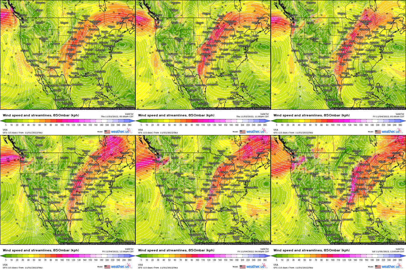
The surface low associated with the system will be located far up north, along the US/Canada border. As the low descends the Rockies and deepens some, the low-level jet will crank up in response. Gulf moisture will then have a speedy pathway northward.
The timing of the influx of moisture is an issue, however.
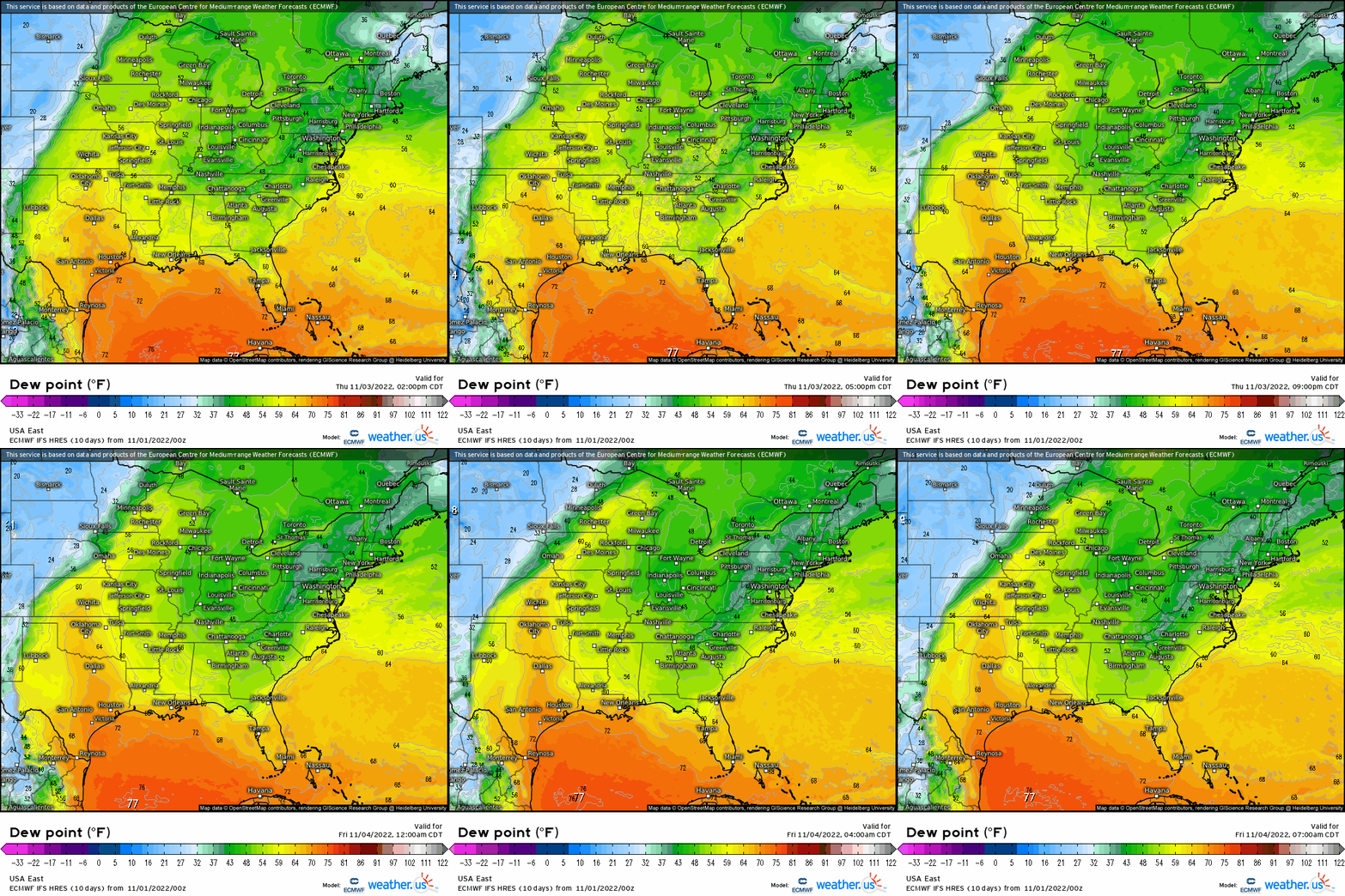
The LLJ doesn’t really get going until the evening hours. Consequently, quality moisture doesn’t begin arriving until well after dark. Thursday’s event will be a nighttime threat.
Watch the loop above again. As the timeline progresses, you can see the dry line in the western part of the Texas panhandle start to sharpen. The moisture gradient becomes much tighter. Around the 10 pm (central) time frame, it becomes very tight. Once this occurs, storms will begin to fire off of the dry line as it moves slightly eastward.
Exact timing isn’t nailed down yet and probably won’t be until later tomorrow, but we do know that this will be an after dark/overnight event.
Let’s take a look at a sounding.
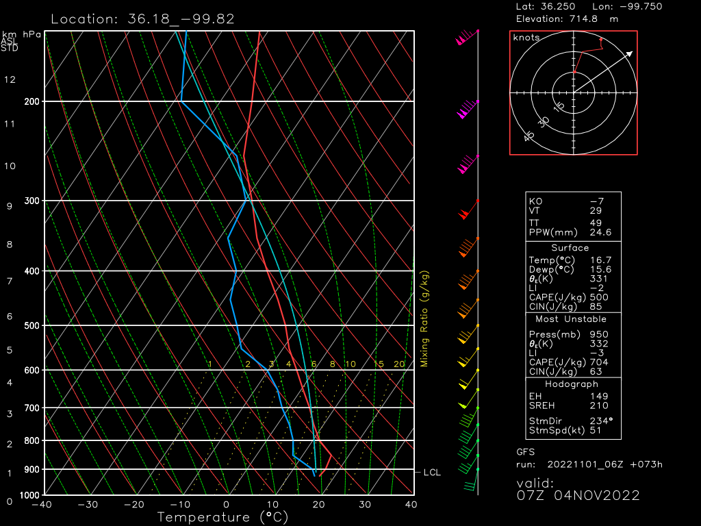
This particular sounding is taken from the southeastern Texas panhandle, near the Oklahoma border. This is from the GFS, which is a little less enthused about the quality of the available moisture than the ECMWF is.
This sounding tells us a few things:
- A cap is expected to be in place. We’ll need forcing in the form of a dry line/cold front to initiate storms. Discrete cells are possible, especially early in the event as the cap breaks slowly.
- We have ample shear, both speed shear to organize storms and directional shear to produce rotation. Supercells capable of tornadoes are possible.
- CAPE, though elevated, is likely enough to support fairly robust updrafts. Large hail is a possibility.
As mentioned, this sounding is from a global model (GFS) with a larger resolution. It may miss out on key details a mesoscale model (NAM or HRRR, etc) will pick up on as we come into range. Therefore, things like timing and exact area at risk of the most intense weather will shake out over the next day or so.
What you need to know now:
- Severe weather is likely Thursday and it will be an after dark/overnight event. At this time, those from the southern part of the Texas Panhandle into Central Kansas carry the greatest risk for severe weather.
- This forecast will evolve over the next day or so as more details come into focus. Keep checking up with the latest forecast if you’re in the area projected to be impacted.
- As of now, all hazards (wind, hail, and a few tornadoes) are on the table for the defined areas.
- Prepare! Have a plan to shelter ready to use as well as multiple ways to receive warnings. At least one of those ways should be guaranteed to wake you as this will be an overnight event.
I mentioned above that this is at least a two day event. Armando will look at Friday’s potential in his Thursday blog. We’ll revisit and fine tune Thursday’s forecast in a blog from me later tomorrow. Stay tuned!


