Cruising Into Second Severe Season
If we factor in yesterday with the potential that today and tomorrow hold, it’s probably safe to say that second severe season is on its way back in.
Yesterday we saw a few severe storms and a tornado or two over the Upper Midwest/Plains region as a shortwave escaped northeastward.
Today (and tomorrow) we have another severe weather threat, though it comes from a different source.
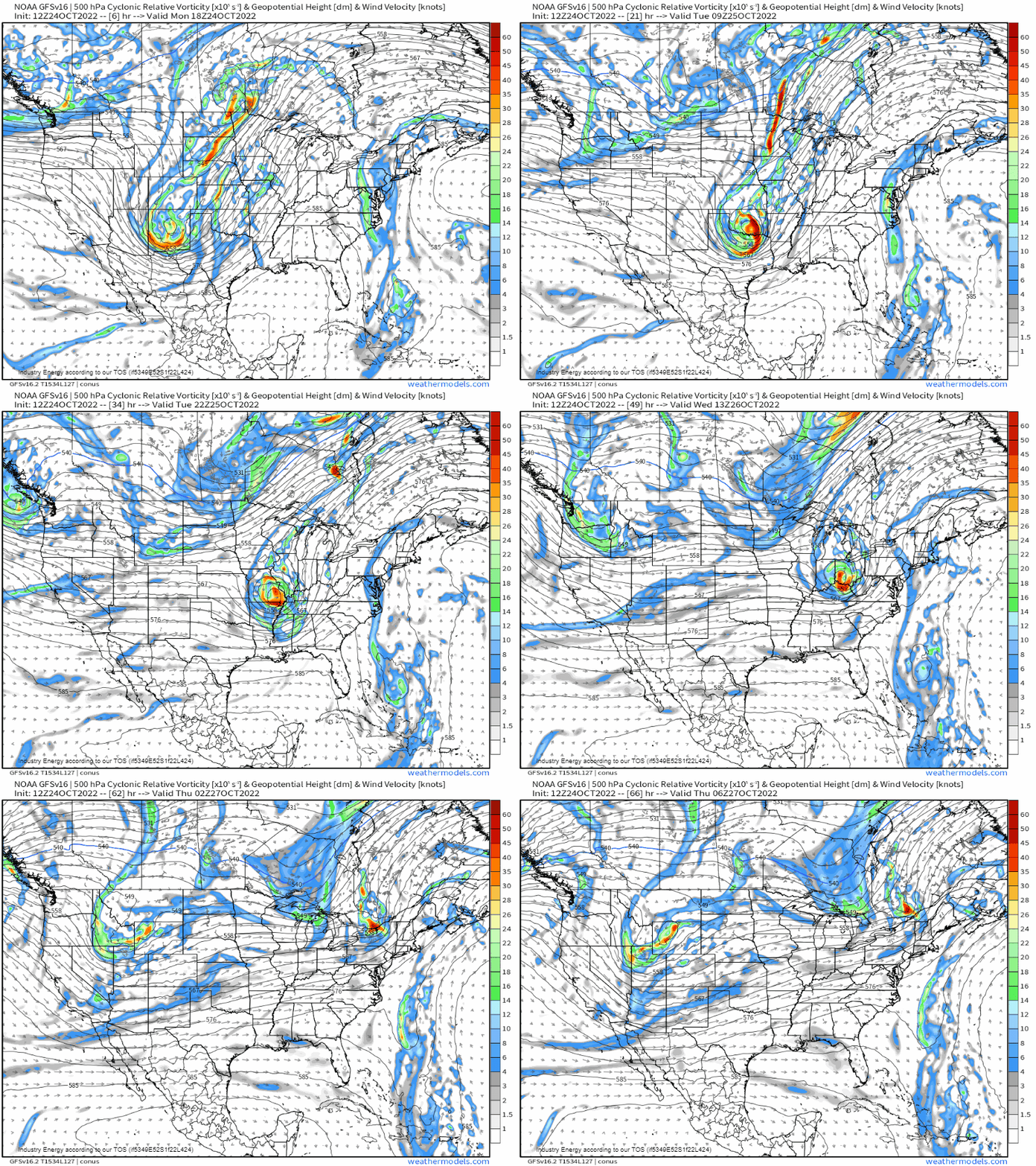
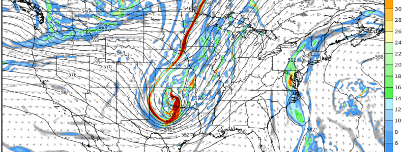
A fairly intense southern stream shortwave trough, and eventually its associated low, will be making its way eastward today. Ahead of it, we’ll see a risk of severe weather.
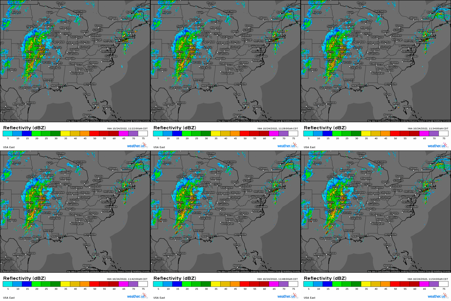
Though rain and scattered severe storms are already ongoing in places like northeastern Oklahoma, the main show, so to speak, will kick off this evening.
As the shortwave trough in question exits the Rockies and undergoes cyclogenesis, conditions conducive to more widespread severe weather threat will materialize – especially for ESE Texas and into western Arkansas and Louisiana.
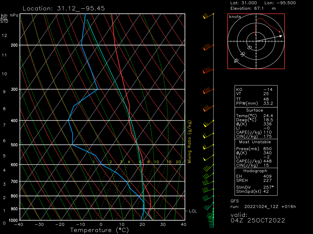
Though this threat isn’t expected to materialize until near/after sunset, soundings show that at least weak CAPE will remain in place.
In addition to CAPE, shear will be adequate to organize storms. A linear mode is favored, though supercells ahead of the line remain a possibility. Additionally, a tornado or two can’t be ruled out, especially where shear is most favorable – Eastern/Southeastern Texas, to be specific.
The severe threat, though likely somewhat weakened as time goes on, will continue eastward in the overnight hours, impacting Arkansas and Louisiana before dawn.
As this is an overnight threat, be sure to have multiple ways to receive warnings including at least one that is sure to wake you. Have a plan to take shelter ready to go in the event that you need to use it.
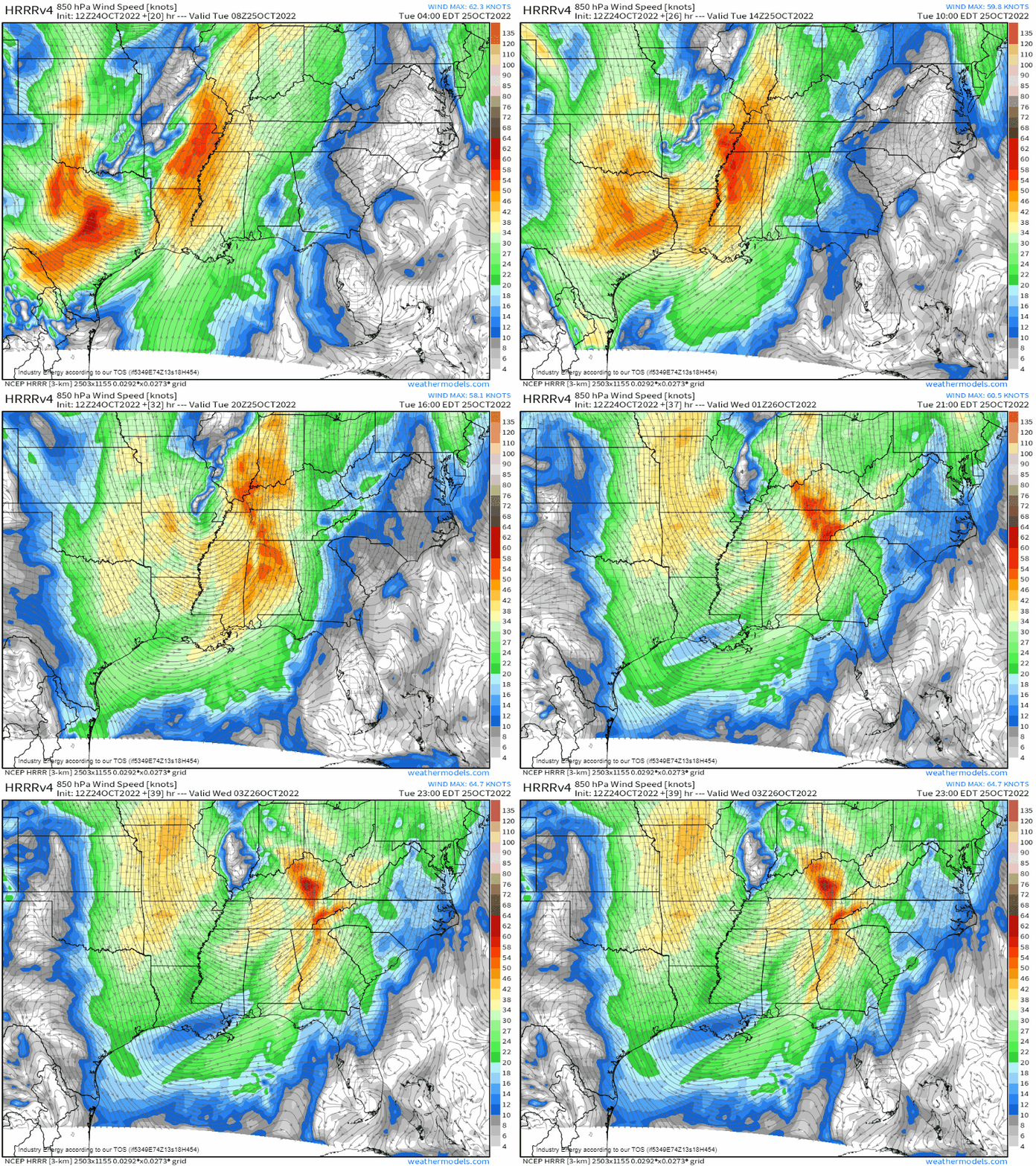
After sunrise tomorrow, the surface low associated with the shortwave trough will begin to deepen some and move northeast. Low-level flow will increase in response, setting the stage for Tuesday’s severe weather risk.
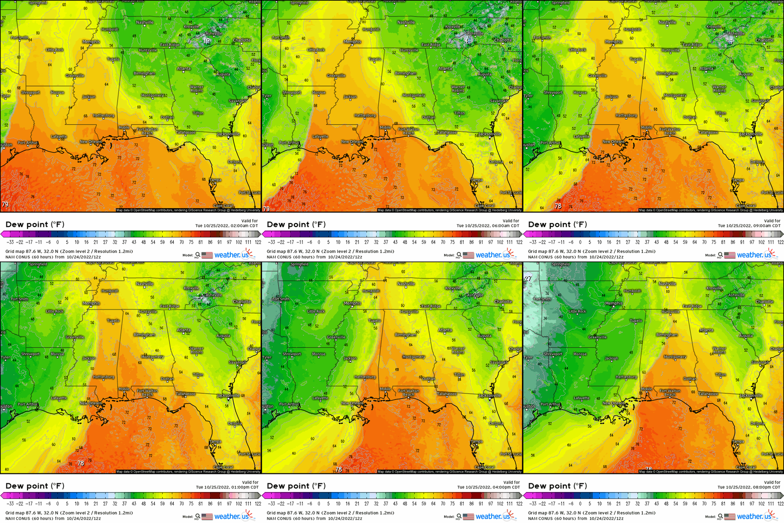
Cloud cover preceding the front/timing of the event may limit daytime heating. However, the low-level flow is expected to be strong enough to bring in adequate moisture to fuel a severe threat.
Timing will be important here. If the front moves quickly and the line rolls through in the morning/near mid-day, there’s a chance that western Mississippi/western Tennessee won’t experience much of a severe threat at all. However, if it slows and comes through after midday, the threat may be a bit more potent.
If scenario one were to play out, the main threat would be more focused along the AL/MS border and into SW/south-central TN.
If scenario two plays out, the most potent severe weather would likely be found in Mississippi and far SW Tennessee tomorrow.
As I said, timing (and how quickly moisture flows northward) is very important for tomorrow as far as determining where the greatest risk lies.
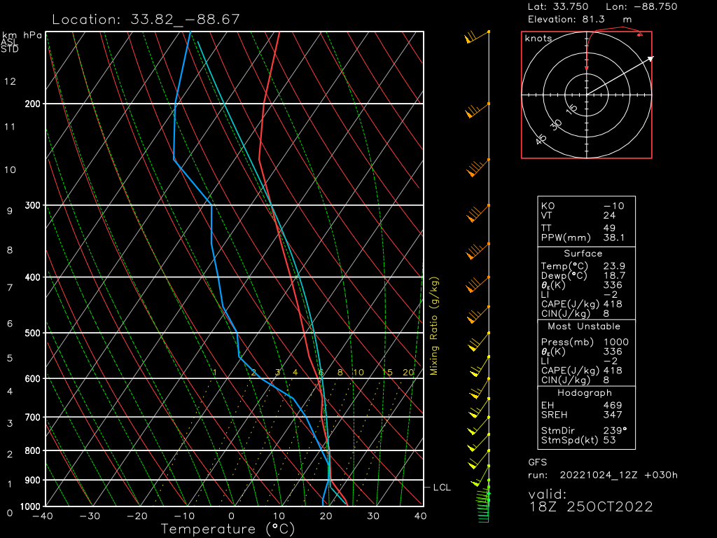
As with today’s threat, shear will be adequate to organize storms. A linear mode is favored but, due to the favorable shear, a few tornadoes embedded in the line are possible.
Now that we’re sliding into second severe season, be ready for any severe weather you may see. Have a plan in place both for the daytime and for the nighttime. Make sure those weather radios are ready to go and that Wireless Emergency Alerts are enabled on your phones.
Monitor the forecast locally for any changes for your area. Always assume that if the information you’re working off of is more than 3 to 4 hours old, it is outdated and you need to seek updates.
Stay safe and watch our twitter feed/your local weather outlets for any significant updates to the forecast!


