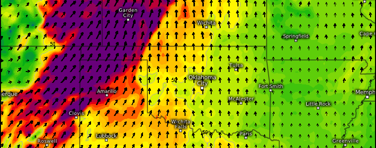
Weekend Fire Weather Concerns
Both Armando and I have blogged a lot this week about the incoming trough over the Northwest. From the overall pattern flip, to downstream potential severe weather, to the return of moisture to the Pacific Northwest, we’ve covered most of the impacts. However, there’s one more to touch on before the changes begin: Fire Weather.
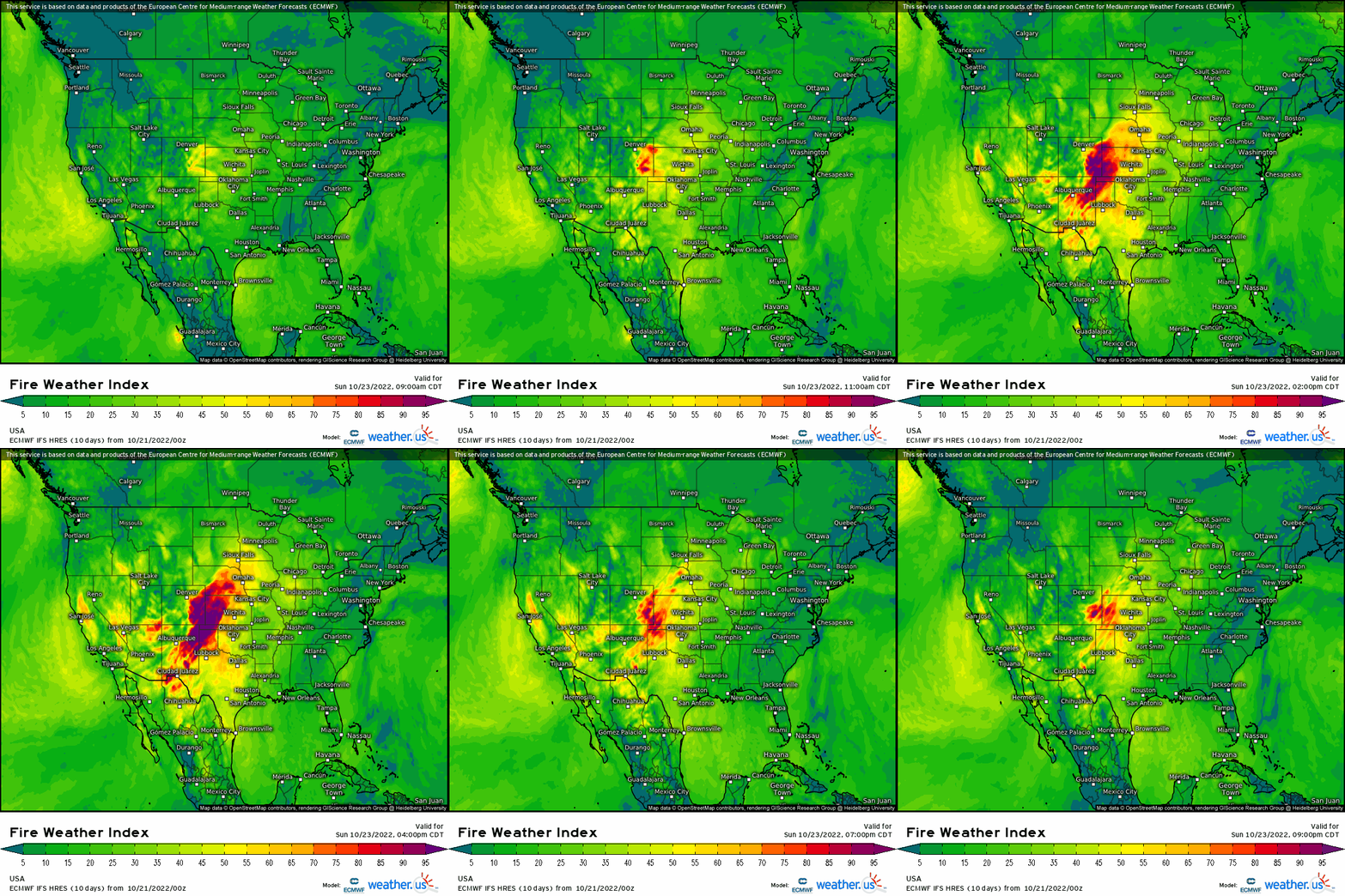
Fire Weather typically doesn’t get as much attention as, say, a severe thunderstorm threat. However, Fire Weather is severe weather and carries the potential to impact a far greater area than a single tornado or thunderstorm.
As our much talked about trough digs into the Northwest this weekend, a few factors will come together to make the weather this weekend – especially on Sunday – ripe for the spread of wildfire in the vicinity of the Plains states.
Our first factor is antecedent dry conditions.
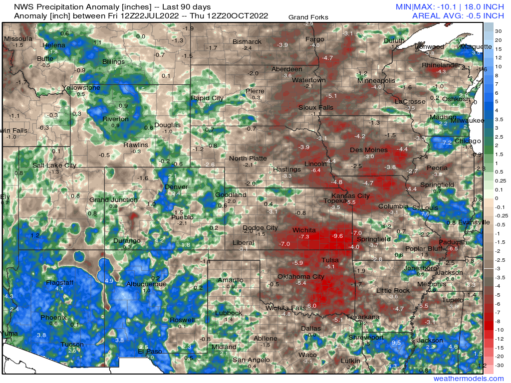
Rain has been particularly hard to come by in recent months for the Plains region. That has resulted in some serious 90 day deficits as well as the expansion of Extreme and Exceptional drought.
To say fuels (grasses, trees, shrubberies, etc.) are dry would be an understatement. Dry fuels are dangerous enough on their own. But combine them with other factors such as gusty winds and low relative humidity, and you have the makings of a serious risk.
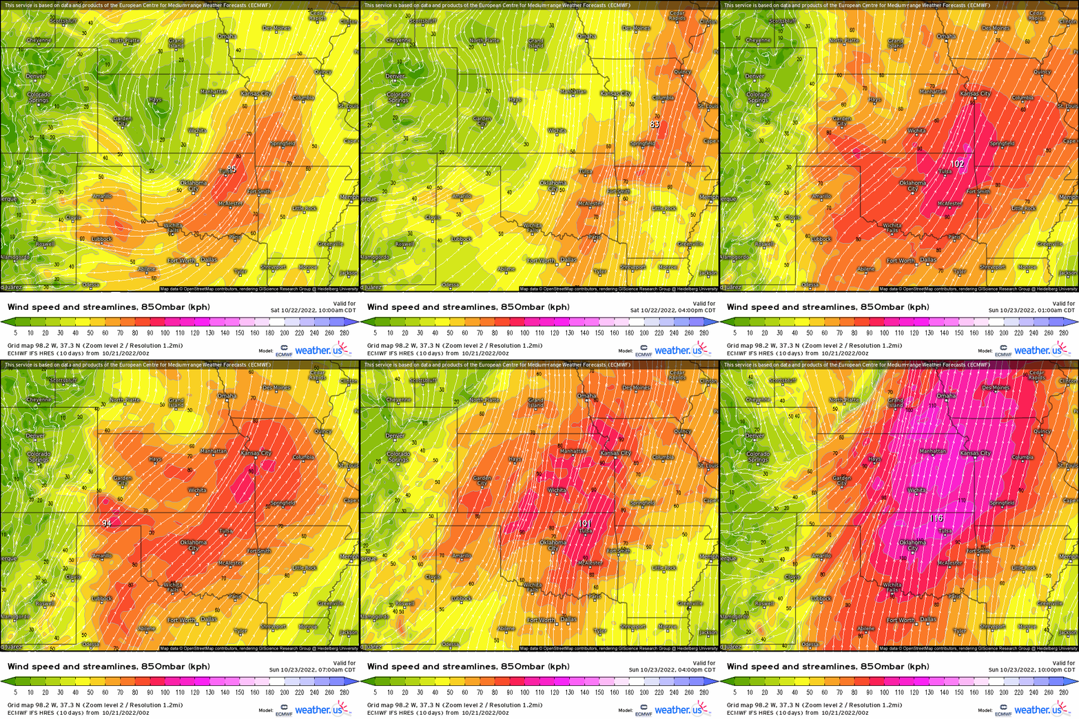
Low/mid level winds will increase ahead of the incoming trough on Saturday, but most significantly on Sunday.
While this will be a southerly wind for the eastern portion of the Plains and may come with a little bit of moisture, the western portion of the Plains/high Plains region could see a more WSW flow. This would allow for downsloping off of the Rockies which results in further drying of the air.
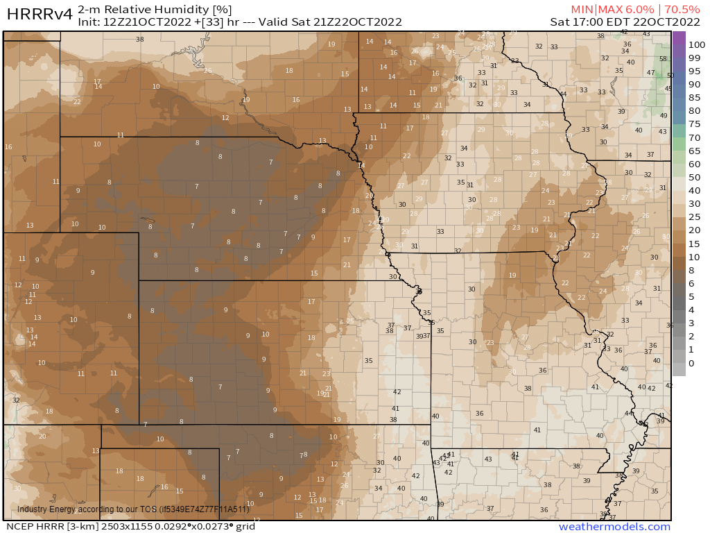
Looking at the forecasted relative humidity, you can really see what I’m talking about. While eastern portions of the Plains are still dry, they may be able to garner enough moisture off the southerly flow to somewhat mitigate a higher fire weather risk.
However, the western portion of the Plains catches enough of that downslope flow to really dry the atmosphere out. This is where we could see a critical (or perhaps extreme?) fire weather risk.
Needless to say, caution must be exercised in all activities this weekend. Avoid anything that has even a chance of sparking a fire.
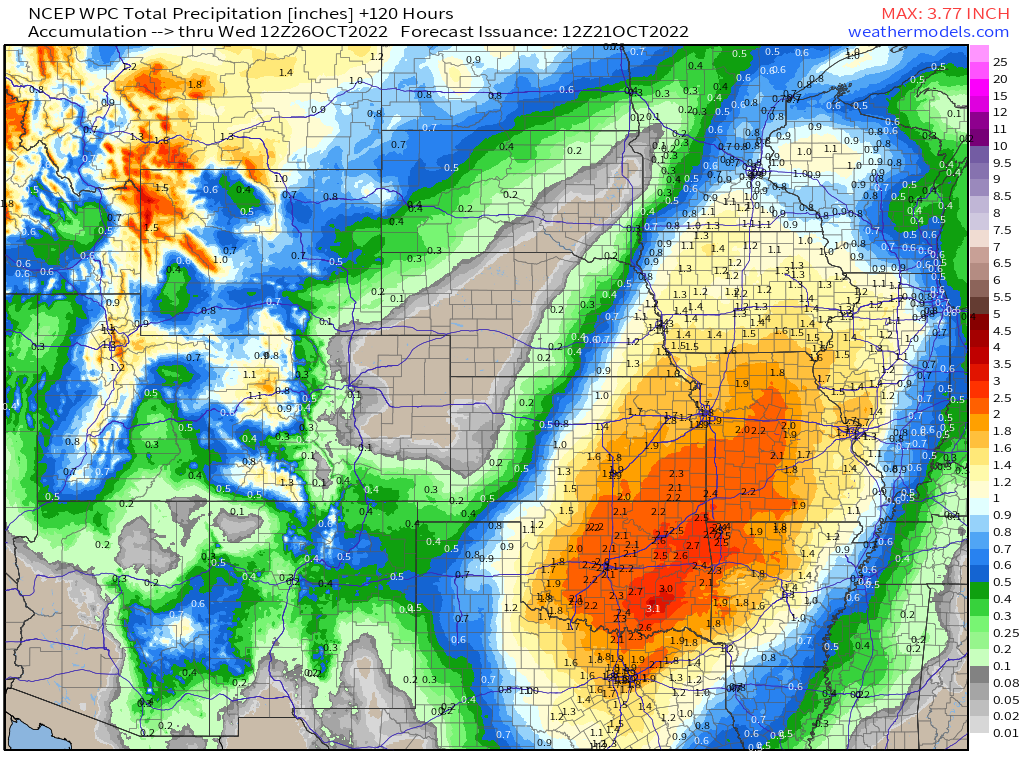
Fortunately, rain will move in toward the start of the work week as a front passes through the region, bringing some decent totals to very dry areas.
Unfortunately, the heavier totals may completely miss the areas that could need it most following a weekend of dry, gusty conditions.
Use caution this weekend and – just out of an abundance of caution and in the name of preparation – be sure your fire evacuation plan is up to date!


