Ever Wonder or Hear of What a “Split-Flow” is?
Heading deeper into fall and winter, something we tend to see a lot develop are what are known as a “split-flow” patterns. Fall is the season, from a macro-global scale, where the transition from summer and into winter becomes most notable in terms of instability between the polar air masses (arctic circle) and the subtropical/tropical air masses (equator). Dips in the polar jet stream grow stronger on a weekly basis from October into December, before peaking later in the winter season. However, there is still the tropic regions especially along and near the equator that doesn’t just modify because it’s winter in either hemisphere; no, rather this remains unchanged all year in terms of where the greatest heat capacity resides. The tropics hold the most heat and the poles contain the coldest air masses. That’s straightforward. What does become complex and can yield high-impactful weather events are when we see these two source regions clash and tangle with different temperature and moisture profiles!
One nice example of this, and you’ll hear it often in the winter is when a large bomb cyclone for instance, develops off the East Coast and manifests from a “phasing” of the polar jet and sub-tropical jet. Some of the more known historical weather events such as the March 1993 Superstorm, was comprised of these two branches of the jet streams interacting and phasing, generating a meteorological spectacle!
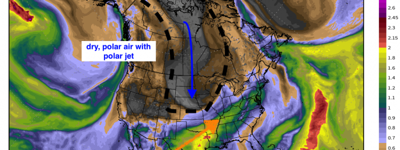
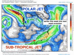
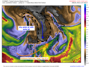
What do we mean by this terminology and how can it be viewed? Take a look at the animation above, which runs from earlier this week and goes out to early next week to show the progression of the 500mb mid-level pattern. There are two identifiable “ribbons” of faster flow – relative to locations adjacent from a geographical perspective. Highlighted to help see them, but notice how the polar jet stream is separated from the subtropical jet stream. The former travels around the ridge on the northern periphery while the latter cuts under the ridge, hence the “split-flow” pattern. What makes this a unique pattern especially during the winter, is that depending on the timing of the interaction between the two, an incipient low pressure can form and further mature. It’ll then get to a point depending on the ingredients and trough axis, along with location, where it deepens rapidly due to the enhanced dynamics that is being fed via the interaction between these two jet streams! The polar jet provides energy along with other important characteristics of the polar air masses, while the southern jet (STJ) provides the warmth and moisture. You can make out each characteristic of both the polar and sub-tropical jet later this weekend by simply highlighting the air content! You combine those main ingredients on top of augmented dynamics, and you can see just how remarkable a storm can deepen and wreak havoc! It does come down to timing however, because you need the right features to align. If the polar jet feature (i.e. trough) is too fast and out ahead of the STJ feature, everything becomes too progressive. Conversely, the STJ feature can eject too quickly out ahead, thereby not allowing any dynamic “phasing”. Or, the STJ feature (which again flows via the STJ) can simply get stuck out in the desert southwest, while the polar jet just trucks along! So as you can see, it’s not often these align perfectly to produce unbelievable major cyclones and bad weather, but when they do, they make for incredible displays on satellite while unfortunately bringing hazardous weather to large populations. Wonder if we can manage something spectacular this winter, especially for the East Coast!


