Reinforcing Shot of Polar Air For the Northeast With a Large Trough This Week!
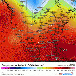
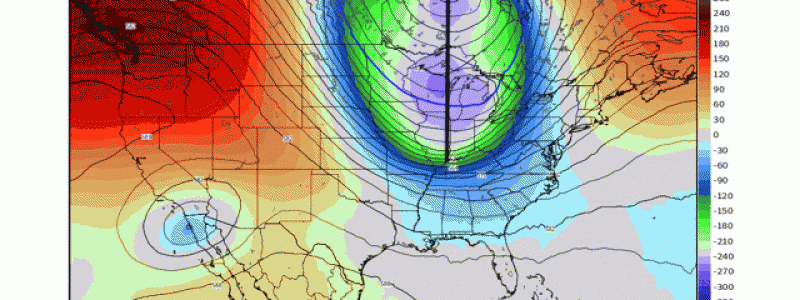
Toward the middle portion of the work week, an amplified pattern will establish across the U.S., with a large-scale ridge out west and a deep trough moving into the East. This pattern, which was highlighted in my most recent post regarding the medium-long range discussion (here), will be a persistent theme through mid-month with persistent cool shots behind cold fronts east of the Mississippi River Valley.
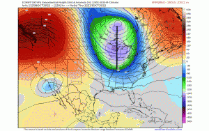
As Meghan noted nicely in here most recent blog (found here) pertaining to the “2nd severe season”, where we get these anomalous clashes of air masses as we transition seasons; while some marginal risk for severe weather look possible across the Tennessee & Ohio River Valley, that doesn’t look to be the case for the Northeast this week. This is due to the limited amount CAPE and also the progressive nature of the entire trough. Aloft at 500mb, despite what appears at first glance, an “intimating” large-scale, negatively tilting trough(which is where you expect inclement and more of the worrisome weather to occur just downstream), the fact-of-the-matter is that the entire trend has been to shift the base of the trough and everything eastward; therefore, the better dynamics also now subjected to also move eastward and at a faster pace. Watch the trend at 500mb valid the same time (Thursday A.M.), and notice how the entire trough shifts eastward. In this animation, it’s the last 5 ECMWF runs valid the same exact time whereby the animation goes from older run to newest and it’s rather easy to point out the trend! This has agreement from other global models as well.
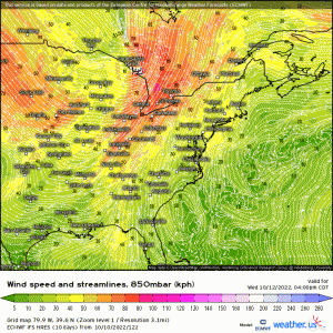
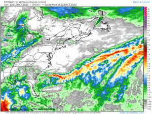
This all translates to a large cold front ahead of the mid-level trough, which will sweep of the entire eastern seaboard by early Friday. Ahead of the cold front across the Northeast, the most notable synoptic feature will be the low level jet, several thousand feet above the surface that’ll clock in at least over 50 knots of speed shear out ahead (denoted by bright colors where verbatim some values are reading over 60mph!). This, in conjunction with high PWAT values, will bring in the threat for more of a scattered to widespread coverage of rain with gusty winds being able to mix down to the surface. The biggest threat, outside of possible minor flooding issues in areas where there is poor drainage, will be gusty winds exceeding 30 mph that can mix down from above the boundary layer and to the ground, for a large majority of the Mid-Atlantic and Northeast. There could be enough “juice”, albeit marginal at best for isolated thunderstorms embedded.
Lastly, in general the consensus in terms of rainfall will be anywhere from .25 up to over 1.50” in more localized regions, depending upon what locations see embedded downpours and heavier rain showers.
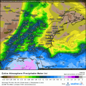
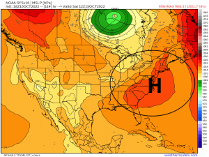
In the PWAT animation, you can depict where the cold front given the sharp delineation between moisture and dry air, and how quickly dry air advects behind the cold front from Quebec to the Gulf Coast. Behind the departing cold front will come once again below average temperatures for a large majority of the Great Lakes, Midwest, Northeast, and East of the Appalachians although not quite as chilly as last weekend. The good news is that with this trough setting in, high pressure with plenty of sunshine will follow for the weekend!
