Medium to Long Range – A Look Ahead What October May Bring!
Looking ahead toward mid-month and toward the end of the month for October, it appears with great agreement amongst ensembles blended with pattern recognition and persistence, that it’ll be a relatively straightforward height pattern!
What I mean by the latter is that we’re going to be somewhat stagnant in regards to the mid-upper levels from a geopotential height perspective. In essence, it’ll mainly be a ridge west, trough east synoptic setup with positive geopotential heights expanding across the Pacific NW and West Coast, with average to below average geopotential heights across the Central and Eastern regions of the U.S. with even hints of a split-flow (i.e. active polar and subtropical jet streams).
Taking a look below at 5-day height anomaly intervals, as one can see it’s fairly straightforward with excellent agreement in ensembles! A tenacious mid/upper level anticyclone will oscillate and be reinforced via upstream (i.e. Bering Sea/North Pacific), with mean-troughing hanging south of Alaska (which pumps positive heights!). Downstream, this facilitates troughs and generally below average heights across the Plains, Midwest, Great Lakes, and a east of the Appalachians, with frequent below average temperature departures via high pressure circulations.
With the latest, freshly initiated CANSIPS – a climate seasonal model – lets take a look at heights, surface temperatures, and precipitation forecast. Not surprisingly, it agrees with ensembles of the GEPS, GEFS, and EPS! The greatest chance at seeing above average temperatures will remain out across the Pacific NW and generally along and west of the Rockies. Average to below average temperatures will prevail across the Central and Eastern U.S., with quick moderation periods mixed in between of course as this again, is smoothed averaging the entire month. However, the signal and agreement renders high confidence in this type of typical pattern for the month of October. In terms of precipitation, we can see a large and expansive area of below average precipitation regarding departure from normal that spans mainly east of the Rockies, with hints of an active Pacific NW and toward the desert SW. As I mentioned above, a “split-flow” will likely develop where the Pacific jet stream will likely remain active, with potential periods of sub-tropical jet stream moisture and disturbances that’ll enter the West Coast underneath the ridge. We’re also approaching the time where stronger cold fronts bring about dry, continental air masses.
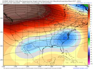
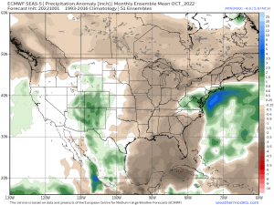
Further, let’s also not forget the newly initiated ECMWF SEAS-5 climate seasonal model! It also highlights similar areas discussed pertaining to where the greatest areas of above average and below average temperatures will be according to the placement of the geopotential heights. It also points out an expansive area of relatively dry precipitation departure, outside of the desert SW with even some hints at an active pattern (tropically induced or big East coast cyclone perhaps?) setting up across the Northeast/Mid-Atlantic. Regardless, it appears to fall in line with ensembles and the other climate models!
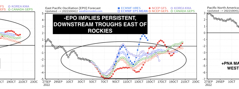
This pattern can be viewed from a teleconnection perspective, and one can infer what the typical Rossby-wave pattern will be for the majority of the month. A +PNA, +NAO, and -EPO imply persistent cool shots via troughs that are rendered by the expansive mid/upper level ridge across the West Coast (+PNA/-EPO). The +NAO will keep the troughs and cool shots moving along with periods of moderation for the Northeast and in general, the Midwest/East regions.
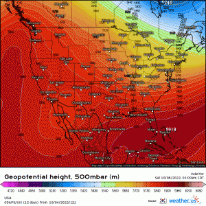
Lastly, this is a nice way to tie everything together through using the GDAPS model ( a “unified” global model that couples the ocean & atmosphere making for a more accurate model), where it largely shows persistent ridging out across the west, with tenacious troughs dipping into the Midwest and swings through the East.
Of course, since we’re trekking deeper into Fall, this means we’ll be seeing more in the way of frozen precipitation that’ll slowly begin to become pertinently as we slowly approach Winter!


