BIG FALL COLD BLAST THIS WEEK – FIRST FREEZE INBOUND!
We suddenly flip the calendar to October and what do we know, a large cold blast follows! This week, we’ll see a robust Canadian high pressure make its way down into the lower 48 states originating from the far western portions of Canada and even have Arctic airmass parcels mixed in, although moderation will occur. Lets see how we get the big cold blast by taking a look at the mid-levels using Geopotential height.
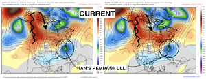
Below is the present day. There is the anomalous stingy occluded mid/upper level low hanging off the Mid-Atlantic coast, keeping temperatures way down and causing coastal flooding issues, along with rain. Upstream across the Rockies and Pacific Northwest, large-scale ridging with positive heights extend from the West Coast up into Alaska. This is ideally a recipe to garner downstream high pressure and cold air, as the polar stream dips southward in response to the ridge billowing into the Arctic circle.
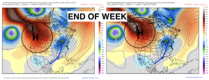
By Thursday, the ridge across the Pacific Northwest amplifies, while a large-scale longwave trough imposes on the Great Lakes and Northeast region. This trough will shift in behind a strong cold front on Thursday, ushering in a robust high pressure.
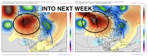
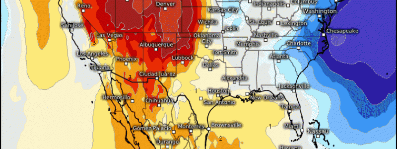
By next week, the trough swings through extending down the Appalachian Mountains and even into the Southeast, bringing about an expansive area of below average temperatures.
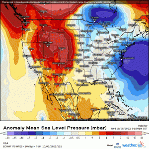
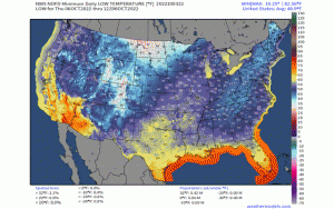
While the mid levels display both an anomalous trough and ridge, the surface translates this just as much regarding MSLP! A strong, +1030mb high pressure system will make its way into the upper Plains later Thursday into Friday. Verbatim, for this time of year it’ll be about approximately +1 standard deviation anomaly, demarcating this as relatively strong for the time of year! Of course the dome of cold air will be moderating as traverses, even up in Canada before it enters the U.S.; however, it’ll still have continental polar air ushering in and bringing widespread below temperatures including below freezing for many. This includes a large area of the upper Plains, Midwest, Great Lakes, and Northeast with 30’s getting as far south as TN, AR, and high elevation areas including NC! This also means daily highs will struggle to get out of the 40’s, 50’s, and 60’s especially for the northern tier regions where frost will occur with below freezing daily lows. This cold blast does moderate some as it traverses into the Ohio Valley and Northeast, but still bringing about widespread below temperatures averaging anywhere from 5-15*F.
Note the daily low’s beginning Thursday through Sunday with the dome of cold air as it dips into the Plains and eventually shifts toward the East Coast. For many, this’ll be the first froze of the season, so certainly take appropriate measures regarding plants, gardens, and even crops!
Moderation is expected once the trough swings through, but the further into Fall we get, the stronger the cold fronts become! We’ll soon be seeing low pressures with snow showing up on models and radar, as we’re gradually approaching the winter season!
