Short-Term Track of Ian – Update on What’s Ahead Into Saturday!
As of 3:05 p.m. EST yesterday, September 28th, Ian made landfall at Cayo Costa, Fl at an estimated pressure of 940mb, with wind speeds up to 130mph. In essence, this made landfall as a Category 4 hurricane. This puts Ian in the top 5 as one of the strongest tropical cyclones to make landfall in the state dating back to 1851, and basically putting it in the same camp with Hurricane Charley (2004).
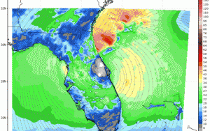
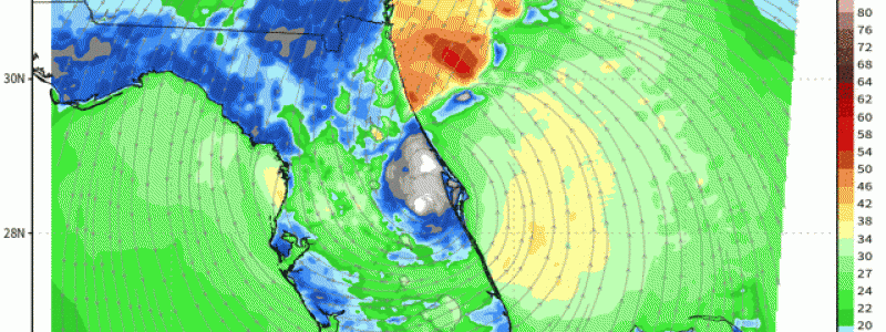
Going forward through today, Ian has been downgraded to a Tropical Storm and it’ll cross the peninsula throughout today trekking taking a N/NE track. By later today, it’s forecasted to emerge into the western Atlantic and go back offshore. As it does so, it’ll likely strengthen to an extent, likely teetering on the border between a strong tropical storm and category 1; however, it’s not the status of the cyclone that matters as much as the impacts! With a favorable mid/upper level interaction with the synoptic environment across the Southeast via mid-latitude trough (despite dry air/shear becoming more potent, it’ll be “protected” to an extent via favorable interaction as mentioned), the cyclone will make another landfall some time tomorrow afternoon somewhere in the vicinity between Savannah, Georgia and Charleston, South Carolina. Here is a hurricane nested model, coined the “HMON” to illustrate the track up to landfall and slightly beyond.
IMPACTS:
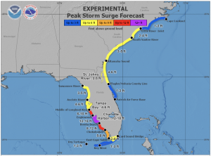
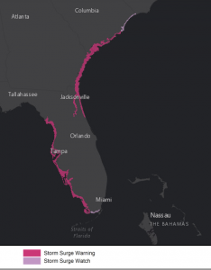
Via NHC (NHC Hazard Products), here are the latest forecasted peak storm surge expected for the Southeast Coast, along with already storm surge watches and warnings. Also posted are hurricane watches and tropical storm warnings. The former extend from northern part of Florida (i.e. Jacksonville) up into the coast of South Carolina. The latter are posted up toward central North Carolina toward Cape Hatteras.
WIND GUSTS
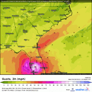
Hurricane-force wind gusts (74mph or >) and tropical storm-force wind gusts (39mph or >) are to be expected through today and into early Saturday with again, the former aimed more toward the southeast coastline and a few miles inland for Georgia and South Carolina closest to the center of the circulation. The latter will be more widespread covering a good portion of northern/eastern FL, S/C Georgia, South Carolina and into North Carolina.
RAIN
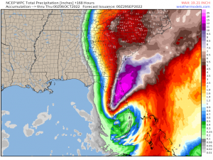
Forecasted total rainfall expected via WPC through the weekend has many areas along the coastline from Northern Florida up to even the Delmarva seeing over 4”+, with double-digits closest to the circulation of Ian and in particular to the north and west of the track (I.e. extreme eastern GA, along SC coast but more toward the Southeastern portion). As already covered in my recent blog (here), major flooding and coastal erosion will be large issues.
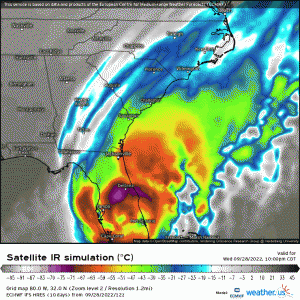
It isn’t until Saturday that Ian will finally degrade to the point of becoming a tropical depression and post-tropical thereafter over somewhere in the Southern Mid-Atlantic, bringing with it rain and wind up the coast by early next week. Here is a simulated loop displaying this sequence through Saturday.
Continued major and devastating impacts will continue today and through tomorrow, so if you’re in the path of Ian this weekend, please be as proactive as you can be!!
