Possible Significant Flash-Flooding & Coastal Flooding For The Southeast & Southern Mid-Atlantic This Week
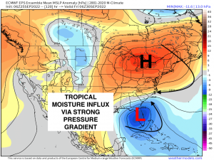
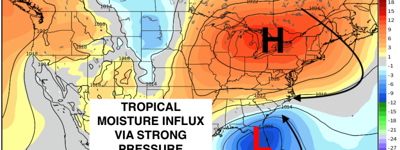
The synoptic setup for later this week behind the departing Northeast trough – which is a critical “key” in Ian’s ultimate track, is poised to establish a strong pressure gradient along the East Coast. As the trough departs, a relatively strong high pressure will move in behind as shown below across the Northeast. To the south, there is Ian. As Ian marches northeastward, which also still is a bit uncertain on where it tracks after landfall, tropical moisture will advect into the Southeast in between the counterclockwise circulation of Ian and the clockwise circulation of the high pressure. This setup is very favorable for heavy rainfall and flash flooding.
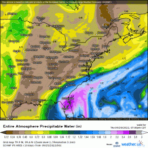
As tropical moisture rotates around Ian via establishing pressure gradient, anomalously high PWAT’s will facilitate a very saturated atmospheric profile across places such as South Carolina and North Carolina. This’ll set the stage for a very high likelihood of flash-flooding and intense rainfall.
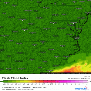
As shown via Multi model, there’s a very high probability that flash-flooding will occur given values greater than 1 as displayed by the flash flood index. The timeframe of this event looks to begin later Thursday and last into Saturday.
Further, the dynamics of this setup favors a robust low-level jet, which will not only induce a strong moisture fetch, but will cause strong winds to be able to mix down to the surface. Aside from heavy rainfall and flash flooding, severe wind gusts (e.g. 58mph or greater) are going to be another hazard that’ll be an issue with this setup along the Southeast coast. With the latter bound to happen, coastal flooding and erosion will also be a large concern from Florida up to
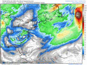
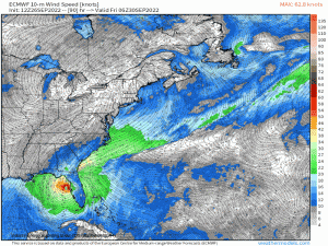
Over 24 hours of easterly/northeasterly fetch beginning late Thursday night and easing by Saturday across the Southeastern states – in particular, the Carolinas and up toward VA. Along with coastal flooding, strong rip currents, beach erosion, and high surf are all going to be exacerbated through this pressure gradient. Below reveals 10m sustained winds revealing the persistent onshore fetch.
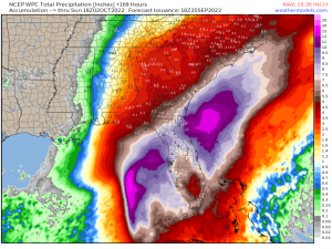
Aside from the significant rainfall that’ll fall across Florida and along the eastern Gulf Coast states via Ian, the WPC is forecasting anywhere from 3-8″ with localized doubt digits possible especially with a variable track still yet to be determined in where Ian makes landfall. The atmosphere will be primed, however, to deliever a very wet Southeast later this week.
The rain won’t end there as interests up the East Coast will have to watch in terms of rain and wind impacts as well. As of now, the strong high pressure will impart a lot of dry air and shear out the remnants, but some precipitation may move into the northern Mid-Atlantic and perhaps the Northeastern states by next week.
