Southeast, Ohio River Valley, and Southern Mid-Atlantic Rain Reprieve
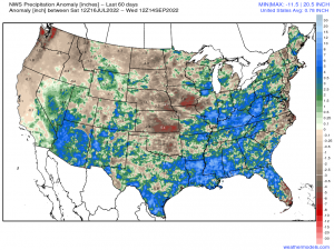
Over the last two months, it has been abnormally soggy for the Southeast, up the Tennessee River Valley and into the Ohio River region, and across the Southern Mid-Atlantic. Thanks to the NWS Precipitation Analysis, areas are highlighted where regions have exceeded their climatological norms in terms of precipitation. Up to as much as 15-20” above normal in some spots, especially the Southeast across LA, MS, and AL, has fallen in the last 60 days.
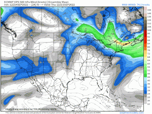
Diving into the synoptic, large-scale height pattern, there is one distinct evolution that transpires across the lower Plains & Deep South. Initially, denoted by the z500mb streamlines specifically across the Southeast and eastern Midwest regions, large-scale subsidence is taking place as a result of deep-layer ridging.
It isn’t until later this weekend that an even stronger anticyclone – indicated by the notable clockwise flow surrounding the mid-level ridge – intensifies and builds into the eastern portion of the Great Plains before slowly stretching in an east-west fashion. Then a quasi-zonal flow manifests with troughiness impinging on the northern periphery of the ridge. This evolution will render two impacts:
-Provide abnormally warm temperatures across the U.S. Corn Belt, Great Plains, and the Midwest before shifting into the South and bleeding eastward.
-Result in large-scale sinking motion from aloft via upper-level convergence, which provides surface high pressure over a thousand miles from TX to the coastline of the Southeast.
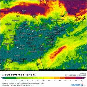
Looking at it through a unique perspective, below displays the chance of whether or not the sky will be covered by at least 75% or greater regarding cloud cover. Through the end of next week, verbatim the multi-model (a model consisted of multiple global models), there isn’t even a greater than 60% chance of seeing mostly cloudy skies! This goes to show how impressive this mid/upper-level ridge and overall height pattern will be.
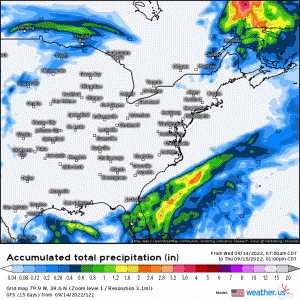
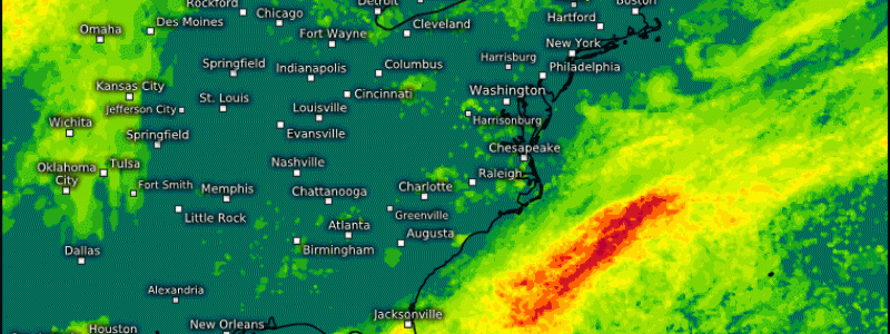
Below is one of the global models (GFS) through next week of the large “hole” of the lack of rainfall, as localized/spotty areas here and there, accumulates and outlines the large-scale subsidence via ridging.
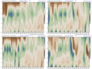
Lastly, to corroborate the notable dry stretch, here are cross sections of relative humidity that expands the 1000-700mb levels of the atmosphere. Point-and-click cross-sections reveal places such as Jackson, MS, Knoxville, TN, Montgomery, AL, and Frankfort, TN to show the large abundance of dry low/mid-level air!
For those living in these general regions and have not gotten much, if any, outdoor work completed or have been anxious to finally enjoy the sunshine; you’ll surely welcome the rain-free stretch and sunshine as these areas surely deserve it adamantly!
