Flash Flood Risks For The Southwest This Week
An active convective string of days, beginning today, will manifest flash flooding risks and concerns across the Southwest, Great Basin, and Intermountain West.
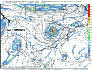
Mid-level remnants, from what was Hurricane Kay last week, embedded within a trough has lingered off Southwest California. This mid-level trough, seen below via ECMWF z500mb relative vorticity, will transition from a closed low, to an open broad wave. As this trough propagates eastward and opens, lobes of vorticity – or embedded shortwaves – will advect and rotate through the trough axis. A combination of height falls via approaching long wave trough, positive vorticity advection via shortwaves, and low-mid level tropical moisture advection from the Eastern Pacific, will facilitate convection and organized flash flooding for areas especially susceptible areas (i.e. areas downstream of higher terrain, adjacent to rivers/streams, and burn scars).
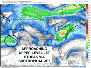
In conjunction with a favorable dynamic evolution, a kinematic component to this synoptic setup will help exacerbate via upper-level jet support. An approaching exit region of the STJ (sub-tropical jet) – more specifically the left-exit region, will support enhance divergence, causing surface pressure falls and enhanced convergence. This simply allows for an environment auspicious for sustained convection, thunderstorms given a destabilizing environment with several hundred joules of CAPE, and training convection/cells.
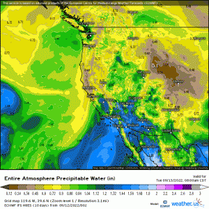
Higher values of PWAT’s can be traced from the Eastern Pacific and Gulf of California, as a result of the counterclockwise flow surrounding the remnants of Kay and synoptic pattern, as moisture is siphoned in between the long-wave trough and mid-level ridge across the Deep South. PWAT’s exceeding ~ .75” for this area, is actually a few standard deviations above normal from a climatological perspective, which is another reason for flooding concerns.
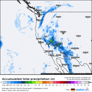
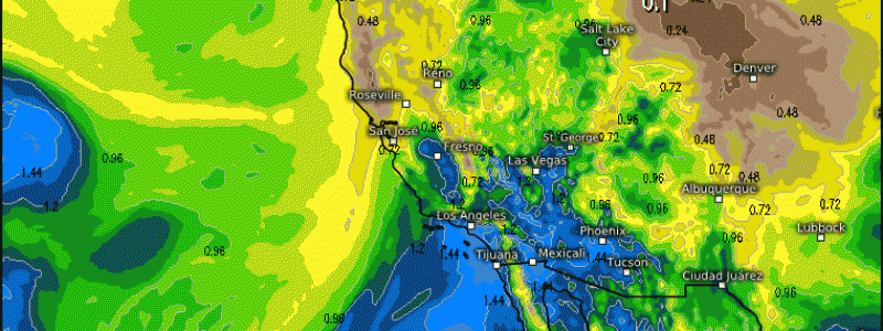
In totality, expect these areas to see over an inch in rainfall. While it may poise as underwhelming, it’s the mere fact that localized areas could see heavy rainfall of over an inch/hr, leading to flooding concerns especially from strong thunderstorms and training storms given the overall weak steering flow.
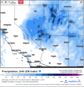
In terms of where the greatest probability of flash flooding, looks to occur across Central & Northeast NV and Central/Northern UT, down into NW AZ. Verbatim the ‘EW index’ – an index used to quantify how unusual a weather event may be for a region, these areas have values near or greater than 0.6. This means it’s closer to the unusual aspect of precipitation from a climatological perspective for this time of year.
Fortunately, by Thursday, expect drier air will filter in and last for a few days. Now, looking ahead toward next week, there is a chance that yet another influx of moisture could manifest depending upon how the state of the Eastern Pacific tropics unfolds, as yet another tropical cyclone appears to form this week. Will be watching the evolution closely!
