Wind and Water: Hurricane Kay Brings Rough Weather to Southern California
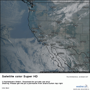
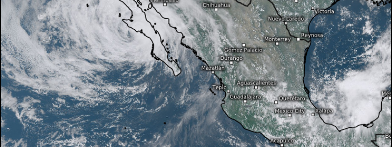
Today’s visible satellite loop of the Western US shows something not often seen in this part of the country:
A hurricane bearing down on Baja California.
In fact, those in southern California are probably now seeing that high cirrus shield slowly working in from the the southeast.
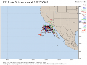
Before I go any further in this blog, I want to be clear that Hurricane Kay is not forecast to make a direct hit on Southern California.
It will parallel the coast before turning out to sea, where it will linger.
Now, just because it won’t be a direct hit, doesn’t mean that impacts won’t be felt. Hurricane Kay will bring rain and wind to southern California and, in doing so, will enter into a very exclusive club. Only 7 tropical cyclones have brought impacts to southern California since 1850. Hurricane Kay will make 8.
That said, what are we expecting?
Rain is a given.
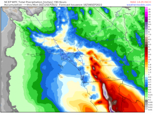
Granted, to those in the Eastern US, this 4 day total rainfall forecast does not look as one might expect if a slow-moving tropical cyclone plowed through, say, the Gulf Coast states. But this is the southwest. Moisture is much harder to come by and smaller amounts go farther. The moisture being brought northward by Kay is maxing out the color chart on the Precipitable Water Anomaly map at 300% of normal.
For example, both San Diego and Los Angeles’ average September rainfall is 0.2 inches. So, even if they “only” end up with 0.6 inches, that’s three times more rainfall than they would normally see for all of September – and all in one weekend.
It’s safe to say that flash flooding is a very real concern, and for more reasons than simply too much rainfall.
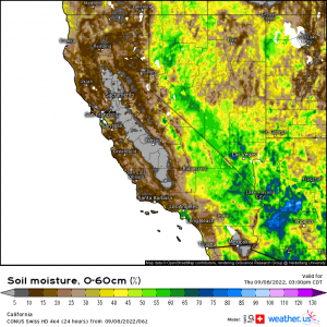
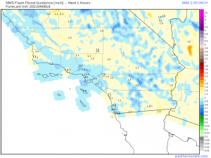
Let’s not forget that this region is in a long-duration drought. As evidenced by the map above, soils are very, very dry.
Picture sun-baked, cracked desert ground. Do you think soils that dry will readily absorb water, especially if it all comes down very quickly? No, absolutely not!
So, where rainfall rates exceed FFG values, we can expect to see flash flooding, some of which could be dangerous.
Let’s not forget to factor in terrain here, either. The southern California coast is bordered by the Santa Ana Mountains and the Peninsular Range. Heavy rain falling on the windward side of these slopes may not get absorbed, but instead run downhill, causing an additional influx of water for lower elevations. This could exacerbate any on-going flash flooding.
Mudslides are also possible as the ground on the slopes becomes saturated.
In addition to water woes, we will also need to consider the wind.
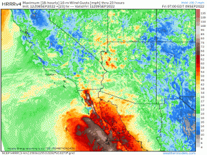
While the region won’t see the strongest sustained winds near the center, it could still experience tropical storm force gusts at times.
Terrain plays a role here, too. With the counterclockwise rotation of Kay, winds could flow down the mountains, accelerating as they go. This downsloping behavior would result in locally higher gusts near the bottom of the mountains, specifically while Kay is still just to the southwest of southern California.
Either way, power outages are possible.
Lastly, rough seas are in the forecast.
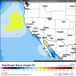
Wave heights of 15+ ft are possible in open water, with lesser amounts near shore. Still, some coastal erosion/flooding and the formation of rip currents are possible, especially as Kay moves north and the flow changes from offshore to onshore. If you’re a coastal resident, make plans to protect your property from the former if you can.
Summary:
Heavy rain resulting in dangerous flash flooding, tropical-storm force gusts resulting in power outages, and rough seas resulting in coastal erosion and rip currents are likely as Kay side-swipes the Southern California coast.
Pay attention to changing conditions and have a plan in place for power outages and also if flooding threatens your home. Do NOT drive through flood waters as roads may be washed out underneath or waters may be deeper than they appear. The risk isn’t worth your life. Stay safe!
