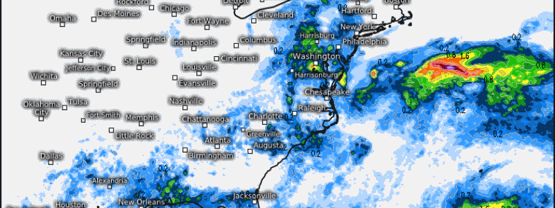
Flooding Concerns and Heavy Rainfall For the Southeast This Week
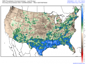
It has been a very wet soggy several weeks across the Southeast since last month. Below displays the last 30 days of total precipitation from an anomaly perspective. Notice that areas from Louisiana, along the Gulf Coast, and across the large majority of the Southeast, has seen several inches above climatology within this span.
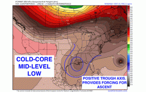
The synoptic setup over the next few days beginning today will feature a mid-level trough, which will slowly cut 0ff from the mean flow and propagate toward the Southwest, oscillating over the Gulf Coast. This will provide forcing for ascent, as positive vorticity advection in conjunction with upper-level divergence downstream the trough axis and with upper-level jet support (250-300mb), will lead to widespread rainfall & convection across the Southeast. In conjunction, mid/upper-level ridging builds across the Northeast, allowing for a meridional height pattern that is slow to budge. Below reveals the positively-tilted cold-core mid-level low that retrogrades toward the S/SW with Hurricane Earl evident northeast of Bermuda. By later this weekend, the trough weakens but still provides sufficient forcing. By early next week, the next trough axis seen digging across the Midwest will act to “kick” the remnant trough east, replacing it with surface high pressure.
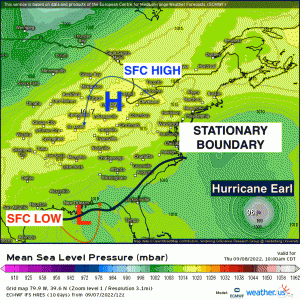
At the surface, this translates to a stationary boundary with areas of low pressure forming along the Gulf Coast and Southeast. Along and east of the Appalachian mountains, a high pressure shifts into the Mid-Atlantic and Northeast. With the counterclockwise flow around the lower heights and surface low pressure, and clockwise flow around the high pressure – this creates a relatively broad area of convergence across the Southeast. This makes for an auspicious environment for localized heavy rainfall, scattered convection, and reinforces the stationary front that’ll mitigate its movement as it’ll slowly migrate northward through the weekend. With continuous moisture advection from the Gulf with a tropical air mass consisted of high PWAT values within the planetary boundary layer – especially at 850mb, a multi-day rainfall event will be on tap as multiple favorable ingredients will be in place to render flooding concerns across areas that have already seen its fair share of inundation.
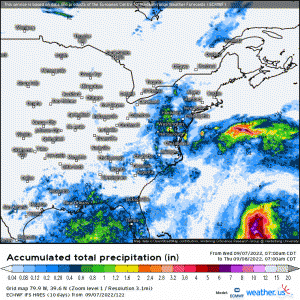
Up to as much as 6″, if not slightly more, is possible across the Florida panhandle, up into GA, and SC. A general 1-4″ is expected for adjacent states from LA up into West Virginia. Also expected are possible thunderstorms with gusty winds being the main concern. Given the migration of the front, it appears that flooding will be more localized and scattered.
Come next week, relief will be on the way with surface high pressure and seasonable conditions for the large portion of the Southeast!
