Significant Fire Weather Ahead
As an extended period of hot, dry weather continues in the Western US, it’s no surprise that fire season has really exploded with activity in the last few days.
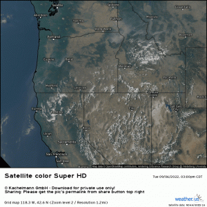
This satellite loop is from yesterday evening, as visible satellite is not yet available today for the Western US – you know, since it’s still dark there as I write this.
Multiple smoke plumes in multiple states are visible in this loop. Some of these include:
- The Rum Creek Fire, SW Oregon – estimated 19,495 acres burned, 42% contained
- The Double Creek Fire, NE Oregon – estimated 43,668 acres burned, containment unknown
- The Four Corners Fire, West Central Idaho – estimated 13,565 acres burned, 45% contained
- The Mountain Fire, Northern California – estimated 11,464 acres burned, 30% contained
Plus many other smaller fires. If you’re wanting more information, check out https://fsapps.nwcg.gov/, which is where I pulled these stats from.
Anyway, today’s forecast is bad news for any fires already burning. In addition, potential exists for new fires to be sparked.
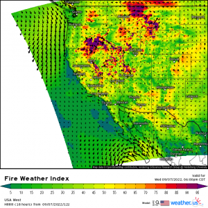
Continued hot, dry conditions combined with strengthening winds will make today a downright dangerous day in regard to fire weather. In fact, the not-often-seen “Extreme” category makes an appearance on today’s Day 1 Fire Weather Outlook from the SPC. This category is confined to the north-central part of Montana, but most of the Pacific Northwest and Northern Rockies carry some level of risk today.
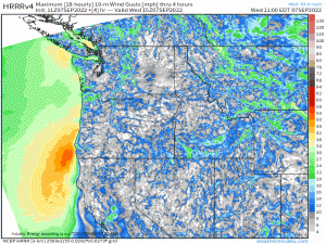
As the day wears on, winds will increase ahead of an incoming trough.
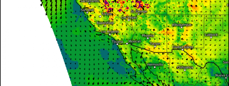
While gusty winds will exist for nearly the entire region, can you identify the real problem spot by looking at that gif?
There are actually two, though only one carries the extreme risk.
- Central Montana
- The swath of consistently higher gusts sticks out like a sore thumb here. What makes this so dangerous is that this region is in the lee of the Rockies. Winds will not only be gusty, but downsloping will be involved. Winds will accelerate down the slopes of the Rockies, warming and drying as they go – effectively leeching out any appreciable quantities of moisture in the air.
- South-Central/Southeastern Oregon and the Great Basin
- We see a swath of gusty winds here as well. Though it does not carry the Extreme tag, it is in the Critical category. Where fuels (trees, vegetation in general) are dry in this region, a fairly significant threat exists.
As stated above, this is bad news for already-burning fires. Increasing winds will likely lead to rapid spread and erratic behavior. If you reside downwind of an active fire, be prepare to evacuate should it come to that. Also, if you have family or friends downwind of an active fire, warn them to be ready.
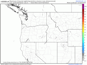
I also mentioned that we’d have to worry about new fires sparking. The incoming trough, in addition facilitating increasing winds, will also bring the risk of dry thunderstorms.
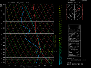
Very dry low levels with moisture aloft and just enough CAPE to allow air to accelerate upward could be trouble for this region later today. Any precipitation falling will likely evaporate in the dry layer before it reaches the ground, but that doesn’t mean cloud-to-ground lightning won’t occur.
The 6-hour Lightning Flash Density map from the HRRR illustrates this rather well.
Though lightning isn’t expected to be on the scale of, say, an MCS with 50 to 60 kft cloud tops moving through moisture-rich territory, it only takes one well-placed bolt to spark a fire. And with dry surface conditions and very gusty winds, that newly-sparked fire could spread quickly.
Summary:
Between the risk for dry thunderstorms and increasing winds/antecedent dry conditions, today may be a very dangerous day in regard to fire weather. Remain aware if you’re downwind of existing fires and have a plan in case you need to evacuate. Also be aware of any new fires as they will likely spread rapidly.
Additionally, avoid any activities that may spark a fire as, again, it will spread quickly.
