End of August Tropical Update
Well, here we are at the very end of August and we’ve still not seen a named storm in the Atlantic Basin since July 3rd. Assuming no sudden development in the next, oh, 7 hours or so, it will be the first August since 1997 to have no named storms.
Further, 1961 and 1997 currently are the only years on record with zero named storms during the month of August.
It’s a La Nina year, which generally equates to an active Atlantic hurricane season, so what gives?
Shear and dry air.
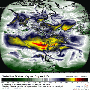
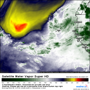
The synoptic pattern hasn’t been a favorable one so far this season. The pattern has continuously, relentlessly pumped dry Sahara air into the Atlantic Basin. Additionally, Upper level lows in the central Atlantic have been plenty, imparting shear to blossoming African Easterly Waves.
So what then do we have at the current time?
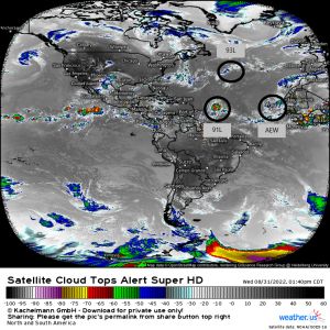
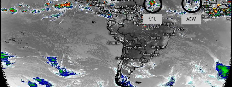
- 91L in the Central Atlantic
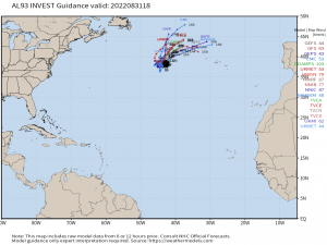
- 93L in the North-Central Atlantic
- An African Easterly Wave just east of the African coast
Of the three, 91L and 93L are the ones with the most potential.
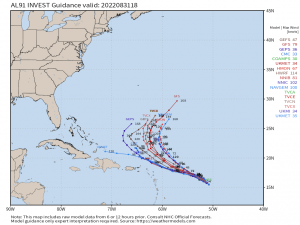
91L has been (very) slowly pulling its act together and will likely become a TC in a day or two as it moves further northwest into more favorable conditions.
Despite the fact that earlier forecasts had 91L coming a bit too close to the East Coast for comfort, we’ve gained better insight into the forecast synoptic pattern. A trough swinging down over the Eastern US will block 91L’s path toward the US, forcing it to recurve harmlessly out to sea. There is a chance it could sideswipe Bermuda, but models favor a recurve far enough away from the island to leave it with limited, if any, effects.
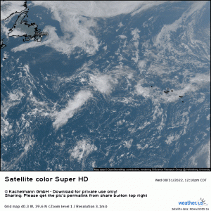
93L has spun up in the last couple of days along an old frontal zone.
Convection is very limited at the moment, but confidence is high that once conditions become more favorable shortly, it will be able to organize into what will most likely be a subtropical depression.
Fun fact: The NHC only started naming subtropical storms as recently as 2002. Some still argue that these should not be named.
Anyway, with this potential storm so far north (roughly 40 degrees north latitude) and already well out to sea, it poses absolutely no threat to the US.
As for the AEW…
While conditions in the extreme short term are somewhat favorable, unfavorable conditions lurk ahead. Yep, you guessed it: more dry air.
There is currently a medium chance of a quick depression forming before hostile conditions take over and prevent further development.
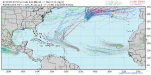
In the medium term, there isn’t too much that catches the attention of the ensembles.
A wave exiting Africa in the next 8 or so days has some ensemble support. Additionally, the possibility of a spin-up in the Gulf of Mexico has a weak signal.
Based on the continued unfavorable conditions in the Atlantic Basin, we very well may be facing a below-average year. But, after the last few hyper-active years, who is really complaining?
On the other hand, perhaps this season will be backloaded. Only time will tell, but time is also running out quickly.
