This Week In The Tropics
It’d appear this week, we’ll see both the Eastern Pacific and Tropical Atlantic have some “noise” regarding tropical activity.
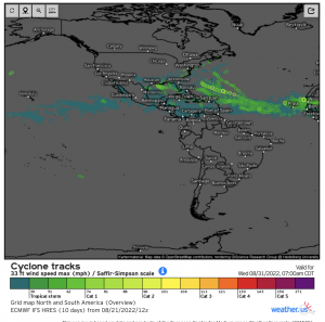
Taking a look at the “big picture” – notice that there are some prognosticated tropical cyclone tracks via EPS. Now, at first glance it appears the MDR and Atlantic in general will get busy quickly; however, verbatim there isn’t one member that gets above hurricane status. There also is a good deal of uncertainty surrounding the state of the Atlantic as discussed in detail in my most previous post. You just take this with a “grain of salt” and acknowledge most pertinently that what the EPS is showing is an idea of what it “thinks” the atmosphere will facilitate in the short-term. It’s a signal, but with some support.
East Pacific:
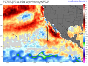
Sunday, we had two tropical disturbances with the one closest to Baja California most organized. The other disturbance that was further west, became disheveled Sunday and yesterday environmental conditions have thwarted development. The more organized cluster of thunderstorms regarding the second disturbance has enough of a favorable window to further develop into a tropical depression this week; however, a relatively cold eddy to the west due (upwelling of colder water temperatures from the subsurface) awaits it. Also dry air advection will infiltrate this general region, causing hostile environmental conditions for future development toward the end of the week.
Atlantic:
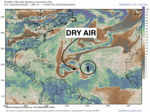
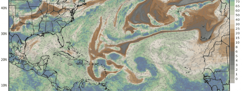
Invest 90L is currently a few hundred miles west of the Cape Verde islands. We’ll be monitoring this closely given a slight window for development as it treks west toward the Lesser Antilles; however, it’ll have to fight shear and dry air. It has still a low chance (<50%) of developing into a tropical depression. Behind this wave, there appears to be two more waves this week propagate across Central and Western Africa to monitor. I’ve highlighted these waves below along with displaying the issues these waves will have to face this week. Dry air can be traced from the upper latitudes via the TUTT and rossby wave breaking into the MDR. Thermodynamic issues also still may stymie development. However, it does appear by next week, we could see a more potent Easterly wave(s) emanate off Western Africa as the tropical disturbances in front could act as “sacrificial” waves by moistening up the ambient environment. Next week looks most likely to render attention and interest, at least relative to the quiescent stretch since last month!
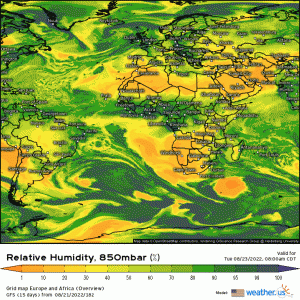
Watch how the dry air (via lower relative humidity at 850mb) infiltrates into the Central and Eastern Atlantic throughout the week. There’s uncertainty in how the monsoon troughs also entangle with some of the waves and the general environment. Again, the intraseasonal state of the tropics does support a relatively active period as also discussed in my last post, beginning next week from the looks of it.
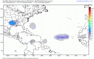
Taking a look at the probability of tropical depressions across the Atlantic basin, Caribbean Sea, and into the Gulf of Mexico – notice the businesses perking up across the Eastern Atlantic as potent Easterly waves moves off Western Africa. Also note some interesting activity that could spur in the southern Caribbean Sea and we’ll also be watching closely for “homegrown” development (i.e. Gulf). The EPS has support from other numerical weather models as well.
We’ll have to first worry about wave development (i.e. 90L) and then maturation, then we’ll deal with track scenarios.
We’ll have a much better outlook on tropical activity across the Tropical Atlantic by the end of this week for what we could be looking at by the last week of August, and also what happens with these disturbances and waves this week!
