Multi-Day Severe Threat: Day Two
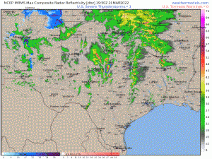
It’s Monday afternoon and storms are firing and quickly going severe, as forecast.
While we’ve had a few tornado warnings so far in north central Texas, I still believe the “bigger show” will be further south, perhaps between Austin and College Station. Storms are just getting going here so we’ll have to see how they evolve. There’s quite a bit of potential, though.
Since tonight’s event is already underway, we turn our attention to what’s expected tomorrow.
IF it all the parameters combine in the correct way, tomorrow has the potential to be a rather dangerous day for some. When the SPC uses wording like “A regional severe weather outbreak, including potential for strong tornadoes, is possible…” you kind of want to pay attention.
That said, the forecast isn’t a complete slam dunk. Let’s look at why.
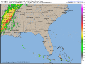
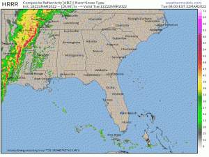
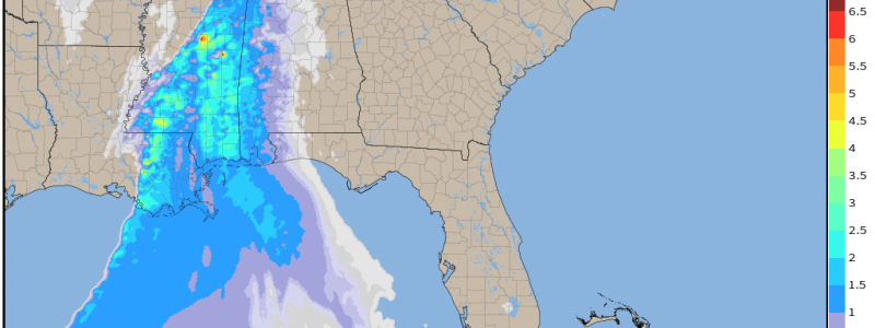
As we near dawn tomorrow morning, a messy line of storms will be approaching the Deep South.
While linear mode convection has its hazards (damaging winds, hail, QLCS tornadoes), it doesn’t have what’s needed to spawn these strong tornadoes mentioned in the SPC outlook. That type of tornado comes from discrete cells.
So, in order for that part of the threat to materialize, we’ll need discrete cells to form and persist in the open warm sector ahead of the line.
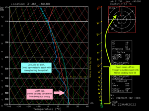
This is the GFS sounding from weather.us. Again, it’s not as high of resolution as the CAMs are, but still useful in determining a few key things.
- Good shear on the order of ~45 kts. Enough to sustain supercells without overshearing them. Surface winds back from the SE, adding extra low-level helicity.
- A slight cap exists in the low levels. This cap will serve to keep every single updraft from growing into a storm. If this were to happen, the warm sector would be full of sloppy storms competing for fuel. With a cap in place, only the stronger updrafts will break through, increasing the chance of discrete cells.
- Cool, dry air aloft increases lapse rates. Good lapse rates are essential for strengthening. A parcel can’t rise quickly if the environment it is in isn’t quite a bit colder than the parcel itself.
- Low LCLs. As mentioned yesterday, low LCLs are a common denominator in stronger tornadoes.
So a few things mentioned above are essential for discrete cells ahead of the main line:
- We need a small cap at least to prevent messy convection.
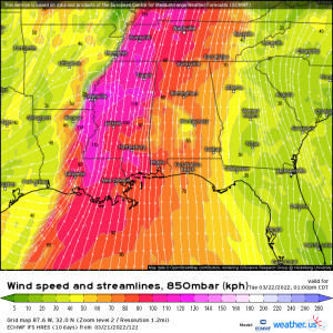
- We need enough shear to sustain our supercells but not too much shear. Earlier in the year we saw a promising set up fail to deliver due to TOO MUCH shear. Excess shear tends to blow the tops right off the storm. Not a great thing if you’re looking for those tall, powerful updrafts.
Models suggest a very strong low level jet which would obviously increase vertical shear quite a bit.
So, although the higher end threat seems likely to verify, it isn’t quite set in stone. However, don’t bet on it failing. Prepare as if it will verify.
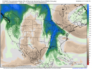
Once again, storms will have access to anomalous moisture. PWAT values 200 to 300% of normal are forecast. Flash flooding is a possible where sections of the line or storms ahead of the line can manage to move parallel to the boundary (train). This is an all-hazards day.
As far as timing goes, this will be mainly a late morning/afternoon event.
The line is forecast to weaken later in the day as it enters less favorable conditions. Still, damaging winds or a QLCS tornado will remain possible in stronger parts of the line.
Summary:
Severe weather is expected tomorrow morning/afternoon. If discrete cells are able to blossom ahead of the main line, strong/dangerous tornadoes are possible. The line is forecast to weaken some as we approach the evening hours and conditions become less favorable.
As always, have your plan to shelter along with your safe space ready to go and be able to carry it out quickly. Have multiple ways to receive warnings and remain weather aware until the line has passed your area.
If there are any significant changes to the forecast, I’ll update tomorrow along with a look at Wednesday’s set up.
