Let It Snow!
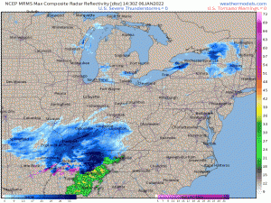
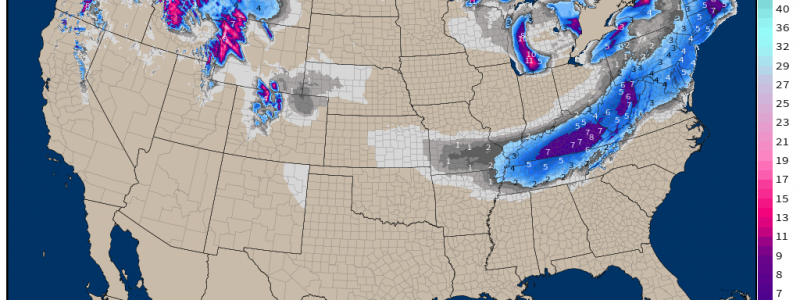
The first stage of our widespread snow event is well underway this morning.
Heavy snow has overspread Tennessee and Kentucky and is piling up quickly.
Let’s take a look at what we expect from this system as it swings eastward.
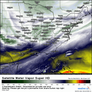
Using the current water vapor loop, we can plainly see a mid-level trough working its way east. A weak surface low is forming ahead of this trough, bringing in moisture to fuel what is forecast to be a fairly potent storm for Central TN through Southern WV.
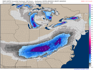
Through tonight, totals could top 6 inches in both Kentucky and West Virginia, especially where elevation changes come into play and enhance the snowfall.
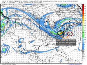
As the trough and associated broad area of low pressure moves east tonight and nears the Atlantic, a change will occur.
The energy from the broad area of low pressure will transfer to a new area of vorticity just off the coast. This will become the new, better defined center of the low.
The new, stronger low is then free to blast northeast, undergoing surface cyclogenesis and deepening quickly. This deepening will have implications on the potential snowfall, but we’ll discuss that in a bit.
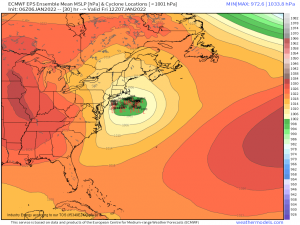
By now, the ensembles have more or less settled on a track for the low as it moves northeastward.
While there is still somewhat of a spread, the center of the low is more or less forecast to remain far enough off the coast that any mixing issues won’t affect land, but close enough that a decent snowfall is possible for the coastal and some of the interior northeast.
One thing to keep in mind, though. Since there is still a little bit of spread in the solutions and therefore a small amount of uncertainty, any wiggle west or east in the position of the center of the low can have implications on the forecast. A wiggle west may introduce mixing issues to the coast along with pushing the precip shield further inland, shifting the axis of higher totals. A wiggle east pulls the precip shield further out to sea, leading to only those closer to the coast receiving any meaningful snowfall.
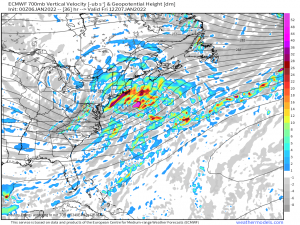
Now, as I mentioned previously, the fact that the low will be undergoing cyclogenesis and deepening quickly can enhance snowfall for some, if it lines up correctly.
Convergence and rapidly rising air means more moisture is brought to levels where it can condense and then fall as snow. This results in a narrow band of greater snowfall totals. Should this play out as models currently suggest, this band could set up over coastal New England. Again, any wiggle in the track would change the location of the enhanced snowfall.
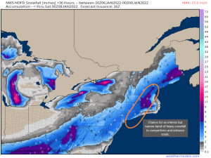
So what are we looking at in terms of totals?
The NWS NDFD paints a decent picture. Greater totals, though not quite on par with blockbuster snow event levels, will be found closer to the coast. Totals diminish quickly as you move further inland and also dip some in Central Virginia/Central Maryland/South-Central Pennsylvania where the energy transfer between the land-based low and the coastal low occurs.
I’ve outlined the area of the New England coast that stands a chance to see enhanced totals from banding. Again, any wiggle in track could change the location of that band so, you know, it’s not set in stone.
Unfortunately, the axis of heavier snow is forecast over the heavily populated I-95 corridor and will likely lead to travel being extremely difficult to near-impossible. Do yourself a favor and stay home if you can. If you truly can’t, use caution in your travel and make sure your gas tank is full and you have supplies in your car (food, water, extra blankets, a way to charge your phone) to survive for at least 24 hours should you become stranded .
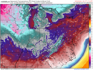
One last thing to remain mindful of. Temperatures will drop quickly behind this front, possibly into the teens as far south as the Tennessee/Alabama/Mississippi borders. Combine those temperatures with a potent Northwest wind, and, well, it’s going to be frigid.
Wind chills could be in the single digits or below zero by Friday morning. Have a back-up plan to stay warm should you lose power during the snow.
Stay safe, y’all! And enjoy the snow!
