Your Christmas Forecast
The holidays are merely a day away now and, like so many others, those of us here at Weather.us and Weathermodels will be off and celebrating with our families. But first, I’ve put together a Christmas Eve/Day forecast in this blog for y’all. Likewise, we’ll post a New Years Eve/Day forecast next week. As a bonus, I’ve done a write up on the Top Weather Events of 2021 that will also be published next week, so keep an eye out for that!
But for now, let’s take a look at our Christmas forecast.
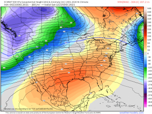
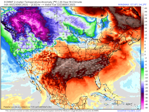
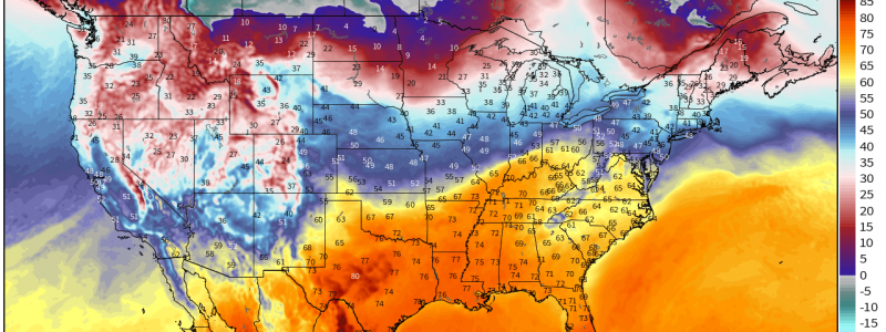
It’s not often that a single image from a single timeframe of a model run can tell us what to expect for roughly the next week, but that’s pretty much what’s going on here.
A pattern that will be very resistant to change is moving into place today. As a deep trough digs in over the West Coast, a strong ridge will build over first the Central US and then slowly bleed toward the Eastern US.
In plain language: this pattern will amount to an extended period of storminess and possibly some record-shattering cold for the West while the East stays fairly tranquil with record warmth.
In regards to the West:
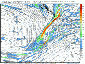
Several shortwaves will swing through the region over the course of the next week, beginning today.
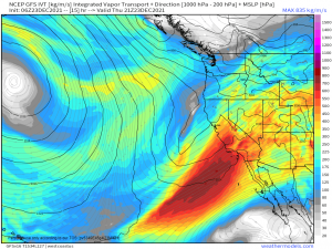
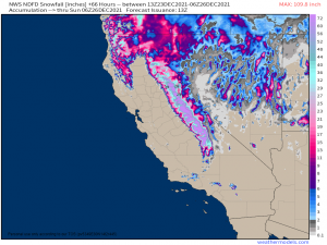
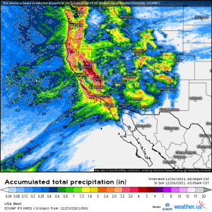
A fairly strong atmospheric river will work in tandem with the system impacting the West today through Christmas Day. The result: quite a bit of water will be thrown at the West Coast. Valleys will see rain while the mountains, especially the Sierra Nevada range, will see significant snow.
Through Christmas Day, snowfall in excess of 5 feet is likely for the mountains. Rainfall in the vicinity of 1 to 3 inches is probable for the valleys, especially for the San Diego and Los Angeles areas. Given the shear amount of water expected to inundate the West Coast, flash flooding is possible. In burn scar areas and other regions prone to flooding, be aware of any developing flooding situations and have a plan to act if need be.
While temperatures will remain nearly average through Christmas, something lurks on the horizon that those in the Northern Tier (Washington, Montana, North Dakota, Minnesota) need to be aware of.
Models have been consistently forecasting some truly Arctic air bleeding south first into western Canada and then into the Northwestern US. This cold air begins to encroach on US territory the day after Christmas and only becomes more potent as we move into the following week. Lows well below zero are likely if this verifies. If you reside in any of the states I’ve mentioned above, you may want to monitor your local forecast and be sure you have ways to keep warm in the coming days.
If you’ll refer back to that last graphic, you’ll see a large area of well above average temperatures over the Central and Southern US. That will be the extent of our weather for the next week.
A strong, stubborn ridge is in the process of setting up today and will persist through the next week at least. For those of us under it, this translates to tranquil, far too warm weather.
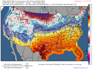
Widespread record-breaking highs are likely for Christmas Day with some locations possibly experiencing their warmest Christmas ever.
And not much will change in the upcoming week for this part of the country. As mentioned above, the ridge and the warmth it enables is expected to persist through the New Year. If you’re a warm weather lover – Merry Christmas! If not, all you can do is hope for a colder New Year.
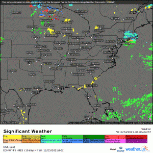
If you’ll glance at that last graphic again, you’ll notice the warmth on Christmas Day abruptly ends around the Midwest/Northeast. This is due to a stationary boundary draped across the region. While nothing particularly exciting is forecast, this boundary will facilitate temperatures not too insanely far above normal as well as a little bit of wintry precipitation in the far northern reaches of these regions.
Again, this really won’t amount to anything exciting. It may be just enough to give locations downwind of the Great Lakes and higher in elevation that magical 1 inch of snow to officially make it a “White Christmas.”
That about wraps up our look at the Christmas forecast! If you’re curious about the specifics for your city, check out the Weather Overview at weather.us or the City Charts section at weathermodels.com for your personalized forecast.
From all of us here at Weather.us and Weathermodels: Wishing you a very Merry Christmas and Happy Holidays!!
