Wednesday Severe Weather Update
Well, I promised in yesterday’s blog that I’d push out an update if the forecast changed at all concerning the severe risk for today. Though it hasn’t exactly changed in regards to what is expected, it’s become a bit more urgent.
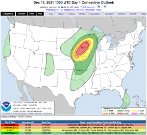
I’ll be honest, though I more or less expected an upgrade to an Enhanced risk, I did not expect the SPC to introduce the Moderate risk. The addition of this level of risk indicates that they are extremely confident in the severe risk playing out as forecast.
Let’s review what we’re expecting.
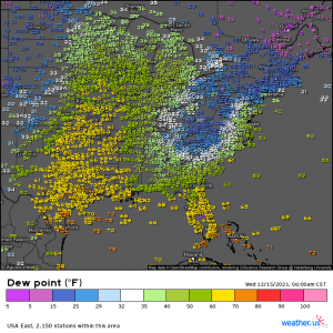
Moisture is already on its way north with dewpoints creeping into the 50s and even 60s in parts of the outlined risk areas. As the Southwesterly winds kick up later this morning and afternoon, more moisture will stream in. Dewpoints in the mid 50s could reach as far north as east-central Minnesota by this afternoon.
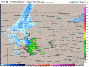
As a deepening low rolls down the Rockies and through the Northern Plains states, it will enter an area of very warm, moist air (for the time of year, at least). The lifting associated with the front will allow a skinny, but potent, squall line to form late this afternoon into the evening hours.
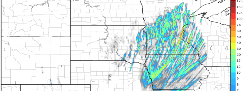
The greater severe risk, as depicted in the Day 1 Outlook, will exist in the northern portion of the line closest to the low, where the forcing is greatest. Embedded supercells may be present here, increasing the risk of a few tornadoes.
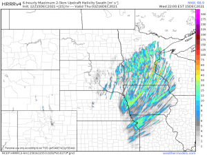
The intensity of the forecast updraft helicity swaths is not only rather shocking for not only this time of year, but shocking for the location at this time of year. There is the potential for a strong tornado or two this evening. These will likely occur after sunset, compounding the danger.
I believe “unprecedented” was the word used by the SPC in reference to the threat posed.
As mentioned yesterday, there are no tornadoes currently on record for Minnesota in December. Further, this is the first time a Moderate risk has been issued for this region in December.
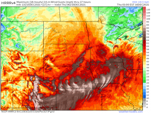
As startling as this tornado threat is, it isn’t the main threat today. The main threat remains that of damaging winds. These are possible inside the storms, yes, but also via a very speedy low level flow ahead of the front.
Hurricane-force wind gusts are possible today, especially in the Front Range of the Rockies. As discussed yesterday, damage along with power outages is rather likely.
Safety:
Being prepared ahead of time and having a plan that you can execute quickly is absolutely imperative today. Once these storms form, they will be moving very fast. Warning lead time may be reduced due to that fact alone. Don’t waste time trying to see the threat as it will likely be dark, just get to your shelter ASAP.
Considering the magnitude of the damaging winds threat, it would be an excellent idea to shelter for a severe thunderstorm warning as you would for a tornado warning. Winds gusting 75 mph + can do considerable damage, even without rotation.
Since this is such an unprecedented event – if you live in this region, warn your family, your neighbors, the guy you pass on the street. If you have family or friends in the region – make sure they know and tell them to alert others. Spread as much awareness as you can!
Be sure to remain weather aware today with multiple ways to receive warnings. Monitor the changing conditions via your local NWS office or your local broadcast Meteorologist. They’ve got you.
Stay safe!


Thanks for the update. The squall line just moved through Boulder CO about 15 minutes ago. High winds and some rain (but not enough).