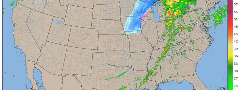
Overnight Severe Threat Expected Friday/Saturday
Originally, I had planned on updating on the Friday/Saturday severe threat later tomorrow. But things have trended up a bit since I covered it in yesterday’s blog so I felt an update was necessary, especially considering the risks.
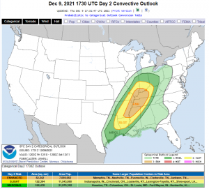
An Enhanced Risk has been added that covers basically the middle Mississippi Valley region.
Those of you who have read my blogs concerning severe weather before know what’s coming next: Don’t focus too much on the scary colors. If your town is in one of the defined risk areas, you have a chance at severe weather tomorrow, especially overnight into Saturday. Yes, some have more of a chance than others due to “higher quality” ingredients (better CAPE, moisture, shear), but your risk is not zero, even in the lowest categories.
That said, the timing has become a bit more certain now so let’s take a look at what we’re expecting.
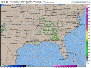
By dawn tomorrow, some widespread showers should be occurring over the mid-South/Southeast. These are expected to be mostly sub-severe as the instability and forcing arrive much later. An exception may be along the Gulf Coast where moisture is already residing. These showers will, however, serve to keep clouds in place over the region in question. With very little daytime heating, most of the instability that will feed storms later Friday night will come from the strong low level jet advecting in moisture.
Once it kicks in late Friday afternoon, it will send warmth and moisture flying northward. Dewpoints in the upper 50s/low 60s are likely all the way to the southern edge of the Great Lakes. In fact, as the LLJ moves eastward ahead of the front through the overnight hours, many in both the Ohio and Tennessee valleys should hit their high temp in the early hours of the morning.
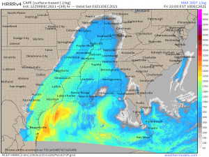
If I’m being honest, the CAPE isn’t the greatest for this event. At least, it isn’t the semi-explosive values we generally expect for a legitimate severe threat.
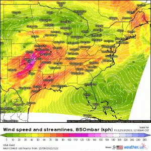
However, it is sufficient, especially considering the magnitude of the forecast shear discussed in yesterday’s blog. This event will technically qualify for the HSLC category.
I do want to mention that, although widespread cloud cover is expected and will limit daytime heating, any lingering breaks in the clouds will allow more instability to build up. High res models like the HRRR hint at a few scattered thin spots in the clouds over the enhanced risk area in the early afternoon.
It isn’t a huge deal, since prolonged clearing isn’t expected, but it’s something that can change mesoscale conditions/forecast and therefore something to be aware of on a local level.
Convective initiation is expected in the late evening hours – well after sunset. This will be a nighttime event. I want to place emphasis on that. Nighttime events tend to be more dangerous since people aren’t as aware as they usually are during the day time.
Let’s discuss the hazards.
- Damaging Winds
- Low-end Hail Threat
- A Few Strong Tornadoes
As always, tornadoes will be more likely early in the event with any discrete supercells that form. It is in these cells that the greatest threat for a strong tornado or two resides.
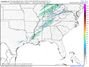
This parameter shows the potential for storms to rotate. That doesn’t necessarily mean each line is a tornado. Supercells rotate too and not every supercell puts out a tornado. But, as you can surmise from the graphic, there’s plenty of potential for rotating storms.
Don’t focus on the exact tracks, though. Your takeaway from this graphic should be that storms can absolutely rotate and you should be prepared for the possibility of any one storm putting down a tornado – some of which may be strong.
In respect to the damaging winds threat – convection is forecast to grow upscale into a broken line later in the event. It is at this point the main threat becomes damaging winds. As usual, however, a brief tornado remains possible with any “kinks” in the line.
On the topic of safety:
As I stated several times above, this is an overnight event with the potential for a few strong tornadoes. Have multiple ways to receive warnings including at least one that will wake you if necessary. You may even want to consider sleeping in your “safe space” to reduce the amount of time you’d spend scrambling out of bed and into shelter.
If anything changes significantly with the forecast, I’ll put out a further update in blog form tomorrow. Otherwise, be safe and remain weather aware!


Excellent update, clear and concise. I always enjoy reading your blog posts.
BTW: what does “HSLC category” mean?
Hi Bill! Thank you for the kind words!
HSLC = High Shear, Low Cape. That’s how we classify potential severe events that don’t have a lot of CAPE, but have plenty of shear to make up for it.