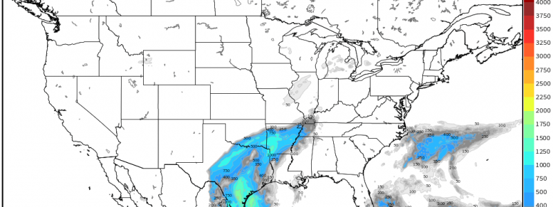
Sunday Severe Threat
As the next system gets ready to roll across the country, we’re eyeing the Sunday evening/overnight timeframe for a bit of a sneaky severe threat.
Honestly, with all of these lingering above-average temperatures, I would have been surprised if the first system directly following didn’t offer at least some hint of a severe threat.
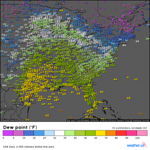
A persistent southerly flow has brought moisture fairly far inland. It’s nothing crazy – dewpoints are in the mid 60s to low 50s – but it is still two days out from the event in question.
However, once the low level jet kicks up ahead of the front on Sunday, that moisture is expected to be advected further north. Exactly how far north is still in question.
For now, most models suggest that locales as far north as the southern tips of both Illinois and Indiana could be seeing dewpoints flirting with 60 degrees. This, of course, isn’t blockbuster levels of moisture but, with the help of lifting via the cold front, it may be enough to see a round of severe weather in the Mississippi Valley region.
Lower dewpoints obviously mean less energy to work with and therefore less CAPE. Shear, however, will make up for what we’re lacking in instability.
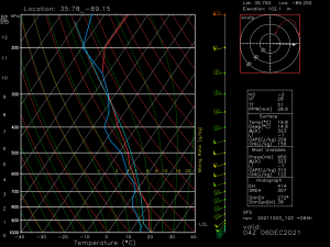
This is a forecast sounding for Sunday at 10 pm central in far West Tennessee. As evidenced by the arcing hodograph, the low level jet is forecast to be quite speedy providing strong low-level sheer. So, essentially, this event is looking like a HSLC (high shear, low CAPE) event.
From time to time, strong shear can make up for a lack of CAPE and produce isolated severe weather. We’ve seen a few of these types of events produce fairly significant isolated severe weather in the past.
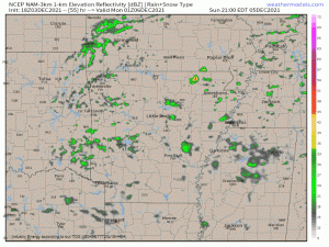
Damaging winds are expected to be the main threat for the northern part of the activity. As the forecast stands now though, I’d be wary of the possibility of a few tornadoes as well – especially in Northeast Arkansas, Southeast Missouri, West Tennessee, West Kentucky and far southern Illinois. We are still 2 days out and there are discrepancies between models, but it’s something to monitor the trends on – especially since this will be an overnight event with convective initiation not occurring until the late evening hours.
Should a small tornado threat materialize, it will likely be most prevalent during the earliest part of the event – should any discrete supercells form. Upscale growth into more of a pre-frontal convective line is expected to happen rather quickly at which time the main threat will transition to damaging winds. As long as the shear remains in place, though, QLCS tornadoes may remain on the table.
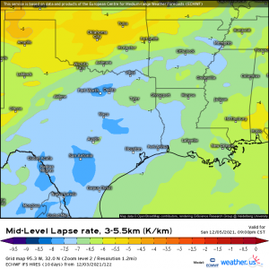
Further south, away from the strongest forcing, steep lapse rates could facilitate the risk for some severe hail.
This threat is mainly for Texas and perhaps western Louisiana and western Arkansas.
This is still an evolving forecast as some factors are a bit up in the air thanks to model disagreement. Be sure to monitor its evolution through the weekend if you reside in an area that may be affected.
Should it play out as currently forecast, be sure to have multiple ways to receive warnings – especially since this will be an after-dark and overnight event.
