Ida’s Remains Make Flash Flooding Possible for Appalachia
Ida, now a depression, continues northward today. As we know, tropical impacts don’t start and end at the coast. Oftentimes, the remnants of these systems have far-reaching effects. Recall any recent tropical system: Fred and the flooding in North Carolina, Henri’s deluge in New Jersey and Pennsylvania. And Ida won’t be the exception to the rule, either.
As Jacob wrote in an extensive blog yesterday, flash flooding is likely over a large part of the eastern US as Ida journeys toward the Atlantic. As it stands now, Flash Flood Watches are posted over roughly 1200 miles of the US – from southern Alabama to the tip of Cape Cod.
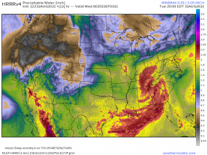
Deep tropical moisture accompanies Ida on its trip north and the flash flood threat, for today, will focus on Appalachia. A moderate risk for flash flooding is posted from northern Georgia through the southwestern tip of Pennsylvania, indicating better-than-usual odds for someone to see significant flooding.
Within this broader region, a few specific areas are of concern.
Northern Tennessee/Southern Kentucky received quite a bit of rain yesterday from a few slow-moving storms. This area sits on elevated land, known as the Cumberland Mountains/Cumberland Plateau, that is oriented in a SW to NE direction. Rain from Ida will be arriving from the southeast, which is nearly perpendicular to the elevated land, and maximizes orographic lift.
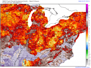
As depicted in the map above, FFG values for this are significantly lower than the surrounding area. If you combine the already-saturated ground with the extra boost from orographic lift, significant rainfall totals are possible in a focused area along the edge of the Cumberland Plateau.
Applying the same logic to the topography of northern Georgia, western North Carolina, western Virginia, and western West Virginia, significant totals are possible here as well. While the FFG values are better for GA and WNC, they are rather low for the mountains of WV and VA. Flash flooding may be more likely in these locales.
There is another location where a rainfall/flooding maxima may exist that isn’t enhanced by topography: North-central Kentucky into southwest Ohio.
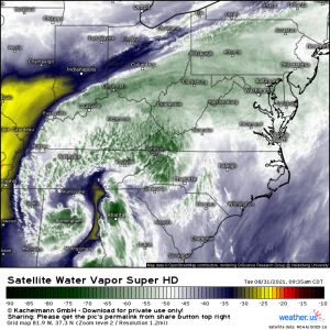
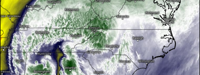
A nearly stationary front is draped across the Ohio Valley and extends off into the northeast, as evident on water vapor imagery.
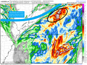
As Ida’s rains filter in from the southeast, they will interact with this boundary.
The added lift as moist air from the south flows over drier air to the north can produce enhanced rainfall totals, especially where the boundary is oriented favorably (SW to NE) to the southeasterly flow. With FFG values already low in this region, I’d watch it carefully for flooding issues later on.
This same front will interact again with Ida tomorrow, potentially significantly enhancing rainfall for parts of the northeast. Look for Jacob’s blog tomorrow for a detailed analysis.
