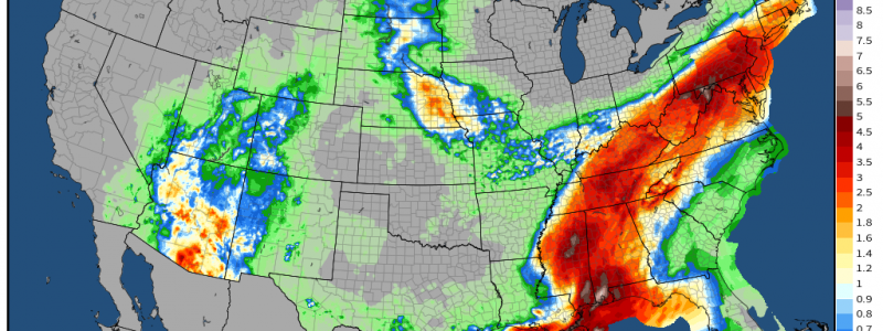
As Ida Weakens Inland, Substantial Flooding Impacts Continue
Ida made a catastrophic category four landfall yesterday afternoon southwest of New Orleans, bringing regionwide power grid failure, substantial surge, and sporadically disastrous freshwater flooding to the metro.
As the storm weakens inland, so too does national attention towards angry Ida. But the cyclone, now a tropical storm, will continue to bring a substantial hazard well inland: widespread flash and river flooding due to heavy, persistent rainfall.
Tropical cyclones carry with them immense envelopes of very deep moisture. Precipitable water near Ida’s center, a measure of how much rain could be condensed out of a static column of the environment, currently exceeds 2.5″. This indicates a high amount of potential for prolific rainfall- really, amounts exceeding 2″ are considered extreme.
Rain, as you surely know from reading my blogs, requires an additional ingredient aside from moisture- lift. Other factors, like instability, speedy low-level flow, and the depth of warm clouds, can dramatically increase the ‘efficiency’ of converting atmospheric moisture into rain. These parameters are typically hard to find in the same place at the same time, but tropical cyclones can often concentrate all in one region. This can make them very dangerous prolific rainfall producers- even when a tropical cyclone sheds its hurricane force winds and storm surge with time inland, the overlap of parameters that support extreme rainfall can continue.
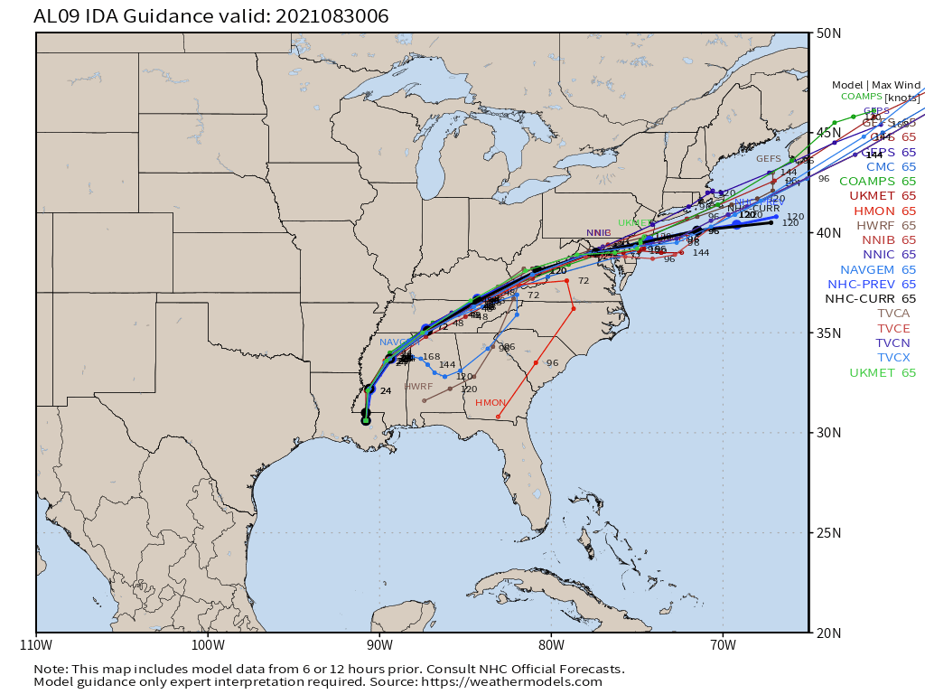
Tightly clustered model support takes Ida inland slowly over the next 12 hours, before the storm accelerates into a broad right hook over the next several days.
As the storm tracks inland, so too will the aforementioned envelope of conditions quite favorable for prolific rainfall.
Where these ingredients can overwhelm environmental ability to whisk away the deluge, flash flooding will occur. This will happen wherever the tropical storm’s rain can either occur with a great deal of persistence or coexist with substantial pre-existing saturation.
Day one- noon today through tomorrow morning
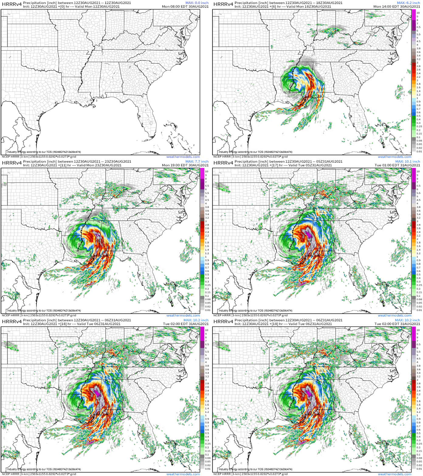
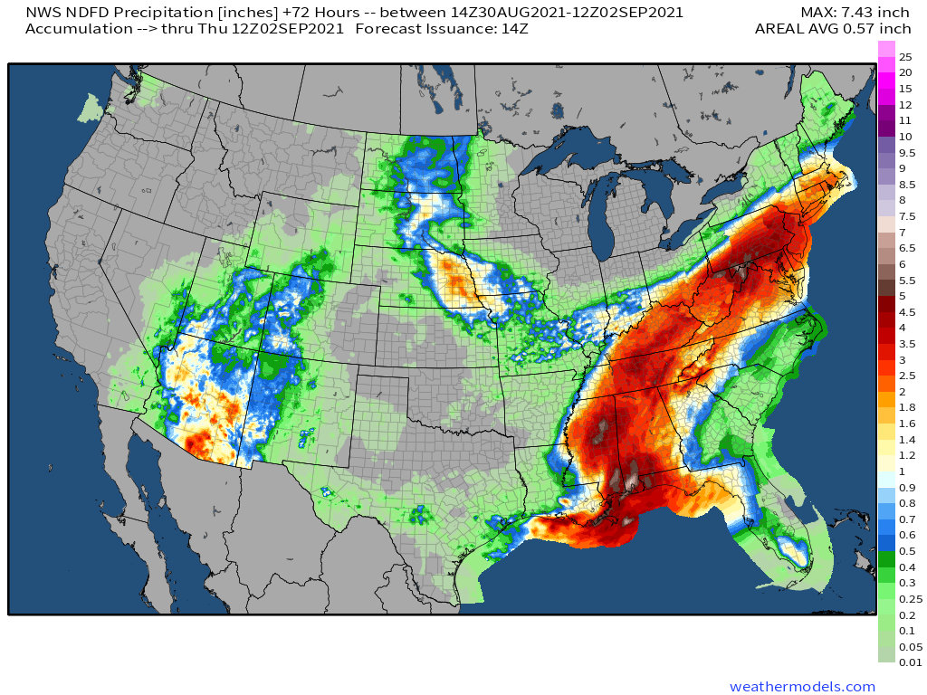
Today will see Ida crawl slowly north through Mississippi, with the storm reaching the northeast border with Alabama by noon tomorrow. This slow motion will lead to a high amount of persistence, with convergence associated with the storm’s feeder bands interacting with incredibly rich moisture to produce prolific rain totals over a long time. Many locations in Mississippi and surrounding areas will see ‘training’ of tropical convection today and tonight, with numerous hours of high precipitation rates that should easily overwhelm runoff capacity in places.
Don’t focus on the exact locations impacted by the core of today’s rain- rather, focus on the potential for 10+” to fall in unlucky swaths of the region. These will likely lead to flash flooding unusual in both intensity and extent, capable of threatening life and property.
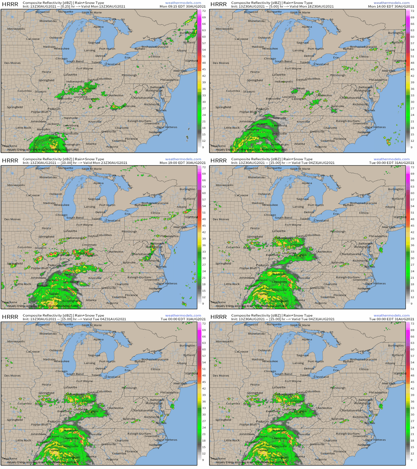
Meanwhile, a slow-moving cold front to the north of Ida will interact with moisture from the tropical storm to develop thunderstorms capable of dropping unusually prolific rainfall from Tennessee northeast through Kentucky and into parts of the interior mid-Atlantic. Storms will move rather slowly amidst fairly stagnant flow aloft, increasing the risk for quite a bit of rain to fall over areas impacted.
These showers and thunderstorms will be quite widespread closer to the tropical cyclone, becoming more scattered further north and east. They will also move faster with northern extent, as midlevel flow is stronger further north.
These storms should not be capable of causing flash flooding, aside from one or two unlucky localities. Any flash flooding that does occur should not be very serious. However, locations that see partial saturation will have the stage set for substantial flash flooding later, once the storm actually moves through.
Day two- tomorrow morning through Wednesday morning
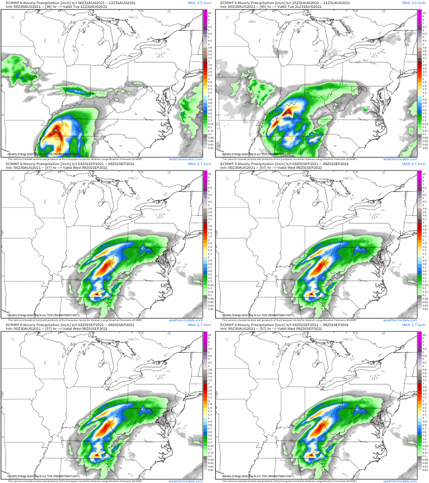
The day two period will feature something of an initial lull in the ability of the atmosphere to deliver substantial flash flooding, as Ida’s remnants speed up and lose some of their organization and moisture. Still, tropical stratiform is a fierce beast, and a widespread 2-6″ is still plausible from the northern Mississippi/Alabama border through Kentucky.
Two potential issues here, though, display how flash flooding is not simply an atmospheric threat.
First, remember Tennessee’s catastrophic, historic rainfall event last week that led to 22 deaths and widespread devastation west of Nashville? That area is much more vulnerable than typical due to extensive soil saturation from, well, 17″ of rain in 12 hours. I’d be worried about the ‘scar’ of this flash flooding event as a potential region of increased vulnerability for substantial flash flooding with Ida’s prolific rainfall.
Second, remember the slow moving, tropical thunderstorms I talked about before that will impact parts of Tennessee and Kentucky today? Areas that see these storms will likely experience a degree of soil saturation today, which will promote excessive runoff risk with the precipitation shield tomorrow. While it’s really hard to predict where this will be at the moment, by tonight, residents who receive significant rain today will know to be extra wary of flash flood risk tomorrow.
A couple places could see flash flooding that is considerably life and property threatening, though of Monday, Tuesday, and Wednesday, I’m least worried about Wednesday bar the locations I’ve mentioned, which should be fairly scattered.
Day three- Wednesday morning through Thursday morning
As a hydrology nerd, I’m quite nervous about what Wednesday could mean for parts of the mid-Atlantic.
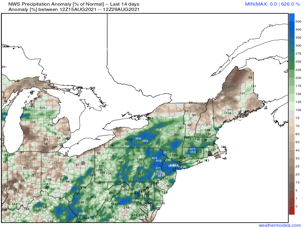
This part of the country is in a very unusual place, hydrologically, for late August- two tropical cyclones in the last two weeks have brought widespread very heavy rain, leading to swaths of extensive deep soil saturation amidst 300% 14 day precipitation.
When Henri moved through, I called it lucky that the storm’s rain shadow largely failed to overlap with that from Fred. The former extends from northeast Pennsylvania into northern New Jersey, the Catskills, and New England; while the latter extends from the Kentucky/Ohio/West Virginia border area northeast into the Finger Lakes. Fred left a target, if you will, of saturated soils, and Henri was unable to hit it with enough overlap/intensity to cause substantial flash flooding.
But as a third tropical cyclone moves through, the target is now effectively impossible to miss, and it’s quite hard to conceive of a situation in which Ida’s heavy rain swath misses the heavy rain swaths of both Henri and Fred.
Take a look at the extensive swath of depressed long-duration (6 hour) FFG values associated with excessive rain over the last two weeks.
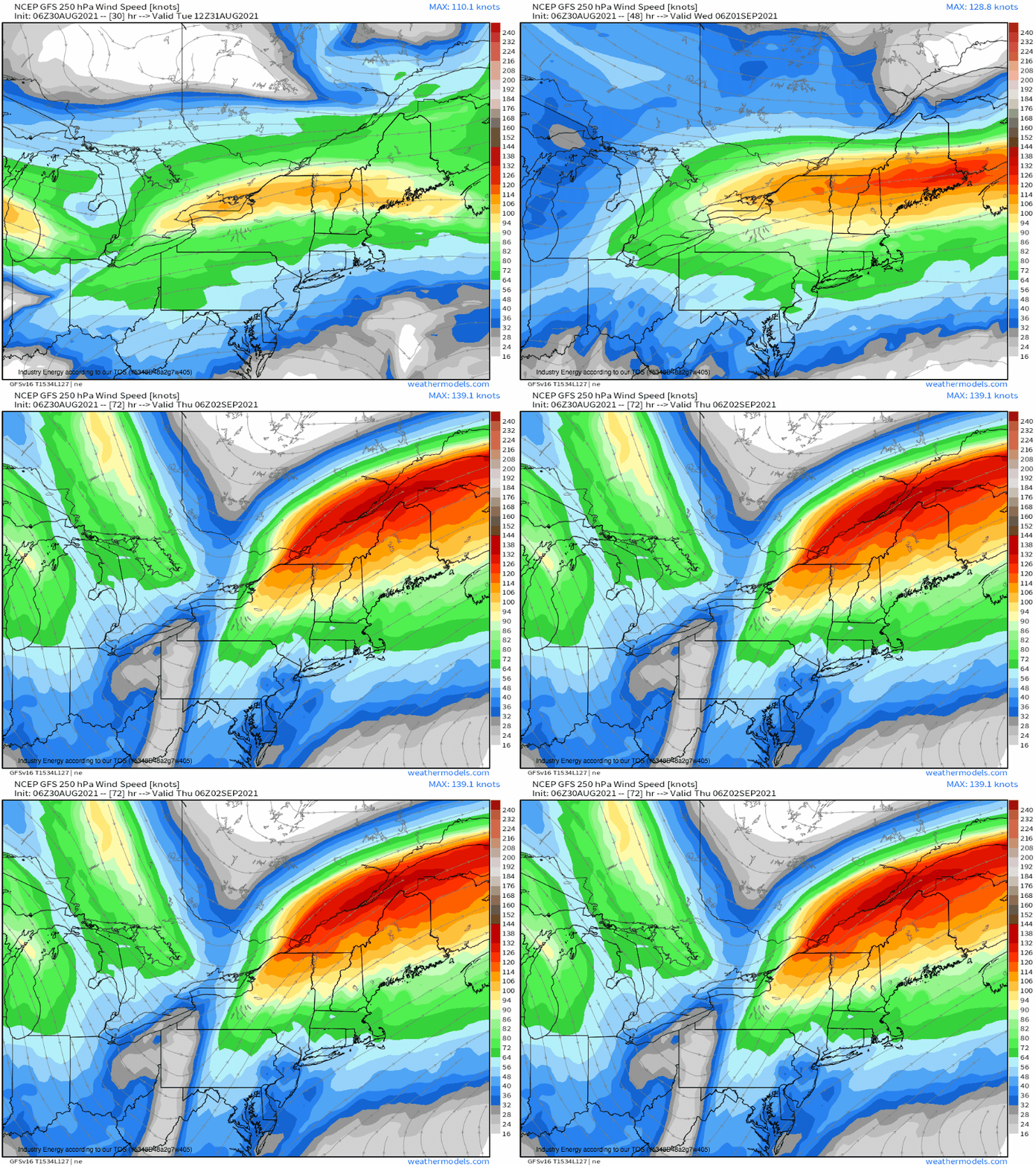
Additionally, the atmosphere will be well set up to bring increasingly prolific rainfall to those in the storm’s path come Wednesday. As Ida turns further right, heavy precipitation with tropical stratiform to the cyclone’s north will be oriented largely parallel to storm motion, increasing the potential for such heavy rain to train along the same swath of land. This rainfall potential itself will be aided by synoptic ascent associated with increasing proximity to a jet streak over the northeast, which will enhance rainfall rates.
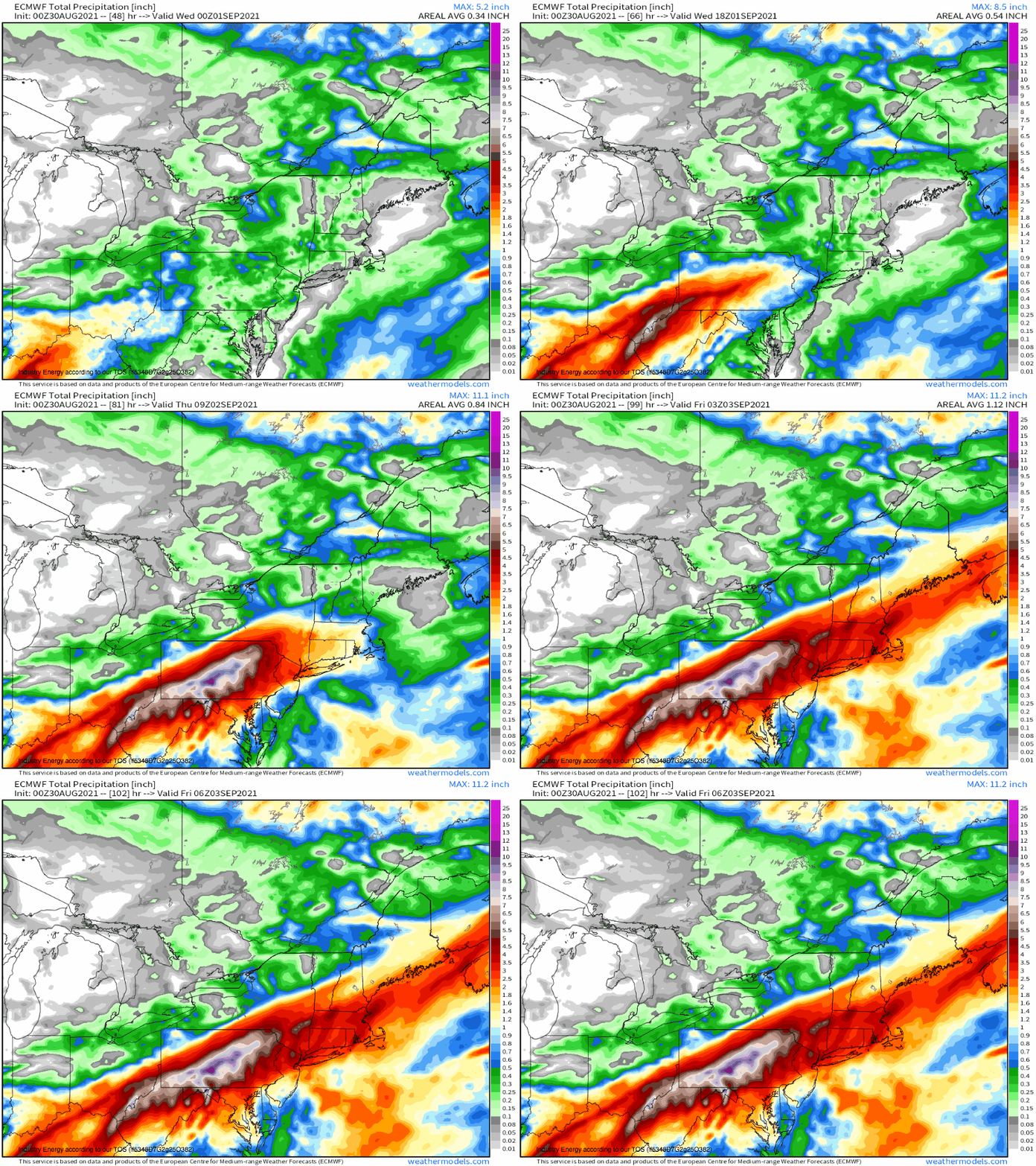
The confluence of training and increasing synoptic support for extreme rainfall rates will result in the potential for a highly unusual rainfall event across a swath of the northeast, from West Virginia through southwest New England, to drop a widespread 2-6″. Totals could locally approach a foot where topography steps in- I’m most concerned about parts of West Virginia, Maryland, and Pennsylvania.
It looks like, therefore, we have the possibility of seeing very heavy rain leading to flash flooding amidst persistence, from favorable storm track, and widespread pre-existing saturation. This flash flooding could reasonably be a very high end event, especially by the standards of the northeast, and could feature multiple instances of large floods capable of threatening life and property. River flooding will also be possible, especially over basins in Pennsylvania that will see widespread critical runoff as very heavy rain falls on soils that simply cannot sufficiently absorb it.
That’s all for now. Stay tuned to this evolving hazard. Remember- most flooding deaths take place in cars. Turn around, don’t drown!
