Wide Swath of Dangerous Flooding Possible
When Fred made landfall as a strong tropical storm in Florida yesterday afternoon, bringing gusty winds, a few feet of storm surge, and freshwater flooding to Michael-battered Mexico Beach, its story was only beginning.
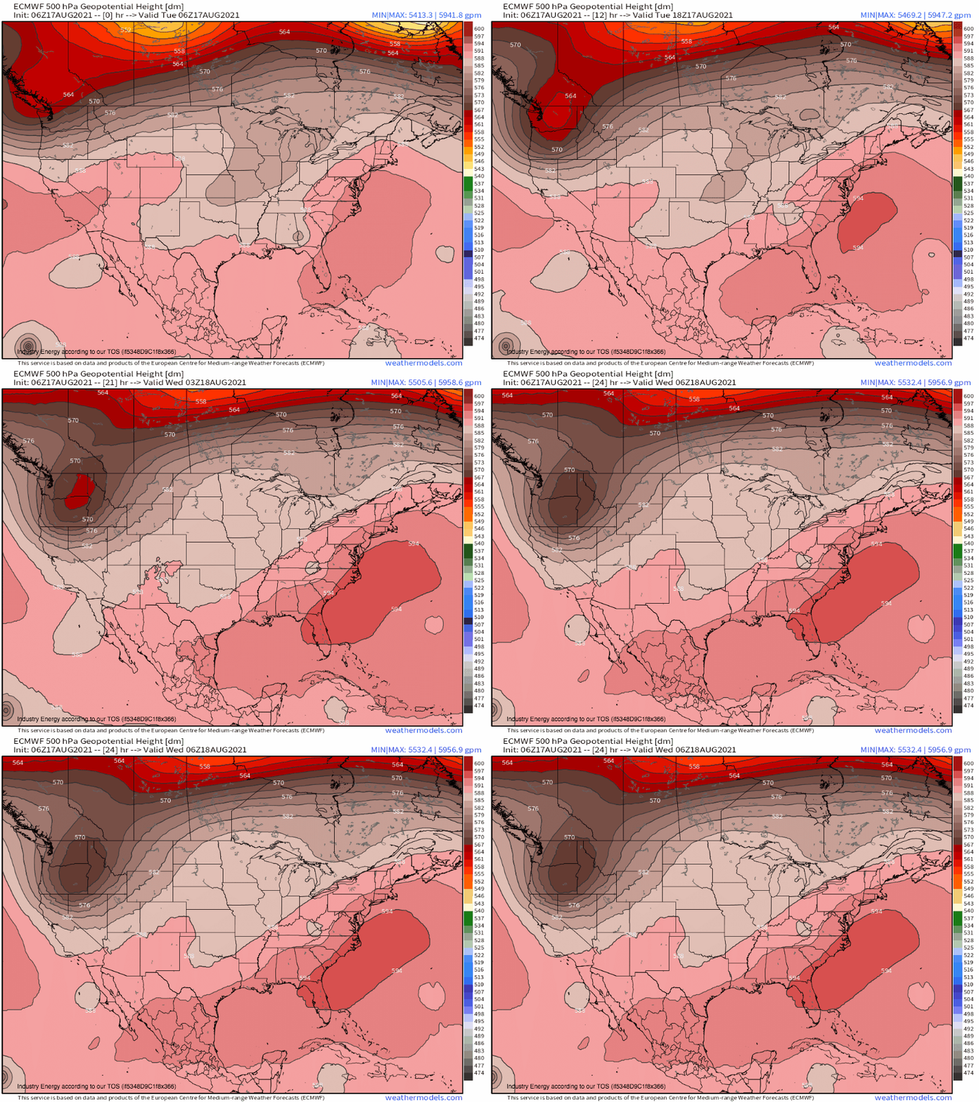
As the remnants of Fred head north/northeast today, they move along the eastern periphery of a deep but low-intensity upper level trough.
Two facts about how TCs interact with their environment will prove substantially impactful.
Tropical cyclones get their energy from the condensation of heat-rich tropical water, and so the environmental envelope around the storm center is chock full of deep moisture.
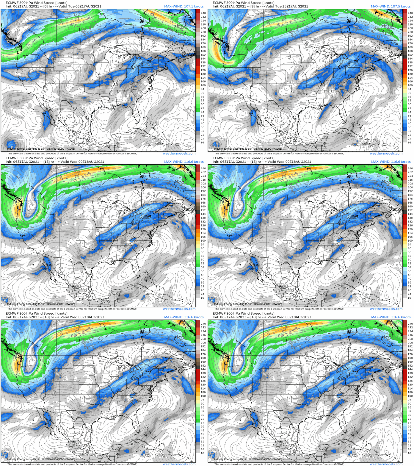
Meanwhile, the ‘venting’ of very warm air in the storm’s core strengthens downstream ridging, resulting in flow that increases in speed down streamline. When the TC is imbedded along the SE periphery of a trough, like today, that process looks something like this:
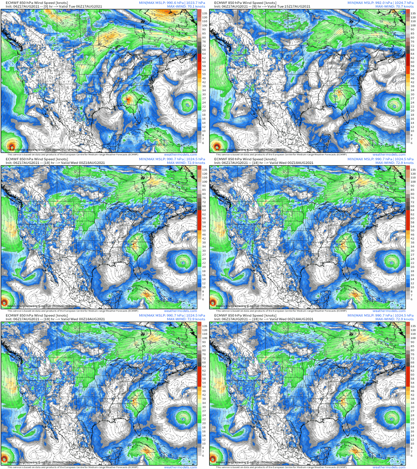
This intensification of flow downstream has been ongoing for a few days now. The importance of the process is that flow increasing along streamline leads to a vacuum effect in the upper levels known as speed divergence, which encourages mass at the low levels to evacuate up. Because the low levels can’t just siphon air from below when vacated like the upper levels can, low-density warm air from the south rushes north- forming a southerly low level jet.
Like the upper level setup, this didn’t just start up once Fred landfalled. Rather, the low level jet has been nosing slowly north over the last couple of days.
Remember what I said before, about how tropical cyclones tend to exist within an envelope of super rich moisture due to the processes that energize them? That’s an important nuance here, because it means that low level jets moving north from a TC carry a great deal of water vapor with them. A tongue of very anomalous precipitable water content has extended hundreds of miles north of Fred for the last few days due to the storm’s interaction with the UL trough and cascading impacts on LL flow, and it’s continuing to deepen north today.
When this water vapor races north from a TC, it sets the table for something called a predecessor rain event, or PRE. Not only do PWAT values this high assure efficient, prolific rain, they also increase the probability of instability that promotes extreme rainfall with convection.
Even with all this moisture and instability, though, convergence is still required to actually get rain. But this isn’t a high bar: from fronts to diurnal troughs to sea breezes to topography, convergence is everywhere in the East in August. The result has been, and continues to be, a widespread mixed bag of convective and stratiform showers well ahead of Fred’s center.
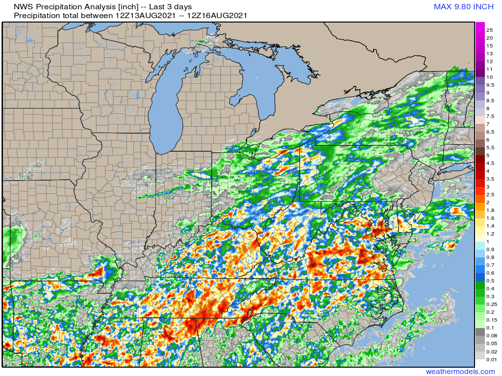
Over the last 48 hours or so, this regime has supported prolific rain across the interior mid-Atlantic, with numerous flash flood warnings already issued. The ‘winner’ has been a section of West NC that’s seen up to 10″ of rain from topographically forced PRE enhanced convection.
Where such rain has fallen, soils are readily saturated, and some flash flooding has already begun. This is a first glance at the danger of PREs: as standalone events, they overwhelm soils. Remember this for later.
The PRE regime will continue to support widespread showers capable of dropping very heavy rain, especially along topography, as far north as interior NY over the next 24 hours.
The P in PRe stands for predecessor. Predecessor to what, exactly?
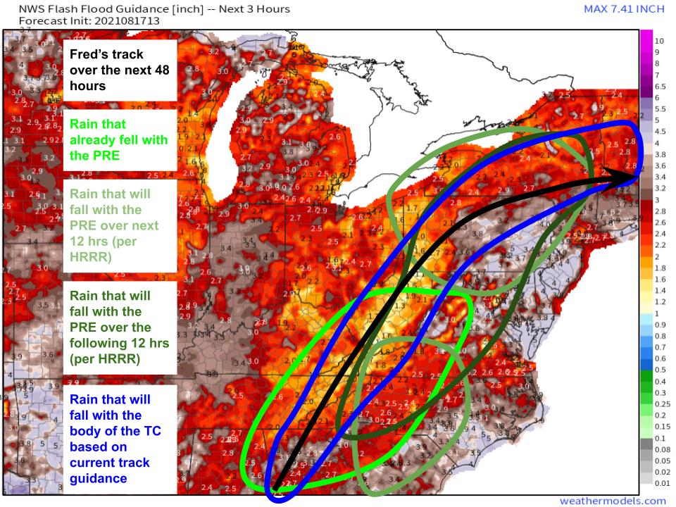
Over the next two days, Fred will move slowly in an arc over the interior mid-Atlantic. If you thought the moisture content ahead of the TC was low, just wait- the storm’s body will pack PWATs locally approaching 3″ per guidance, and will be capable of dropping several inches of rain over a few hours as it passes.
Flash flood guidance is already fairly low over parts of the area. The PRE, as I’ve said, is really good at lowering it further by saturating soils. This is problematic in areas that see both heavy PRE action and the TC body, which could be quite a large swath of the eastern US.
I’ve drawn outlines that approximately show the spatial extent of rain that has fallen and will fall with the PRE over the East, as well as an outline of where I expect the highest precipitation to fall with Fred’s body itself. This is all over a map of FFGs, showing swaths of land with low to moderate values that will certainly continue to fall over the next 24 hours.
Remember that PREs are widespread but not geographically constant. It all depends on forcing for ascent, with some areas favored by topography or slow-moving atmospheric convergence seeing windfalls, and others seeing little to no rain at all. We can’t say for sure which locations will be in which camp, though E->W topography is most favorable for prolific rain in such S-ly flow events.
A lot of locations in the interior East are likely to see locally complete soil saturation with a multi-day PRE event. Some already have, like the southern Appalachians in interior NC. For these places, things will probably get messy really fast as Fred passes, with almost all of the brief, prolific rain likely to runoff, creating serious flash flooding.
So, we already know severe flash flooding is likely today in parts of the Appalachians where prolific rain fell with the PRE. As the PRE continues further north, more of these locations will probably pop up. One potentially favored zone will be near N. PA and SW NY, where topographical forcing and the parallel track of the TC could collaborate to drop prolific rainfall. Stay tuned.
