Storms Threaten Central US With Severe Weather, Flash Flooding
A potent summertime pattern will bring a plethora of hazardous weather to the central US today, with risks that include widespread severe thunderstorms and potentially significant flooding.
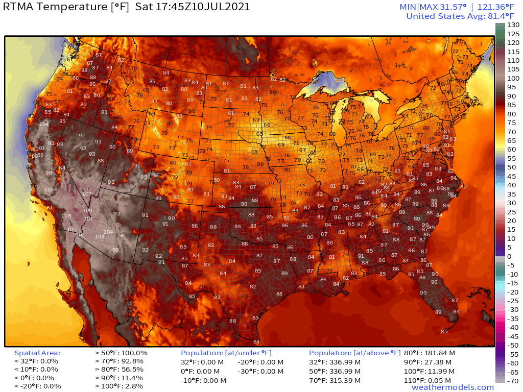
A belt of seasonably strong northwesterly flow, veering to westerly with extent south and east, makes up the periphery of a very positively tilted northeastern CONUS longwave. Just to the east of this belt, a lead shortwave is spreading out the midlevel air upstream, enhancing divergence. It’s a pattern that supports the type of midlevel mass removal which, in turn, promotes the lowering of surface pressure. But unlike the intense low-level cyclones that form when neutral or negative troughs dig, this surface depression is more like a zone of relatively muted pressure than a singular, discrete low. Wind responding to the resulting pressure gradient have inspired a sluggish front over the middle of America, which is pretty apparent on temperature analysis.
This boundary will be responsible, in large part, for the two-headed threat of storms that should evolve with time today.
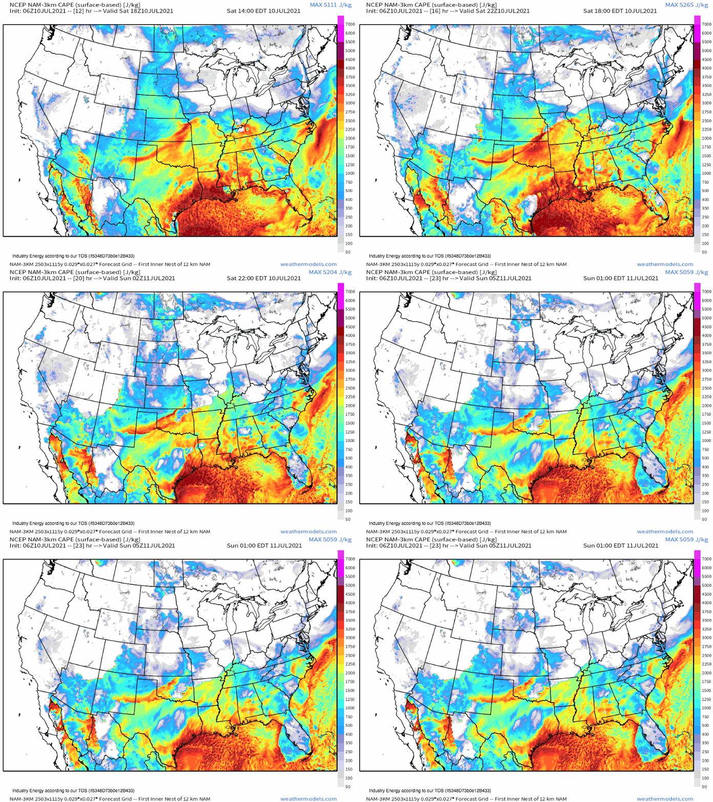
Already, ample moisture streaming north from the Gulf has nudged dewpoints to the mid 70ºs F across much of the south-central and south-east US. Favorable lapse rates streaming east towards Missouri are overspreading this very humid airmass from the west, promoting an atmosphere with incredibly potent potential energy for storm development. Surface based CAPE already exceeds 4000 j/kg over parts of the south-central Plains, and the areal extent of this extreme instability-signifying contour will increase through the early evening.
The northern half of this instability, which should prove sufficient for intense thunderstorms, will be overspread by deep layer shear courtesy of the aforementioned midlevel jet streak. Storms will develop along the boundary over the next couple hours, and will be pushed away from the initiation point by midlevel flow.
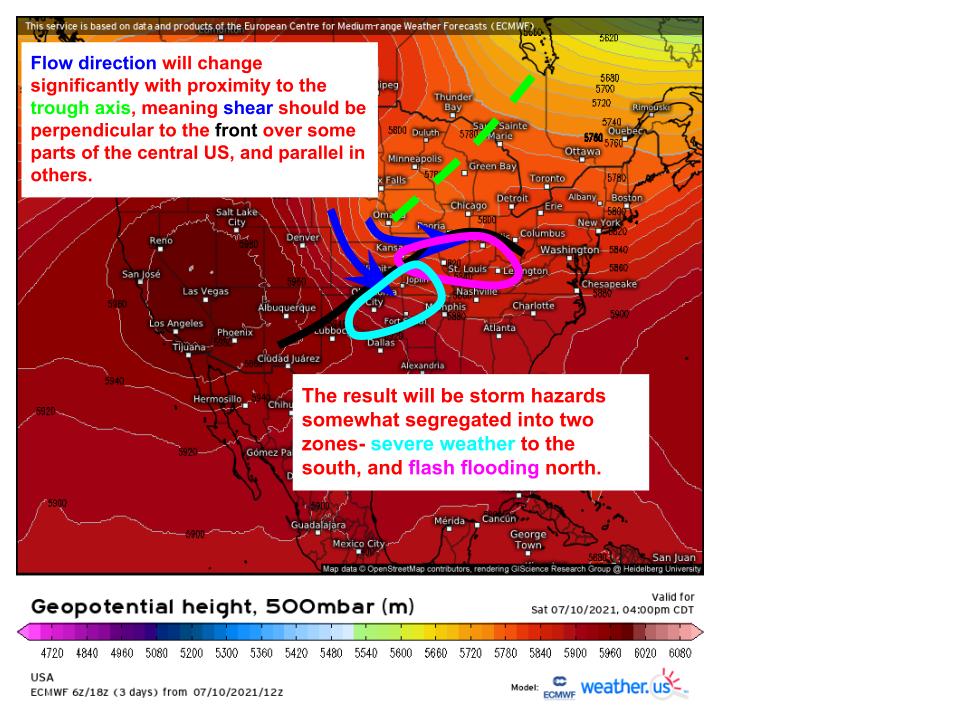
But flow won’t act the same everywhere; rather, locations closer to the trough axis will see shear with a significantly larger westerly component than locations further away. This makes a pretty big difference to the angle between the frontal orientation and wind shear.
One of the most important things to consider when trying to forecast thunderstorm development is how multiple storms will interact. Severe thunderstorms do best when they can evolve without updraft interruption, which often comes in the form of a different storm’s cooled outflow. This means, as a general rule, storms can become most severe when they propagate parallel to other storms, which lets them develop as fully as possible before unfavorable interacting with each other. From here, it follows that storms that move perpendicular to the orientation of the initiating boundary have the best odds of becoming substantially severe.
The opposite is true with flash flooding. This hazard requires heavy rain that lasts a while, which generally means storms have to either move very slowly or track over the same place over and over. This means, as a general rule, storms threaten flash flooding most when they propagate perpendicular to other storms, which lets them train over the same locations ad nauseam. From here, it follows that storms that move parallel to the orientation of the initiating boundary have the best odds of producing substantial flash flooding. See where this is going?
In contorting itself both parallel and perpendicular to the boundary, then, midlevel flow is assuring a somewhat bifurcated hazard mode when thunderstorms initiate. To the north, front-parallel flow will encourage flash flooding, while to the south, front-perpendicular flow will keep storms significantly severe. Of course, localized severe weather could occur with the former, and flash flooding with the latter, but the differential flow trajectories should largely segregate these threats to respective regions.


