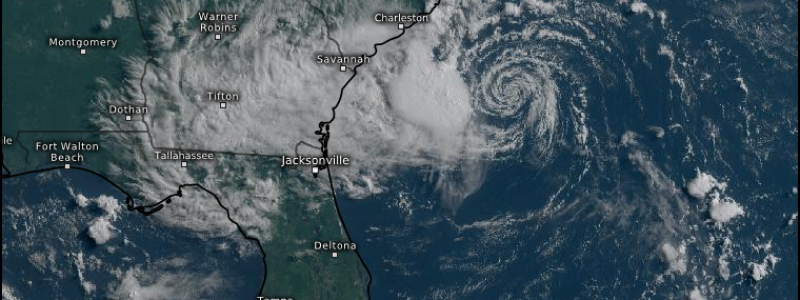
96L Eyes the Southeast
While the historic heatwave in the Pacific Northwest is ongoing today and we will definitely be discussing the records it has set once it winds down, we’re going to take a break from talking about it to discuss a sneaky little tropical feature off the southeast coast this morning: 96L.
With all eyes on the west coast this weekend as the heat was building and records were breaking, this little bugger appeared as a spot to watch. Currently, it is given a 70% chance at formation, though there are a few roadblocks: mainly time and shear.
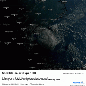
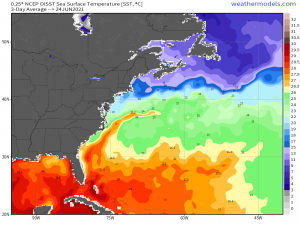
96L is currently located not far off shore of Georgia and South Carolina. It sits over a plume of rather warm SSTs – the Gulf Stream.
As that plume is rather narrow, it will only have a brief window to take advantage of optimal SSTs before land interaction makes intensification unlikely. Were this an ideal, organized storm, it may have already done so. However, if you take a look at the satellite loop again, you’ll notice that 96L isn’t that storm.
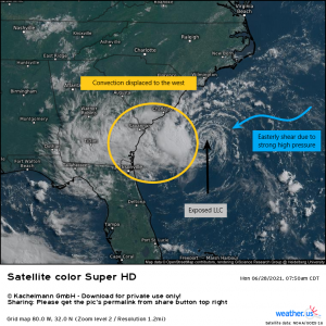
Thanks to easterly shear from a strong Bermuda/Azores High, it’s low level center is exposed. Note the naked, but rather pretty, swirl. All of the strong convection is displaced to the west. In order to intensify beyond a tropical depression or perhaps a minimal tropical storm, 96L needs to wrap that convection all the way around it’s center. Rather unlikely at this point, as time is against it with effects already being felt over the southeast and landfall likely sometime tomorrow.
The NHC has noted that if it manages to fire additional thunderstorm activity, they plan to issue TD/TS advisories. That suggests that, despite its skewed appearance, 96L is likely on the cusp of TD status and needs just a bit more convection to push it over the edge.
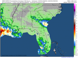
All this talk of classification aside, the impacts will be much the same regardless. The main threat will be locally heavy rain.
Rain will be heaviest at the coast, along and west of the center since 96L is western-weighted. Locally heavier totals are definitely possible as we see training/slow moving bands.
Gusty winds along/near the coast will also be likely, perhaps up to tropical storm force gusts if 96L manages to strengthen just a bit more despite the conditions working against it. Rough surf and coastal flooding is a possibility with an onshore flow, though any storm surge should be fairly negligible given the lack of intensity in the wind field.
And, as with any landfalling tropical system, conditions conducive to tornadic activity may be seen in the front right quadrant of the storm – eastern Georgia and southern South Carolina. This is something to take seriously as, though many of the tornadoes spawned by tropical systems are weak and short lived, there are some that are significantly stronger and longer-tracked. Should conditions be conducive, these will be hard to catch with much lead time so be prepared to act if you reside in this general area.
We’ll keep you posted with any updates to this storm!
