Rich Low-Level Moisture and Above Average Temperatures Lead to Widespread Severe Threat of Varying Degrees
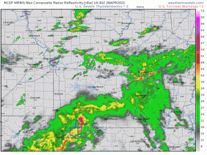
Well, it’s not even lunchtime yet and already severe weather is cranking up across the interior of the country.
A few severe thunderstorm warnings and a brief tornado warning this morning in Texas and, more recently, two tornado warnings in Missouri for embedded rotation within a line pivoting northeastward.
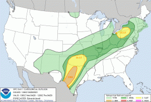
We will see the potential for more severe weather over a rather large part of the Eastern US. In fact, I’m going to share the SPC Day 1 Outlook since it does encompass such a large area.
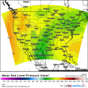
Two troughs will help to incite a greater risk of severe weather in two different parts of the country. First, a longwave, positively-tilted trough moving eastward out of Arizona will serve to assist with storm formation in Texas and into Oklahoma.
Second, a shortwave trough will pivot through the Great Lakes region, providing lift to the already-destabilizing environment of the Lower Great Lakes.
Between these two higher risk areas, several areas of weak low pressure are connected by a quasi-stationary cold front.
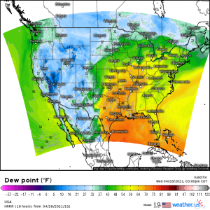
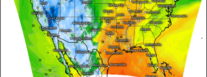
This cold front is expected to shimmy roughly southeastward throughout the afternoon, providing the boundary on which storms can fire. These storms are expected to remain rather scattered. With dew points already well into the 60s across the region along with ample CAPE, severe storms are possible here with the main threats being damaging winds and small hail. A tornado can’t be ruled out, as we’ve seen already in Missouri, but it’s going to depend greatly on the mesoscale conditions present. For example: an area with winds backing from the southeast may see a slightly heightened chance of a tornado due to better shear than an area with surface winds from the southwest. Either way, it’s a day to be weather aware.
But let’s look at the two maxima.
Texas/Oklahoma
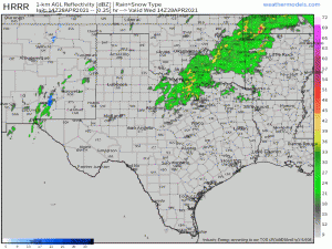
The approaching trough, as mentioned before, will assist in kicking off a renewed round of severe weather this afternoon with the highest chances focused on the corridor from roughly the north-central Texas border to the south-central Texas border.
The activity is expected to remain mostly cellular in nature through the evening before upscale growth and the loss of daytime heating allows it to evolve into more of a messy blob in the overnight hours.
Some of the supercells that form could be very strong, as they have a speedy low level jet feeding them, forcing approaching from the west, and plenty of instability to work with. Very large hail is likely, especially with the cells further south. The SPC mentions the possibility of hail up to 4 inches in diameter here. That’s pretty significant.
Tornadoes are also possible, much like we saw yesterday.
Also worth mentioning is the risk for flash flooding.
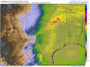
Very high Precipitable Water Values and training storms could allow for the same areas to see repeated heavy rainfall throughout the day leading to flooding conditions. This not only goes for Texas and Oklahoma but along the front into the Great Lakes region as well.
Lower Great Lakes
Ahead of the longwave trough and below the semi-stationary boundary, rich low level moisture is surging northward.
The atmosphere is destabilizing across this rather large area but a shortwave pivoting over the Great Lakes will provide some extra lift this afternoon to the soupy atmosphere of the Lower Great Lakes. As it sweeps northeastward across Erie and Ontario -though, perhaps a bit more focused on Erie where there is a better thermal profile and moisture availability- storms will begin to form as the support exits the colder waters of the lakes and enters the unstable air over land. Since this is only a shortwave and the lift associated with it is weak at best, these storms will likely use the “lake breeze” to help them out by forming along this boundary.
Storms are expected to be mostly cellular in nature at first and, with plentiful moisture and help from diurnal heating, we could even see a few supercells form. Damaging winds and hail, given the strong lapse rates, are the main threats, however, there is a small risk for a weak tornado – possibly where storms track over favorable terrain.
These cells may evolve into a line, or even a small bow, in which case the wind threat would be maximized.
There is a lot going on today in much of the eastern half of the country with various threats and timing. Be weather aware today and have ways to receive warnings, even if you aren’t directly in a higher risk area. Storms don’t just automatically weaken when they exit a higher risk area, nor do they much care about categories defined by humans. Any tornado threat outside of the higher risk areas will likely be attendant to mesoscale conditions and may materialize rather quickly, so it is important to be aware and ready to act.
Otherwise, enjoy this little preview of summer and get outside before the storms, if you can!
