Large Hail Threat for Texas Today; Pattern Change Ahead
I feel like we’ve been writing about severe weather in every blog lately and today is no different. Fortunately though, today’s severe threat will remain confined to a smaller area (Texas, S Oklahoma). It will also likely be the last event of this active period as we begin to transition into a pattern less favorable for severe weather.
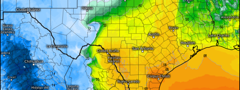
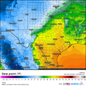
A shortwave will pass out of northern Mexico and into Texas this afternoon and interact with a trailing cold front attached to the nearly stationary occluding low in the Great Lakes region. This will serve to increase moisture return ahead of the cold front and sharpen the dryline behind it.
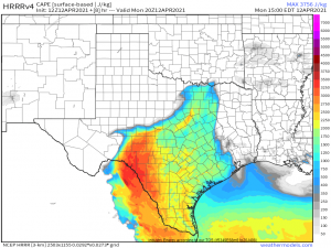
By this afternoon, we could see convection begin to fire off of this dryline in the warm sector. While there is a risk for locally damaging wind gusts inside these storms, the main risk today will be large to possibly extremely large hail (exceeding 2 inches in diameter). Lapse rates approaching 8 degrees C per km and CAPE maximums of up to 3000 J/kg may allow for rapid vertical development capable of producing the aforementioned large hail.
The highest probabilities of severe weather will be focused mostly in south-central Texas, with lesser odds extending through central and north-central Texas and even into the very southern reaches of Oklahoma. No matter your odds, be aware that there is, in fact, some risk of severe weather today and make sure you’re able to receive warnings.
This will be mainly an afternoon/early evening event as the severe risk will lessen after sunset with the loss of daytime heating and return to stabile conditions.
Looking ahead:
Today’s severe threat could transfer east into Louisiana for tomorrow with activity focused in the southern portion of the state along a stalled boundary. Confidence right now, however, is low, though we will still mention the risk for damaging winds and some hail should conditions be conducive to storm formation. It’s something to monitor as we move into tomorrow.
Beyond that, we are looking at a significant change to the pattern.
(gif) Link
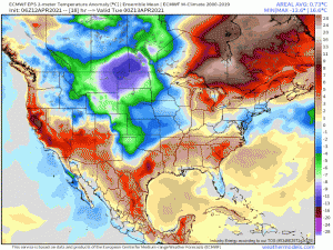
A dip in the jet stream will allow cooler air to slowly filter deep into the US, eradicating the wonderful warmth we’ve been experiencing between rounds of storms lately. Speaking of storms, this cool air will also bring a halt to any severe weather for the time being. Widespread temperature anomalies of 5 to 10 degrees below normal look likely. It’s not an arctic blast by any means, but it will likely feel much cooler than the summer preview we’ve been treated to this past week. Unfortunately for warm weather lovers, this pattern looks to remain in place well into next week, at least at the moment. There are hints of another warm-up in the long range (end of the month), but it’s simply too far out to discuss just yet.
Enjoy what’s left of the warmth if you can today and remain weather aware in Central Texas/S Oklahoma this afternoon.


