Severe Concerns For A Large Portion of the Eastern US Today
After some surprisingly more severe weather than originally anticipated yesterday (huge hail in Texas/tornadoes, possibly fairly significant, in E Tennessee), we roll right in to another day of expected severe weather. Jacob wrote about the set up in his blog yesterday, so if you’re interested in how it is all coming together, go check that out. We’re going to talk about what to expect today and tonight in this blog.
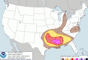
I hardly ever share SPC outlooks in blogs because I feel like sometimes people concentrate on the colors issued and not the fact that if you’re inside any of those colors, you retain some level of risk for severe weather. However, I wanted to share today’s for two reasons: 1. There is at least some risk for a LARGE area of the eastern US today and 2. The most significant risk, as depicted by the map, is wind damage.
Is there a risk for tornadoes? Yes, a middling risk and more so in the Texas-to-Mississippi stretch. But the big story today is wind. Remember, winds inside severe thunderstorms can often do as much damage as a low-end tornado.
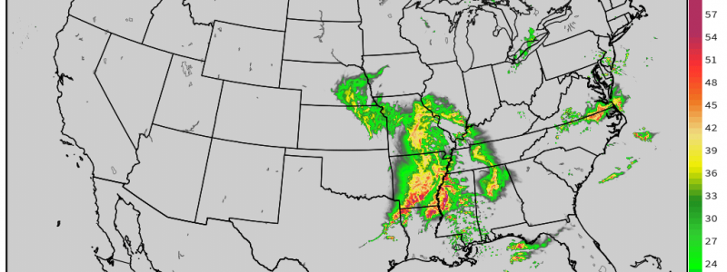
A large, bowing line of storms can transition into a Derecho (definition: a line of intense, widespread, and fast-moving windstorms and sometimes thunderstorms that moves across a great distance and is characterized by damaging winds) and cause serious damage to a wide area. The possibility of a derecho developing today has been mentioned, and, based on some of the simulated radar images I’ve seen, the structure could be similar. Regardless of official classification, bowing lines of storms are notorious for wind damage and the SPC has mentioned the possibility of hurricane-force gusts embedded in these storms.
(gif) Link
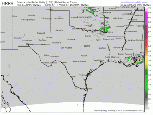
Storms should kick off later this morning along and east of a dryline situated just west of the Dallas/Fort Worth, TX area or possibly along the front in Oklahoma. They should, rather quickly, consolidate into a strong QLCS that will perpetuate eastward.
The risk for tornadoes will be greater in the earlier stages as any supercells ahead of the line will encounter very favorable conditions with CAPE approaching 3000 J/kg in places and shear of 40 to 55 kts. Aside from tornadoes from single cells, it is possible that supercells embedded in the QLCS could spawn a few tornadoes as well. The environment is definitely capable of supporting it.
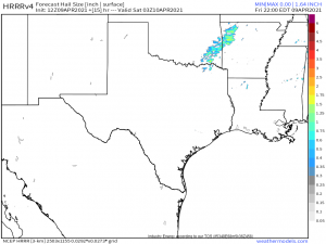
We also need to introduce the risk for large hail, generally in the same area of the greatest tornado threat. Hail approaching/in excess of 2 inches is possible from stronger storms.
I’d like to reiterate that the most serious threat today will be the widespread threat for damaging winds. If a severe thunderstorm is issued for your area today, I strongly encourage you to shelter as you would for a tornado warning. As mentioned, some of these storms could be packing hurricane-force gusts and then would be capable of damage similar to a tornado. Don’t take chances. Today is not the day to ignore warnings of any sort.
As far as timing goes: this event will begin early this afternoon and persist into the day on Saturday as it moves east. It will weaken some the further east it goes and the threat will lessen, but those in the eastern reaches should still prepare for and remain aware of severe weather, especially since a good deal of the weather will occur overnight.
There are two other threats to address ahead of the main event.
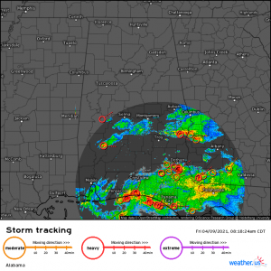
Storms are currently in progress over the mid-Gulf coast region and moving inland. Some of these are strong to severe. Large hail is possible with stronger cells. Destabilization ahead of these storms could lead to a low-end tornado threat for Alabama and Georgia into the afternoon hours as the storms move into a favorable environment. The good news here is that this early round of storms will somewhat lessen the threat the main line brings, though it still won’t be zero.
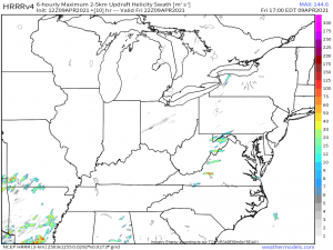
Furthermore, thunderstorm activity, possibly edging into the severe, is expected to initiate along a cold front in the mountains of WV/VA/NC this afternoon.
Hail and damaging winds will be the main threats but, like we saw yesterday in Tennessee, a tornado or two is possible, especially in favorable topography. Sometimes the elevation changes serve to enhance rotation instead of destroying it. This is something to remain aware of as the day progresses.
In summary: The entire south/south central/mid-Atlantic should retain some level of weather awareness today, though the higher chances definitely lie from the southern plains into the deep south. In these areas especially, I strongly urge everyone to shelter even if the warning issued is “just” a severe thunderstorm warning. I can’t emphasize enough the potential damage from non-tornadic winds alone. Make sure you have multiple ways to receive warnings. Make sure those warnings will wake you, if need be. Have a plan in place and be ready to execute it quickly. Turn to your local meteorologists for updated information and timing and your local NWS for watches and warnings.
Be safe!!!
