Dangerous Weather Targets the Southeast Thursday
Severe weather will start ramping up tonight as an upper level trough swings in from the west and begins to incite a response. The extent of the aforementioned response is still up for debate as far as storm mode goes, but otherwise, the ingredients appear to be falling into place. Now it’s up to the atmosphere to decide to cooperate with the forecast or do its own thing, as we’ve seen many times before. Let’s take a look at what we’re expecting.
Jacob wrote an in-depth blog on the set up yesterday, so be sure to read through that if you’re curious on how it is all expected to come together.
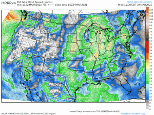
As energy approaches from the west through this morning, a low level jet will begin to crank up, bringing in plentiful warmth and moisture.
(gif) Link
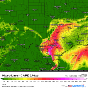
The jet will be relatively weak at first, strengthening as it perpetuates eastward ahead of the upper level trough. For this reason, the severe weather threat for today, centered mainly over eastern Texas, SE Oklahoma, and SW Arkansas, is a bit conditional, dependent on how much instability can actually be brought in.
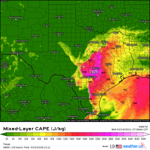
As far as the short-range models go, the NAM is slightly more excited about the extent of available instability than the HRRR is. Should it play out as the NAM suggests, a line of strong storms are possible this evening. The tornado threat is currently low, but not zero. The more likely hazards are damaging winds and large hail, especially considering the steep lapse rates and cold air aloft.
Should the HRRR be correct in the amount of available instability, the risk will be somewhat lesser, though not zero. If you reside here, monitor the development during the day and make sure you’re set up to receive warnings.
Unlike the somewhat conditional threat we face today, tomorrow has all the makings of a dangerous, long-fused event.
(gif) Link
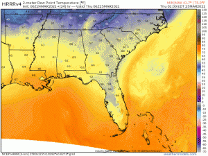
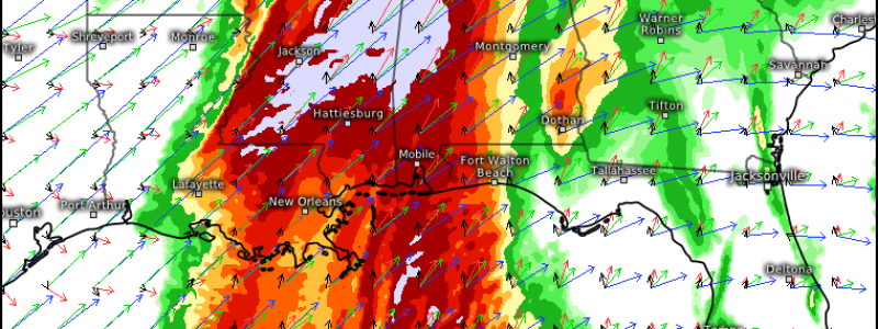
Moisture, which is already in place over the southeast, will be reinforced and enhanced as the low level jet really takes off during the early morning hours. This jet is expected to be much stronger than the one that fed last week’s outbreak, meaning more moisture, more warmth, and more damaging winds, should they mix down inside a storm. A strong jet like this also assists in the speed shear values, which look to be in the 60 to 80 kt range. Combine this with CAPE values approaching or exceeding 2000 J/kg and surface winds backing from the SE (especially in the MS/AL border region) and you’re looking at an ideal environment for strong tornadoes.
As mentioned above, I expect the greatest threat to materialize in the central border region of MS/AL, perhaps even into northwestern AL. This is where all the high-end ingredients overlap the most. Just like last week, I would carefully watch the corridor from Jackson, MS to Tuscaloosa, AL to Birmingham, AL (and points directly north). We saw repeated training of tornado-producing storms here last week. Historically, this corridor is a tornado magnet and tends to produce strong tornadoes with an assist from the changing topography. I also wouldn’t be surprised if a stray supercell makes it into southern/middle TN, especially with the warm front forecast to lift just above the area. Lift from said warm front could assist in intensifying any cells near it.
Now, though it certainly looks like an outbreak is likely, there are a few failure modes which could somewhat decrease the threat, should they occur. Let me preface with this: Do not depend on any of these failure modes occurring. Plan for the worst, hope for the best. Better to be prepared and have it “fizzle” than to be caught off guard.
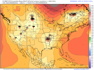
The location of the surface low is key. Though there seems to be general agreement on where it will track, should it shift south, the threat will remain confined further south. Conversely, should it shift north, the more northern areas will be suddenly in play.
Another huge factor is the location of the warm front and whether or not it stalls. Currently forecast to lift well over Middle Tennessee, it enables the warm air to flow north, placing the northern reaches of MS and AL and even some of TN in favorable conditions for severe weather. If that warm front gets hung up or stalls out (last week it stalled over N Alabama, leaving N AL, N GA and S TN in cool, stable air), the ripe conditions will remain further south. Conversely, if it lifts further than forecast (this would likely coincide with the low being further north), the threat will extend more northward.
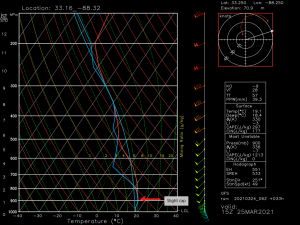
We also need to consider a possible capping inversion and what it’s strength and duration may be. This forecasted sounding for 10 am suggests a very slight cap that later erodes by 1 pm. The longer the cap stays in place, the more the instability is able to build up, leading to more powerful, discrete cells. If the cap erodes quickly, we may see a few short hours of discrete cells before storm mode becomes more “messy” with numerous cells competing for the same space and fuel. Understand, there will be at least a few hours of powerful discrete cells. Whether or not that lasts will be dependent on how quickly the cap is broken.
These strong, long track tornadoes are most likely to occur in discrete supercells, meaning the larger threat will come in the form of development in the warm sector ahead of the front. However, there will also likely be a secondary round later in the evening in the form of a convective line ahead of the cold front. Generally, wind damage is most likely with a line, but if the environment is still ripe, embedded supercells could still produce tornadoes.
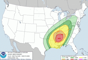
(via SPC)
I’m sharing the categorical outlook because I’d like to make a point. Don’t focus on the colors. People tend to hone in on a “scary” color and ignore the fact that EVERYONE in ANY color has some level of risk tomorrow. It’s a bit like playing the lottery. You buy a ticket (amount of atmospheric ingredients) even though your chances of winning (seeing severe weather) are very slim (lower colors). The more tickets (more/higher quality of atmospheric ingredients) you buy, the more your chance of winning (higher colors/seeing significant severe weather) increases.
Devastating storms still occur outside of the scary colors. Yesterday alone we saw a few tornado warnings in a marginal risk. We’ve seen damaging, significant tornadoes in both marginal and slight risks this year as well. My point: Prepare for severe weather no matter what color you reside in. Take a minute and read through my preparedness blog again to make sure all your bases are covered.
Remember that there will likely be two rounds of severe weather tomorrow, beginning late morning and ending after dark. Do NOT let your guard down if a lull in activity occurs. Expect to be weather aware all day into the early hours of Friday morning. Turn to your local broadcast meteorologists for all-day coverage on their respective stations and to your local branch of the NWS for watches and warnings.
Up-and-coming broadcast mets not in the area: take this opportunity to watch James Spann’s live stream from ABC33/40 in Birmingham. This is how it’s done. Spann is one of the very best in the business and the compassion and knowledge he displays during these events are nearly unparalleled. We could all learn from him.
Thanks for reading through this really long blog. Hopefully you have an understanding of what we’re expecting tomorrow. We will update you as needed as things develop over the next 36 hours or so. Stay safe!!!
