A Second Day of Severe Threats For Florida on Sunday
It seems Florida, with it’s warm, lovely weather while everyone else freezes, has decided it’s jealous of all the attention the winter weather is garnering and wants in on the action. No, I’m not referring to snow, but instead to a multi-day severe threat.
We talked yesterday about today’s potential severe weather which, so far, has been somewhat subdued. Early thunderstorm activity and heavy cloud cover over the northern part of the marginal risk area has stabilized the atmosphere somewhat and may lessen the chance for any severe storms this evening as renewed activity approaches from the west. The southern extent of the risk area still has a chance, though, with sufficient CAPE and continued daytime heating. It’s something to be aware of, at least, as the evening progresses.
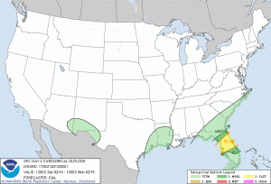
But beyond today, the severe storm threat returns with renewed vigor as the same area under a marginal risk today has been upgraded to a slight risk tomorrow.
(Graphic via the SPC)
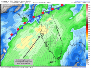
Florida has spent much of the week in the warm sector of a stationary front which has kept it spring-like while the rest of the country is in the ice-cold grip of arctic air. The southeasterly flow here is bringing in moisture and heat from the Gulf, priming the atmosphere. Tomorrow, a longwave trough will begin to dig deep into the center of the country. That’s what will be bringing a cornucopia of winter weather to the rest of the country. Out ahead of that, however, a few shortwaves will progress across the northern part of the state, providing a “jump start,” so to speak, for unsettled weather.
Though lapse rates aren’t all that impressive, modest shear and adequate CAPE, thanks to dewpoints nearing the 70s and copious daytime heating, could allow for the formation of a few strong to severe storms here in the warm sector. The low level jet is expected to increase in speed as the day progresses which in turn will increase the speed shear aloft. This suggests conditions will be somewhat more conducive to tornadic formation later in the day, though still a bit less than ideal. For this reason, the main threat is damaging winds, with the lesser possibility of a few low-end tornadoes.
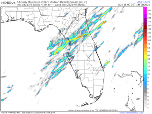
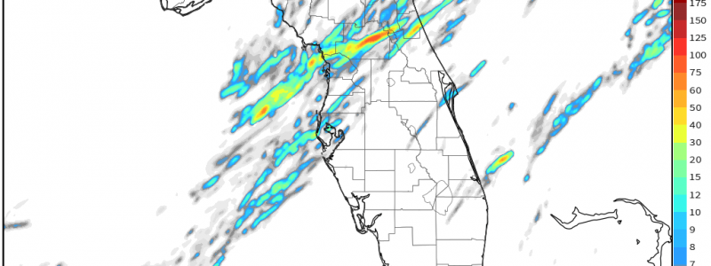
The HRRR suggests a few decent updraft helicity swaths beginning around 21Z which is enough to require monitoring at the very least.
I’ve written these words before and I’ll write them again and again because it’s important: Do not sleep on a severe threat, even with only a low chance of tornadoes. We have seen damaging tornadoes come out of less ideal set ups than this. For example: the EF3 that hit Fultondale, AL last month. That was a rather strong, destructive tornado that came from a slight risk and a conditional set up. Another example: the Pinellas County EF2 in December of 2020 which occurred during a marginal risk day. My point is that if you reside in the defined risk area, stay weather aware and be sure to have multiple ways to receive warnings. A NOAA weather radio is your best option since it does not rely on an internet connection. As a second source, WEA alerts will sound on your phone if you’re inside a tornado warning polygon. Your local news station’s weather app will also push out warnings to your phone.
I mentioned earlier that this is a multi-day threat. Monday is currently defined as a marginal risk day in much the same area as Sunday is. However, there is still a lot of uncertainty associated with Monday’s threat.
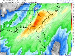
The longwave trough facilitating winter weather elsewhere is expected to move eastward through the day Monday. While it does so, a surface low is expected to form in the Gulf and slide up through the southeast. The uncertainty lies in the northern extent of the warm sector- will it include only Florida, or how far will it reach into Georgia?
A decently strong low level jet should be able to advect enough moisture in for sufficient destabilization, though the models currently disagree on the northern extent and amount of said destabilization. In other words: it’s still a developing situation. At the very least, the potential exists/there is a decent chance for a 3rd day of severe threats in Florida. This would be another afternoon/evening event so we still have about 36 hours or so to nail down exactly what to expect.
Should the threat for severe weather become more pronounced for Monday, I’ll push out an update blog tomorrow evening. Let’s get through the rest of tonight and tomorrow first. Stay safe and weather aware!
