Significant Ice Event Kicks Off Today For the Eastern US
Another day, another winter storm as a very active pattern continues to crank out disturbances over the eastern US. Jacob wrote yesterday on the significant ice threat set to begin today and we will continue to discuss that in today’s blog due to its impactful nature.
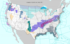
via Weather.gov
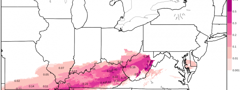
A long-duration ice storm is expected tonight and tomorrow and Ice Storm Warnings have been issued for a large portion of the interior eastern US. This includes parts of Kentucky, Arkansas, Missouri, and Tennessee. The surrounding areas have been issued a Winter Weather Advisory but it is possible that certain areas could be upgraded later today if conditions become more conducive to ice.
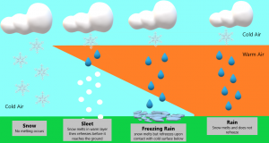
As Jacob mentioned yesterday, the conditions required for an ice event are finnicky. We need a shallow freezing layer at the surface and a deeper layer of air above freezing aloft. The precip must remain “melted” in rain form until it reaches the surface. It is the freezing temperatures at ground level that cause the precip to turn to ice.
There’s a little refresher graphic if you need to visualize it.
Elevated surfaces (trees, powerlines, bridges) usually see accumulations first as they cool faster than the ground. With a long-duration event like this, though, impacts are likely to be significant– roads will likely glaze over and power outages should be expected as powerlines freeze and heavy ice causes trees to fall.
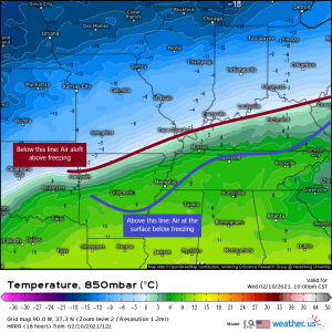
The area I’ve outlined above has the greatest chance of seeing some sort of ice event over the next 36 hours or so. Now, these aren’t hard and fast borders. The atmosphere is a fluid and doesn’t adhere to uniform boundaries. Should the warm air aloft travel further north, it will introduce an ice risk to areas north of the line. Should the sub-freezing temperatures at the surface filter further south or even not as far south, that also changes the risk. My point is: defining the ice risk is difficult due to the very specific conditions required. So, the outlined area is MOST LIKELY to see ice if conditions materialize as forecast.
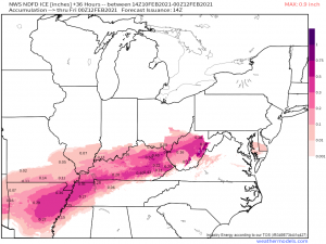
With forecasted ice accumulations like this, if you reside inside the defined area or even near the defined area, take action toward being prepared for the after-effects of an ice storm. What does that mean? Well, prepare to not be able to travel – make sure you have the essentials. Prepare to lose power- have gas for your generator if you have one, have flashlights (and batteries), candles, and, most importantly, have a way to stay warm (blankets, a heater, etc). As this system passes, it will usher in some extremely cold air.
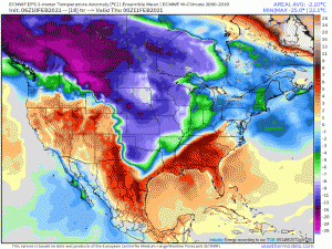
This will likely be record-breaking cold air, especially for the Plains states. So, whatever is frozen will stay frozen for awhile. These temperatures will make it difficult to “recover” from any damage the ice has done – getting the power back on quickly, for example. Take precautions against the cold should you lose power and heat.
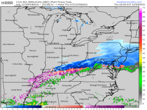
Overnight tonight will be the main window for wide-spread freezing rain. We also introduce the chance for some (generally light) accumulating snow to parts of the upper Mid-Atlantic. We’re looking at totals from perhaps 1 to 4 inches from northern Kentucky to New Jersey with locally higher amounts in the elevations.
The weekend brings at least two more chances at wintry weather plus some serious cold, but we’ll discuss that after this ice event is behind us. Enjoy the day and stay safe if you’re expecting ice today/tonight!
