A First Look At an Impending Nor’easter
No doubt by now you all have heard about a big weekend/early week snow event for the eastern half of the country. It’s true; the signals look good that we will indeed experience some sort of major winter storm. What’s not clear yet, though, is who will see the highest totals. Let’s take a look at what we’ve got so far.
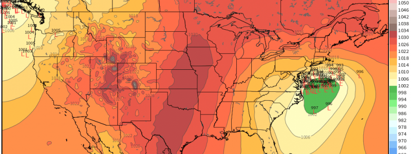
The set up we will see for this storm is what is know as a “Miller Type B Nor’easter.” In this scenario, the initial low develops over the midwest and tracks over the Ohio Valley. It then loses its circulation when it encounters the Appalachians. The energy transfers to a stronger low that forms off of the east coast and perpetuates in a north-easterly fashion (hence the name nor’easter) up the east coast bringing heavy snow and rain.
Models are in agreement that this is the class of nor’easter that will develop. The low is projected to track over the Ohio Valley, weaken, and then re-emerge as a stronger low off the East Coast. This is where the agreement ends.
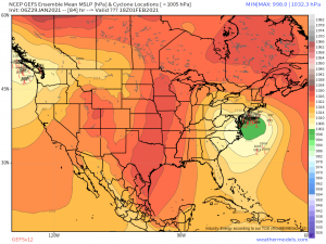
The GEFS ensemble places the low very close to the coast. This scenario means the heaviest snow would fall inland, likely somewhere through eastern Pennsylvania/eastern New York state. A coast-hugging low could cause mixing issues for the I-95 corridor as warm air is advected around the low aloft. For the coastal regions of New England to receive snow, we need the low to be far enough offshore that the cold air can funnel all the way to the coast, but not so far that the precip shield is completely offshore.
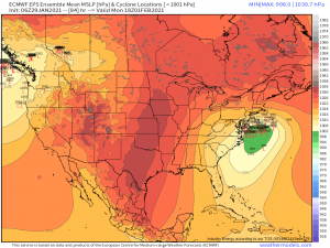
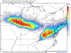
Which brings us to the Euro ensemble solution. The Euro keeps the low offshore a bit. In this scenario, it would be an almost-entirely snow event for the coastal locations, however, much of the precip shield would be kept offshore meaning locations inland may not see much precipitation at all, if any.
Regardless of track, a few things are a given about this system.
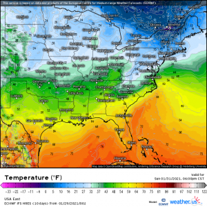
Unlike most of our other storms this season, the antecedent airmass will be COLD. A strong high in eastern Canada will be funneling in frigid air all weekend ahead of the system’s arrival. The ground will be cold and we won’t need heavy snowfall rates to overcome warm ground temperatures before we see accumulation. Where ever the heaviest snow ends up falling, it will undoubtedly stick.
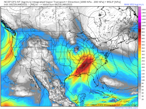
This system will have access to plentiful moisture, especially in it’s early stage. The energy from this storm is coming from the same energy that drove the atmospheric river that soaked California over the last week. So, as that energy moves east, it brings Pacific moisture with it. That wanes a bit as it crosses the country but the low will then tap the Gulf moisture and, via a strong low level jet, wraps it around it’s circulation. Translation: Midwest locations in the cold sector of the system are going to get pounded with heavy snow.
Keep in mind, this is the Euro ensemble probabilities, so as far as New England goes, it shows accumulation chances based on it’s current solution of the low being kept offshore. But what I’m trying to show here is that regardless of the eventual track of the coastal low, the initial low will track over the Midwest and there is a high chance for significant snow (over 6 inches) for the lower Great Lakes regions. Expect some mixing on the southern fringe of the swath as warm air aloft allows for sleet or even freezing rain to mix in.
There really isn’t much of a point discussing snow totals or probabilities for the northeast until we get more agreement on the track. For that reason, I’m not going to cover it in this blog. I’ll leave that up to Jacob for his blog tomorrow when we will (hopefully) have more of a consensus.
Generally with a storm track like this, we would need to watch the southern states for severe weather. It doesn’t seem like that will be the case this time. The same cold antecedent temperatures that are priming the north for snow will effectively squash the instability needed to fire off severe storms. The south has been pretty frigid over the last couple of days and will remain below average leading up to the event. The south will spend less than 24 hours in the favorable southerly flow in the warm sector that usually enhances instability. That doesn’t give the warm, moist air being advected in enough time to overcome the cold, stable environment we’ve been entrenched in for the last few days. For this reason, the SPC has defined just a small area of general thunderstorm activity mainly over parts of the southern plains for Saturday and the same in Florida for Sunday.
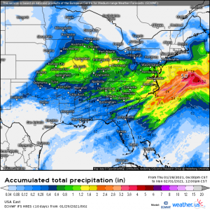
With plentiful moisture in play, where it doesn’t snow, locally heavy rain could fall. Specifically looking at the mid-Atlantic here, with totals creeping toward 2 inches directly on the coast.
Well, that’s it for our first look at our impending nor’easter. Stay tuned to our blog for an update from Jacob tomorrow on the evolving situation. Y’all have a good weekend!


Thanks for an excellent write up about this storm. A minor correction though: the name “nor’easter” derives from the direction of the winds, not the direction the storm travels.