First Looks at the Early Week System Set to Impact the East
A dynamic system is set to impact the eastern US early next week. Everything from possible severe weather to snow is on the table, though it’s not exactly crystal clear who sees what just yet. Though these uncertainties remain, we’re going to take first looks at it today.
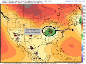
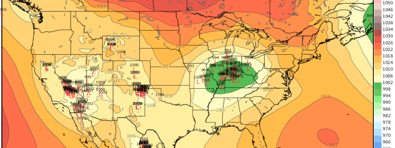
Yesterday there was some disagreement as to what the ultimate track of this low would be. This morning both the GFS and the Euro have converged on a solution with only very minor differences. Due to the placement of the low, this will not be a southern snow event. The south is placed firmly in the warm sector and will be dealing with the potentially severe part of this system. The upper mid-Atlantic will be the battleground between rain and snow. Places like DC and Philadelphia are the question marks as far as what type of precipitation will fall.
Let’s look at the snow portion of the system first.
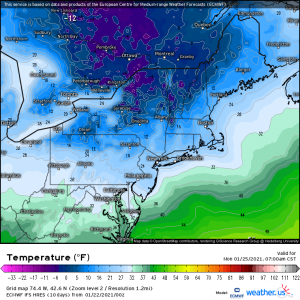
Thanks to a well-placed high and some really cold air, having the thermal support necessary for snowfall won’t be an issue for most locations this time like it has frequently been this winter. The locations above the center of the low and within the precip shield will have no problem seeing snow.
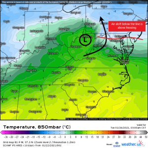
The problem, of course, will be the areas closer to the center of the low: DC, Philadelphia, etc, as mentioned above. Here we need to worry about warm air advection raising the air temperature above freezing aloft and turning the precip into either a mix or even a cold rain.
The map above is the 850 mb temperature (5000 ft). We can clearly see warm air being funneled north with the circulation of the low. The air temperature at this level below the red line I’ve drawn is above freezing. That will likely cause precip problems. Any wiggle in the track of the low will probably be the difference between all snow, a mix, or plain rain for this part of the mid-Atlantic. Should the low nudge south, there’s more cold air to tap and less chance of warm air advection. Should it nudge north, they will be pushed into the warm sector and hopes for snow dwindle significantly.
We also need to consider where the secondary low forms when it materializes off of the east coast. Once again, further north would mean more warm air, less chance for snow while further south would allow the cold air to creep further in and support an all-snow event.
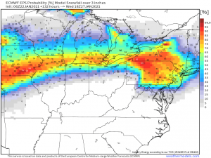
In situations like this, it’s better to look at probabilities than definitive total snowfall predictions. You’ll see that probabilities for “plowable” snow (3+ inches) aren’t so great in the areas we’ve been talking about for the exact reasons I outlined above. Now, that could change! For worse or for better, we’ll have to wait and see. Let me stress: wiggles in the track of the low can make a big difference in mode of precipitation for these borderline areas.
Moving on to the severe threat:
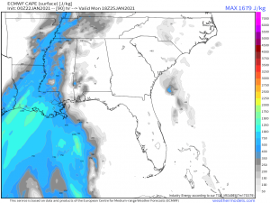
Although chances were looking good for seeing a severe threat from this system earlier in the week, they have dimmed a bit with recent model runs. Though the south will spend an extended amount of time being bathed by a speedy, warm southerly flow, instability seems to be limited along with less-than-impressive lapse rates.
As a reminder, any CAPE values below 1000 J/kg is considered weak and not conducive to any sort of severe outbreak. So, once again, we will likely face a high shear/low CAPE event in which a few severe storms could possibly, maybe, form. As with the other events, the main hazards will likely be damaging winds that mix down from aloft in the thunderstorms themselves and perhaps a tornado or two where there is just enough instability to allow a spin-up to form. There would be a higher chance for these along the Gulf coast where instability will be marginally stronger. No organized, widespread severe event is expected at this time.
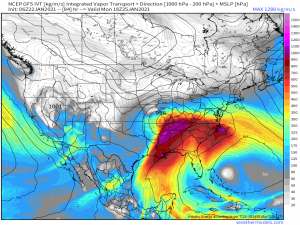
As mentioned previously, we are working with an extended southerly flow which means this system will have access to A LOT of moisture. Though the severe threat is low, the heavy rain potential is high. Totals from this system could approach/exceed 3 inches meaning flash flooding could also be a concern, especially for locations that just saw a lot of rain out of yesterday’s event.
Alright. Well, that was a long blog so thanks for sticking with me and reading through it. As with any forecast, things will change and we will keep you apprised of those changes. Look for Jacob’s blog tomorrow with further information including any modifications that need to be made.
Have a wonderful weekend!
