An Unusual California Storm Brings Strong Winds to Much of State
Good morning!
Aside from some pretty intense lake effect snow ongoing downwind of Erie and Ontario (which I wrote about on Saturday) , the US east of the rockies is rather calm at the moment.
To the west, though, some impactful weather is shaping up for California today.
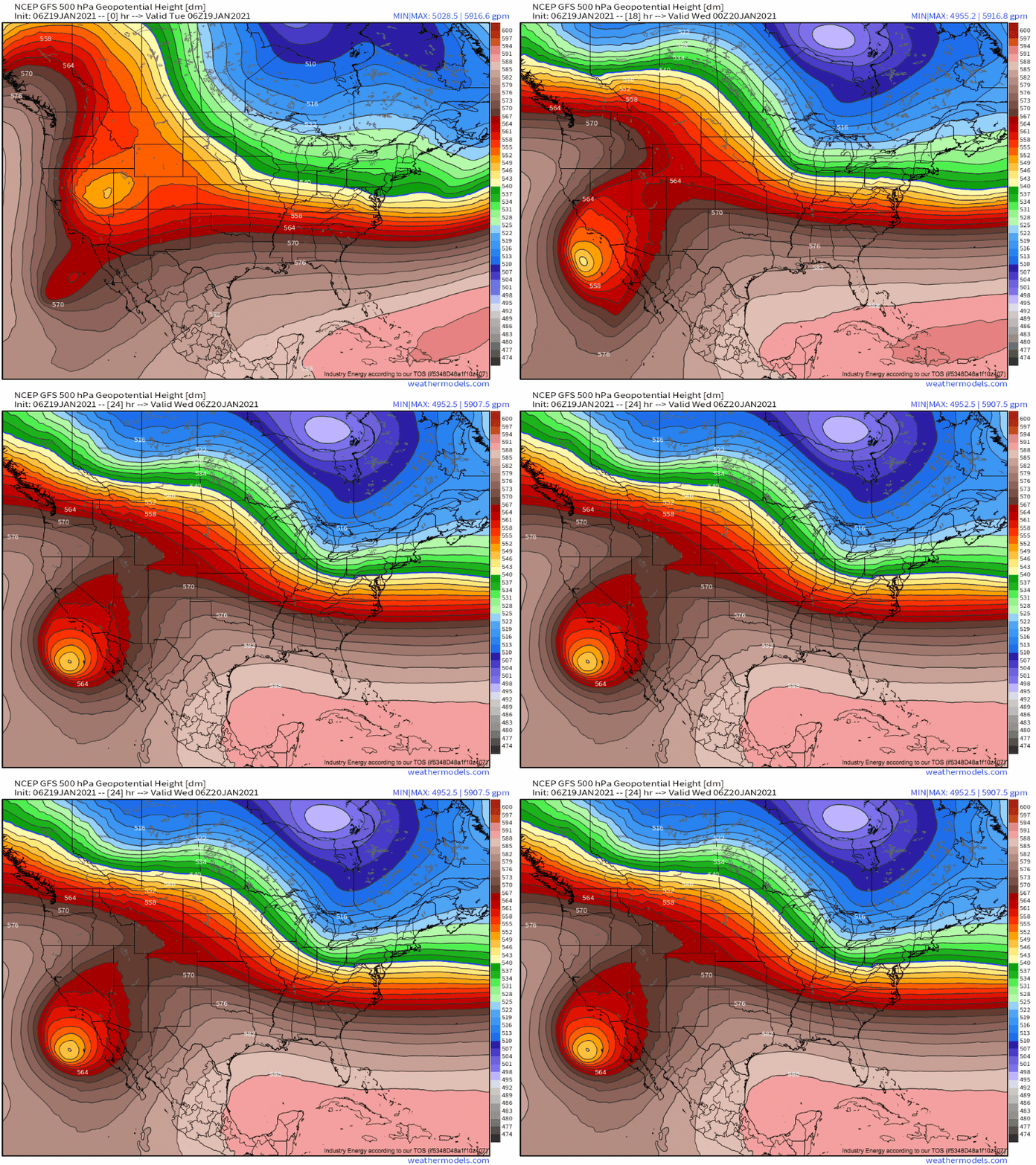
In California, an unusually amplified midlevel pattern sees a powerful trough sliding southwest into SoCal today. 
The closed low, which will approach a normalized height anomaly of -5 stdvs off the coast of the Baja peninsula tonight, is kicking the California wind machine into high gear today.
Typically, the pressure gradients that bring strong winds to California in the winter are driven by one of two forces:
1, A low pressure system making landfall from the Pacific, generally to the north, with a strong pressure gradient stretching south through the state on account of the low’s intensity. These are typically found ahead of intense troughs rotating around the semi-permanent Aleutian low, and the strength of the wind event depends on the strength and, secondarily, position of the low.
2. A powerful high pressure system sinking into the Great Basin, which is “stopped” from spreading all the way west to the Pacific coast by the mountains that ring the eastern California border. As a result, a steep offshore pressure gradient develops, with only a few hundred miles separating the core of the high pressure dome from relatively normal pressures over interior California. These are typically found immediately behind intense, high amplitude, dramatically positively tilted troughs, and the strength of the wind event depends on the strength and position of the high in similar amounts.
This setup, unusual both in the western extent of the trough axis and the intensity of the closed low, will bring an odd combination of both, as a low-level cyclone develops near Baja California while strong high pressure slinks south against the Sierra Nevadas.
While the position of the high itself is somewhat un-ideal for a high wind event, the combination with the coastal low will bring a strong pressure gradient to the region, with pressures in central Nevada ranging from 1025-1035mb and pressures immediately offshore SoCal below 1000mb.
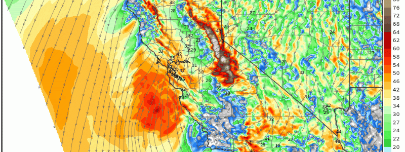
The somewhat predictable result of this intense pressure gradient will be a potentially damaging offshore wind event, unusual in both intensity and geographical range. Unlike a typical atmospheric river event (high wind scenario 1), the gusts won’t be localized to the coasts and hills near landfall, and unlike a typical Great Basin high event (high wind scenario 2), the gusts won’t be localized to the hills of wherever the high is most intense.
Rather, basically the entire state is getting in on the wind.
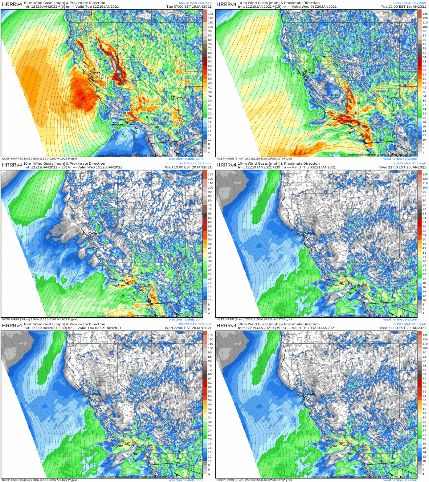
Gust displays by models like the HRRR can be misleading in thermally complicated east coast high wind events, but the substantial mixing allowed by the relatively dry air and typically high-lapse rate environment in California means that I have a fair degree of confidence in this model’s portrayal of gusts.
The picture painted is clear: strong to damaging winds will be possible in much of the state today, maximized in NorCal this morning and SoCal tonight. While they will wind down across NorCal later today, SoCal will see a much longer duration event as the low level cyclone meanders near Baja.
Naturally, with strong offshore flow comes fire danger, something Meghan wrote about in depth in her blog yesterday. Check it out- fire weather could be a significant secondary concern from this event in SoCal, thanks to the long duration offshore flow, a shocking lack of season-ending rainfall for this part of the year, and local topographical enhancement of these kinds of threats.


