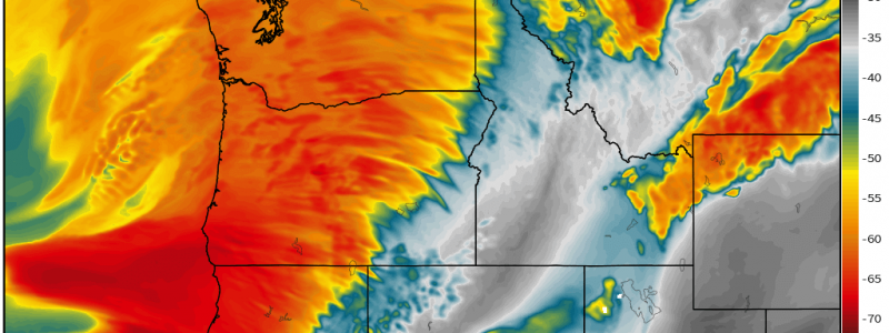
A Long Duration Atmospheric River Event Targets the Pacific Northwest
A “high end” atmospheric river event is setting up over the Pacific Northwest this week.
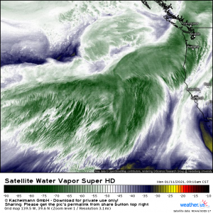
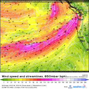
First, for those who don’t know: an atmospheric river is a concentrated band of water vapor in the atmosphere that transports tropical moisture from lower latitudes to higher latitudes that don’t typically see tropical moisture. It looks like this:
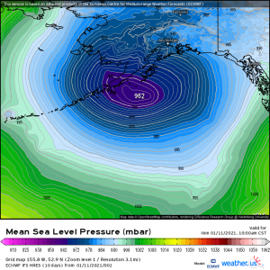
This particular atmospheric river is commonly referred to as the “Pineapple Express.” Why? Well, the origin of the moisture is the waters off of the Hawaiian Islands. The counter-clockwise flow around the Aleutian Low, commonly found somewhere near the Aleutian Islands of Alaska, takes this moisture and transports it northeast to the western coast of North America. A stronger Aleutian Low = a stronger atmospheric river event.
Second: why are we calling it “high end?” Because of the duration and intensity. We’ll get to that in a bit.
We have this rather strong Aleutian Low currently sitting in the northeast Pacific. It is expected to persist in location and intensity through at least early Wednesday before a high builds in over the Pacific Northwest and redirects it. So, for the next two days, the upper west coast is going to be bathed in a firehose of moisture.
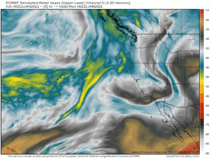
Basically, this:
(gif) Link
Now, about the duration and intensity.
Thanks to a powerful low level jet that will persist through at least Wednesday morning, the Pacific northwest will receive a constant stream of rain, snow, and wind. The persistently strong winds will also increase the risk of dangerous seas. The orientation of the jet to the coast and, further inland, the mountains, will ensure that moisture will be continuously lifted and totals enhanced. As we’ve discussed before, orographic lifting (upward forcing of moisture with increasing elevation) further saturates the atmosphere, giving it more water vapor to turn into precipitation.
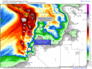
Precipitation will fall entirely as rain outside of the mountains as the temperatures will remain sufficiently above freezing. By the end of this event, coastal areas with favorable topography could be measuring 8+ inches of rain. For drought-stricken locations in southern Oregon and northern California, this is welcome news. The mountain ranges will also receive a decent snowfall, further enhancing their snowpack. The size of the snowpack is important come spring when the meltwater runs down into the valleys, providing them with the water supply to last through the dry summer. Larger snowpack = more meltwater = less dry conditions going forward.
However, the heavy snowfall totals predicted for the Cascades of Washington also introduces the risk of avalanches. Totals could top 3 feet in the highest elevations and all of that will fall in the span of about 2 days. The heavy, sudden addition to the existing snowpack can often trigger a run. The first 24 hours following a heavy snow are usually the most dangerous.
Following this AR event, the Pacific Northwest will have a chance to dry out as no major events seem to be in sight through the next week or so.
Enjoy the day, and may your coffee be stronger than your Monday!


Hi, thanks for the analysis, is there any chance of this atmospheric river pushing over to West Coast & California ?