From Severe Storms to Snow, Freezing Rain to Flooding: A Busy NYE
Happy New Years Eve!
Unfortunately, a multi-faceted impactful weather event will dampen the celebratory mood in many parts of the country today and tonight. There is a lot to discuss, so this blog will be less in-depth about any specific aspect than typical, and will feature many images. Strap in.
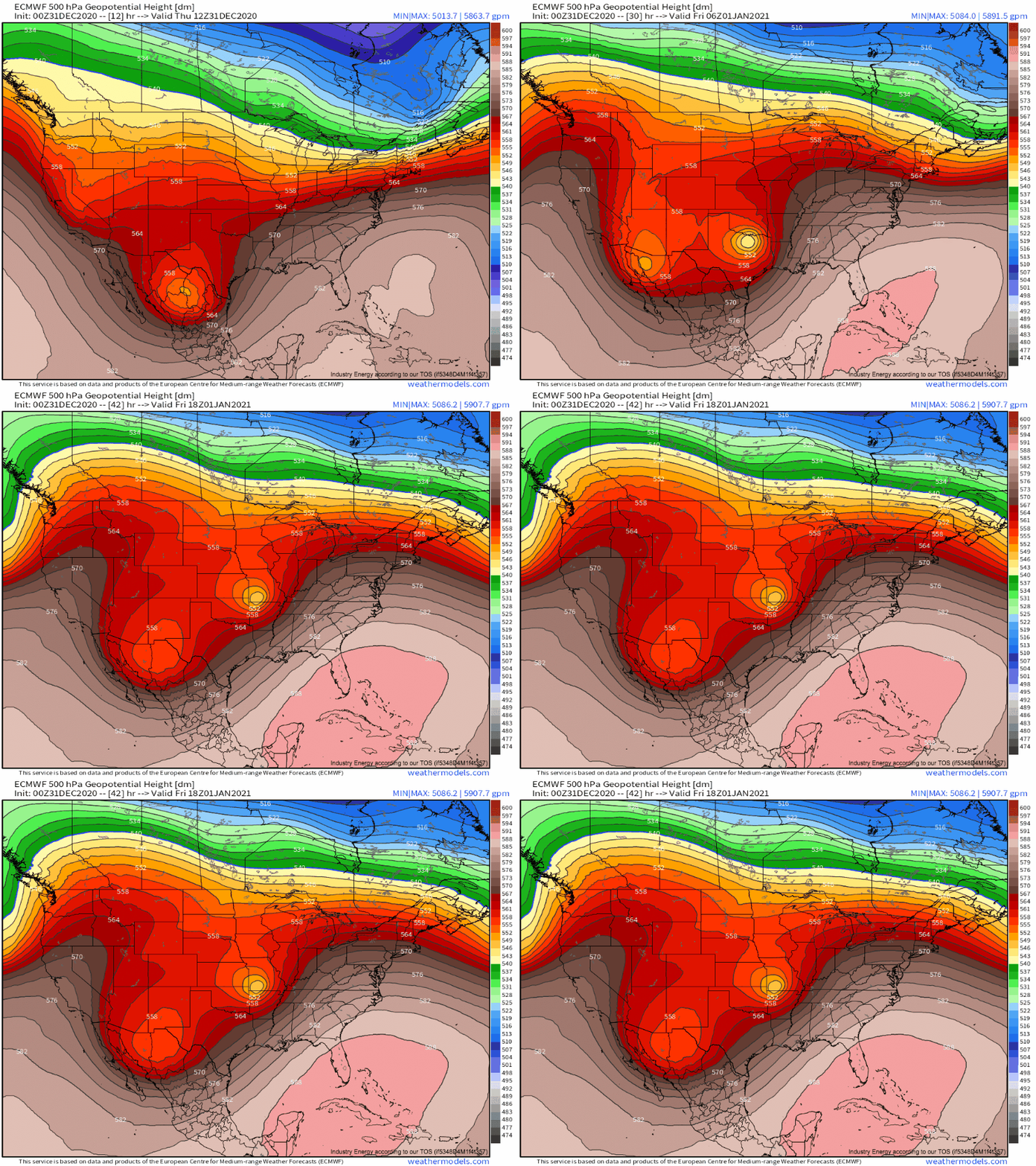
To blame for everything is a ball of cold air pivoting up the eastern extent of a longwave trough.
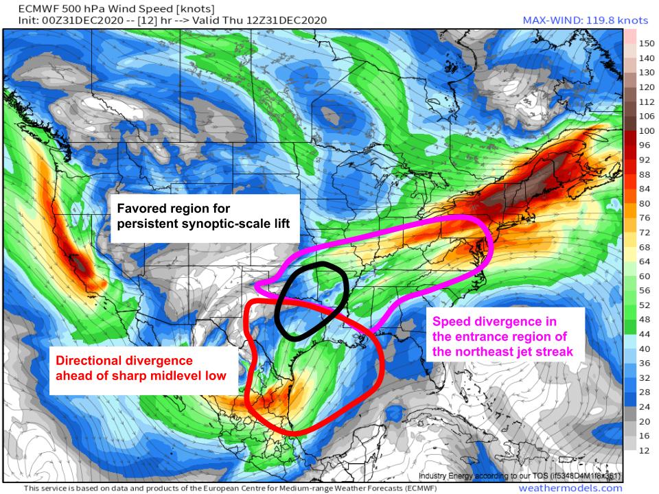
As this closed midlevel low slides towards Texas, impressive divergence immediately ahead is allowing a low level cyclone to intensify. This cyclone is drawing warm, moist southerly flow inland from the Gulf, introducing it into an environment quite favorable for precipitation, with plentiful synoptic-scale lift.
In english, ‘plentiful synoptic scale lift’ means that the upper half of the atmosphere over a region features ‘spreading’, either directionally or via increasing speed along a streamline, which encourages air to rise. This means that, even without more specific surface based forcing, widespread moderately intense rain can occur. With parts of the south central US in the exit region of the midlevel low and the entrance region of a jet streak over the northeastern US, there is synoptic support there for widespread rain for as long as those features remain favorably positioned.
Complicating matters is a surface front draped across the area. It wants to move south in response to the departing trough, and north in response to the incoming closed low. As a result of this conflict, it’ll largely sit still, leading to persistent surface convergence over Okla-Ark-La-Tex today, increasing rain rates.
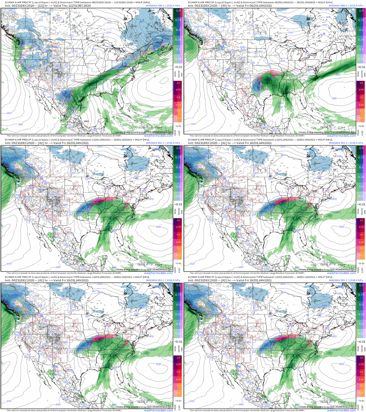
The combination of all these aforementioned factors will allow heavy rain, with a threat for flooding and flash flooding, to develop with persistence over approximately the area outlined above in black.
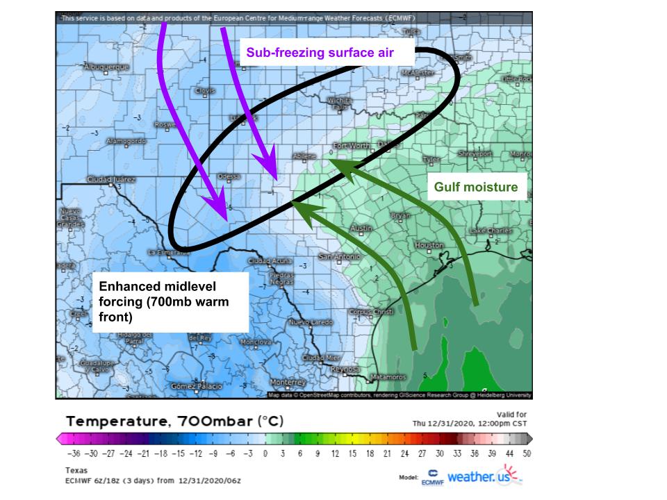
Further west, across central Texas, the backside of the same low level cyclone means instead of warm Gulf air advecting into the region, cold mountain air is bringing sub-freezing temperatures. This air is advecting at the surface into a region seeing southerly mid level moisture advection at the hands of a tilted cyclone, and concentrated lift along a 700mb warm front. This all means that central Texas will see an environment quite favorable for accumulating snow today!
Amounts locally exceeding a foot could occur as far south as the Mexican border in a rather unusually placed snowstorm. It goes to show- where lift, moisture, and cold air overlap, snow will fall, regardless of location!
Back to the warm side of the surface cyclone.
Ahead of the midlevel low, impressive divergence (remember: synoptic scale lift) and strong flow will overspread a strengthening low level jet that’ll be advecting high-dewpoint Gulf air into the central and western Gulf coast. This will allow conditions pretty favorable for severe thunderstorms, including tornadoes, to develop. As usual, widespread cloud cover, cluttered storm mode, and lame lapse rates will keep instability the limiting factor for severe storms, but the kinematics are quite favorable for rotation should a discrete storm tap sufficient instability and become surface based.
This severe threat will likely be maximized wherever local confluence over Louisiana and Mississippi can enhance helicity and allow relatively discrete storms to develop, but anybody from SE Texas to Alabama should be paying attention. The threat should be maximized this evening into the overnight hours, but a couple severe storms and tornadoes will be possible before then.
As the midlevel cyclone ejects north tonight, the cyclone will become increasingly vertically ’tilted’ in a particularly dangerous way. With the 850mb cyclone north of the surface cyclone, the overnight period will feature parts of Missouri with below-freezing surface temperatures but above-freezing temperatures aloft.
The result will be rain that freezes into ice on contact with the surface, or freezing rain, in parts of Missouri. This type of weather can be quite hazardous, as ice accretion can slicken roads dangerously and even cause damage to the power grid if enough falls. With up to 0.5″ and gusty winds in the forecast, some power outages certainly may occur, but shouldn’t be too widespread. However, certainly watch out if you’re driving early tomorrow in north-central MO.
To summarize: it’ll be a pretty busy 24 hours, with heavy rain and flooding in parts of the south central US, heavy snow in parts of central TX, severe storms in parts of the southeast, and freezing rain in MO.
Whew. Thanks for reading!


