The Nor’easter Cometh
Well, today’s the day! As I write this, our nor’easter is gaining strength and creeping closer to the northeast. Before we get to the snow aspect of the storm, we have a few other things to cover.
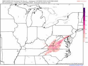
We are already seeing frozen precipitation in North Carolina and Virginia.
Totals of under 0.3″ are generally expected. I know that number sounds low but ice is, well, ice, and can cause a multitude of problems even in small amounts. Should it accumulate on trees and powerlines, expect power outages. The roads may also be quite slick so if you’re in this area, don’t drive unless it’s absolutely necessary.
The SPC has defined a slight risk of severe storms this afternoon in coastal North Carolina, specifically around the Outer Banks. High shear/low CAPE could combine to produce a few supercells. Though the main risk as of now is damaging winds, should these supercells be able to form, a few tornadoes are not out of the question.
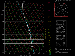
The sounding/hodograph certainly suggests the potential is there. It’s something to watch closely today. Be prepared if you’re in this area. Any tornadoes that form will likely be of the quick, spin-up variety and there will be little lead time on warnings.
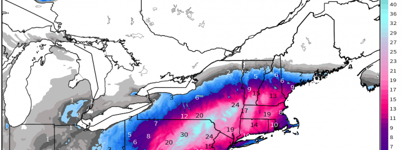
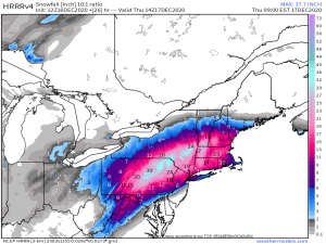
Now the part that everyone is waiting for: the snow. Jacob took a deep dive into the set up yesterday in his blog, so today I’m just going to add a few updates on top of that. First, the snow map:
Link
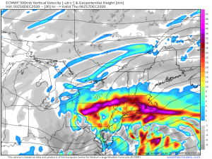
The zone of heaviest accumulation hasn’t really changed since yesterday except that totals have increased with areas of 30+ inches now in play. I feel these totals are completely possible. The forcing involved over these areas is going to be incredible.
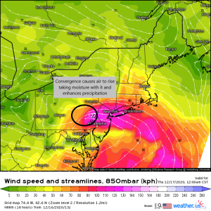
We have a very speedy jet of air aloft. In the area where that jet suddenly slows down, air will pile up (speed convergence). Also notice that the wind vectors flow together and meet (confluence). All the air that ends up in this area will need to go somewhere, so it rises.
As it rises, it brings moisture with it. The moisture is lifted to the level of condensation and enhances what is available for precipitation which translates to greater totals on the ground. This is why the area from central Pennsylvania to south central New York will see greater totals. These processes will take place right on top of them. Snowfall may exceed 2 inches an hour where the heavier bands set up. It will likely come fast and furious overnight. People in these areas may go to bed with a few inches on the ground and wake up to a couple feet. I have to say, I’m pretty jealous.
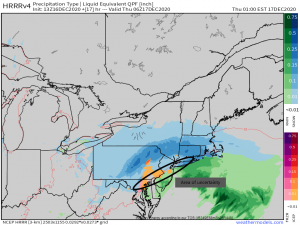
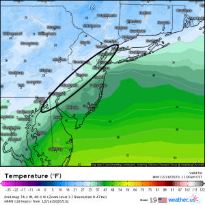
Our greatest area of uncertainty is still along the large metro areas. Warm air advection and dry air have a chance of really diminishing totals in these areas. It’s likely that precip will start as snow, change to a mix or even a cold rain if the WAA is strong enough, and then change back to snow on the backside of the system.
A look at forecasted temperatures for late tonight in these areas has them borderline.
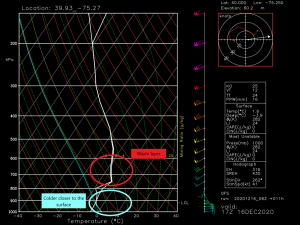
A sounding for the Philadelphia area shows a warm layer aloft with a cooler layer near the surface. A sounding like this typically indicates sleet. Although, with the surface temperature slightly above freezing, this could very well end up as a cold rain. It’s very possible that the cities themselves could end up with significantly lower snowfall totals than the suburbs only a few miles away. This is an extremely difficult gradient to forecast. Temperatures will cool back below freezing toward the early morning hours though, and any left over precip should fall as snow.
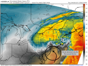
Dry air from the “dry slot” of the system is also a concern for the large metro areas. The soundings for these areas show a decent amount of dry air aloft in the early morning hours. This, obviously, will put an end to the precipitation for as long as it lasts which will also affect the total accumulations.
To summarize: there’s a much higher confidence of significant snow accumulation the further inland and northwest from the low you go. The large cities have the misfortune of being near to the coast and therefore nearer to the low and the temperature/moisture variations it brings. Too much warm/dry air could see these areas end up with much less than forecast.
One last thing to mention: This system is extremely dynamic and will have a decent amount of instability at it’s height. It’s very likely that some, especially closer to the coast, will experience thundersnow, or thundersleet as the case may be. Again, I’m really jealous.
I think I’ve said just about all that I can about this system. Now we sit back and watch it play out. Should there be any adjustments to the forecast, we will be sure to update you either in another blog or via Twitter. Enjoy the day and, for those of you in the thick of this blockbuster storm, enjoy your snow!!


Thanks Meghan!