Entering an Active Pattern: System #1
Good afternoon!
As I mentioned yesterday, the lower 48 is entering into an active pattern.
(Weathermodels link) (Weather.us link)
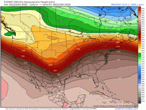
Each little “dip” or wave you see is a potential system to impact some part of the US in the coming days. But for today, we’re just dealing with the present system.
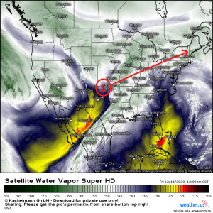
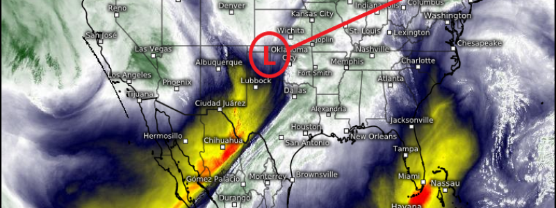
The first of at least 3 (maybe more, but that’s a bit far out to forecast yet) systems is pulling itself together across the middle of the country.
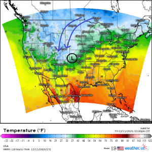
A surface low currently gaining strength as it comes off the lee of the Rockies will perpetuate northeastward over the weekend bringing rain, snow, and probably a little bit of slush where temperatures are borderline. Even severe storms are on the table with this storm.
Cold air will funnel in behind the center of the low, dropping temperatures enough in some places for a delightful snowfall. Oklahoma, for instance, has a chance to experience not only accumulating snowfall in the western portion of the state late in the weekend, but also severe storms in it’s southeastern corner today.
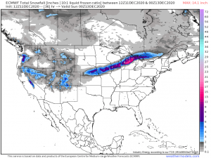
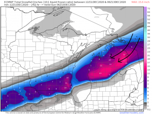
The cold side of our system will initially leave a narrow swath of moderate snowfall across the northern tier of the US with the heaviest amounts seen in northern Michigan.
(weather models link) (weather.us link)
One possible reason for this: During the peak of the storm, the winds will be coming out of the northeast which brings them across Lake Huron.
The moisture from the lake would likely create lake effect snow and enhance the totals across this area. This could also be true for the larger totals seen across lower Wisconsin as the same thing could happen with moisture and favorable flow across Lake Michigan.
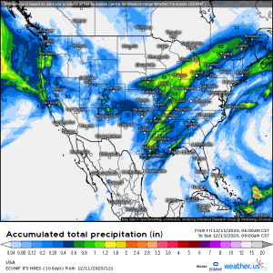
On the warm side of the system, rainfall totals look to approach two inches in a few areas as Gulf moisture is pulled northward.
The last part of the storm, which I very briefly touched on earlier, is a severe threat. The SPC has defined a Marginal risk for severe weather across portions of Texas, Louisiana, Arkansas, and Oklahoma for this afternoon and evening.
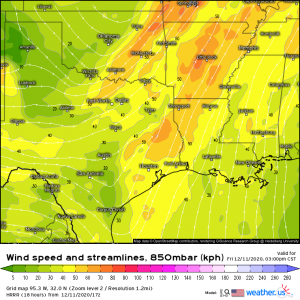
A strong southwesterly low level jet will advect moderate moisture into the area. Adequate shear exists, but low CAPE will prevent any serious outbreaks. The main threat will be from isolated damaging winds but, especially in southeastern Texas where dew points are higher, if any supercells are able to form, a few tornadoes can’t be ruled out completely.
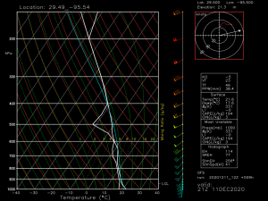
This hodograph from a GFS forecasted sounding near Houston seems favorable for the formation of a few supercells. It’s definitely something to be aware of today. Have a way to receive warnings and please take shelter if any are issued.
Okay, so to summarize: A narrow band of snow in the cold sector of the storm, locally heavy rainfall in the warm sector, and potential severe storms closer to the Gulf coast. And there you have a look at this weekend’s system.
Jacob will be blogging tomorrow to fill you in on the next system and anything else of importance, should it arise. As always, we will keep you updated here and on Twitter.
Have a wonderful weekend!!
