Severe Threat, Part Two (for 11/25/20)
Good evening!
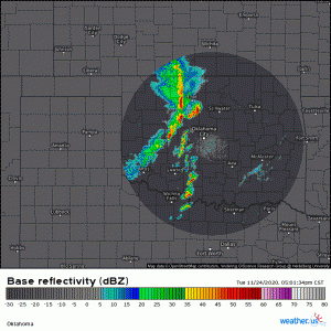
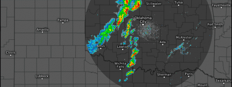
Well, the severe event we have been talking about for a few days is in progress as I write this. So far, there have been an abundance of severe thunderstorm warnings, but thankfully no tornado warnings. The storms have transitioned from a cellular nature to mostly a squall line with a few cells ahead of it.
(link: https://weather.us/radar-us/oklahoma/reflectivity/KTLX_20201125-001255z.html)
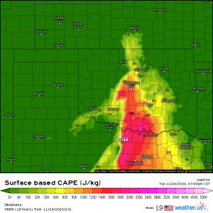
Tornadoes will still be possible with enough CAPE to support them in places…
(link: https://weather.us/model-charts/rapid-us/oklahoma/cape-surface/20201125-0100z.html)
…but once storms transition from cellular to squall lines, tornadoes become less likely. They are not impossible, of course, as any “kink” in the line can indicate a rotating portion of that line, but the main threat then transitions to damaging winds. It is in these squall lines that we see things like bow echoes and, on the more severe side, derechos.
The line of storms will continue to slide east through the night and will bring a renewed severe threat to the Mid-west and deep South tomorrow.
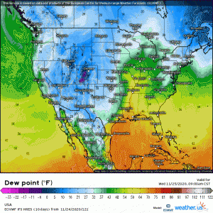
While dew points will climb into low-to-mid 60s across Louisiana, Mississippi, and Alabama…
(link: https://weather.us/model-charts/euro/usa/dewpoint-f/20201125-1800z.html)
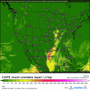
CAPE should be significantly less than the values we have seen today across Oklahoma and Texas.
(link: https://weather.us/model-charts/euro/usa/mu-cape/20201125-1800z.html)
For this reason, the SPC mentions that the main threat will be damaging winds, though they do not completely rule out the idea of a tornado or two. This threat, however is mainly confined to Alabama, Mississippi, and perhaps the southern reaches of Tennessee where dew points will be in the 60s and the instability will be higher. Places north of the aforementioned areas will mainly see gusty storms with possible heavy rainfall.
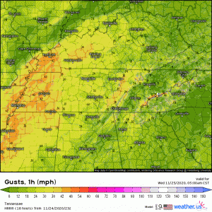
Gusty winds unrelated to thunderstorms will also be an issue tomorrow, especially for Kentucky and Tennessee and into the Smokies. The mountains are prone to some serious wind when strong systems approach from the east. Gusts upwards of 60 mph are certainly possible here tomorrow. If you’re taking advantage of the holiday and hiking the mountains, I would suggest you wrap it up by mid-day. Getting caught on the trails when the wind picks up is a bad place to be.
(link: https://weather.us/model-charts/rapid-us/tennessee/gusts-mph/20201125-1700z.html)
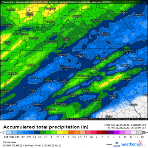
I also need to mention some relatively heavy rainfall with totals approaching or or exceeding an inch in places, especially through the mountains.
Rainfall totals become enhanced in this area when the moisture is lifted into the mountains through the process of orographic lifting. More moisture lifted to condensation height = more available rainfall.
Jacob and I will keep you updated throughout the day tomorrow, as the situation warrants it, on Twitter and also through our blog. Have a wonderful evening!
