Friday Night Blog: Inversion Lesson
Good evening!
My blog is a little late today, as you may have noticed, but better late than never! Since there isn’t really any noteworthy weather going on right now, I thought I’d write about something you may have seen me tweet about over the last few days: Temperature Inversions.
Maybe you’ve heard that phrase used before. You may know what it means. If that’s you, you likely don’t need my little lesson. If you aren’t familiar with the phrase though, pull up a chair and let’s learn something tonight.
As you may or may not know, I am a resident of the Smoky Mountains. I love it here and the varying climates and weather patterns absolutely fascinate me. None more than a good temperature inversion, though. If you’ve visited our mountains, you know they’re tall, but not as tall as the Rockies. I live at the base of a 3000 ft mountain with a great view of Mt. LeConte, the third highest peak east of the Mississippi at an elevation of 6,594 ft. We’ll use this particular mountain to as an example to illustrate and visualize a temperature inversion in a bit.
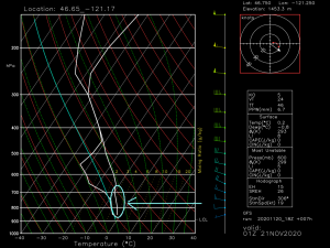
When the atmosphere is in a normal, stable state, the temperature gradually cools with increasing height.
(link: https://weather.us/model-charts/standard)
I’ve circled a spot on the sounding above. For the most part, the temperature is decreasing as we are rising through the atmosphere.
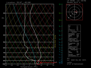
During an inversion, the temperature will increase with height.
If you look inside the red circle, you’ll notice the line is slanting upward, indicating a temperature increase. This is a sounding for Knoxville, TN. In this particular sounding, the 925 mb level or so seems to be at least 5 degrees warmer than the 1000 mb level.
For those who don’t know:
- 1000 mb = surface
- 925 mb = ~2500 ft
- 850 mb = ~4800 ft
- 700 mb = ~9900 ft
So essentially, it is warmer 2500 ft above the ground than it is at “sea level,” or close to it.
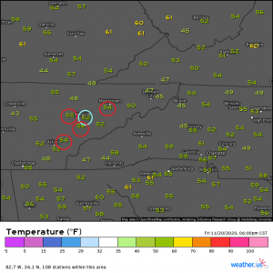
(link: https://weather.us/observations/836-w-353-n/temperature-f/20201121-0000z.html)
Here are some current temperatures for you. The blue circle is Knoxville, where the sounding is from.
- Knoxville- elevation: 833 ft, temperature: 52 degrees
- Morristown- elevation: 1312 ft, temperature: 54 degrees
- Maryville- elevation: 980 ft, temperature: 56 degrees
- Madisonville- elevation: 1030 ft, temperature: 54 degrees
So you can see Knoxville has the lowest elevation and the lowest temperature. As we increase elevation and approach that 925 mb level (2500 ft), the temperature also increases.
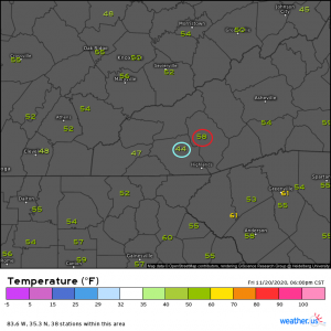
Here’s an even better example from the North Carolina side of the mountains.
- Jackson County Airport – elevation: 2857 ft, temperature: 58 degrees
- Franklin – elevation: 2021 ft, temperature: 44 degrees
Quite the gradient.
How do these inversions happen, exactly?
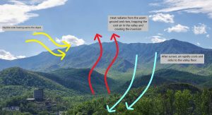
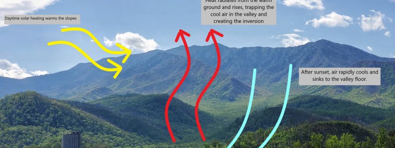
I’ve created a little graphic using a photo I took of Mt. LeConte this past summer. It happens just as I’ve described in the graphic. The daytime heating warms the slopes of the mountains. Once the sun has set, the air on the slopes rapidly cools and sinks to the valley. Meanwhile, the valley floor is busy releasing heat from its daytime heating. That heat rises over the cool air coming down the mountain and traps it in the valley while the warm air continues to rise into the elevations. Pretty cool, isn’t it?
Generally, a nighttime inversion like this will persist until the sun rises the next morning and sufficiently heats the air in the valley to where a thermal gradient no longer exists.
There are other types of inversions, but covering them all right now would have me writing all night. I mainly wanted to cover this one for now since I’ve been mentioning it a lot over the past few days. Now next time I tweet about a sweet inversion in the Smokies, more of y’all will know what I’m talking about!
Hope you learned something new tonight! Have a fantastic weekend!
