Lake Effect Snow Now, Warmth to Come
Good morning!
Well, we are back to winter vibes in the east this morning.
(link: https://weather.us/model-charts/rapid-us)
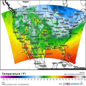
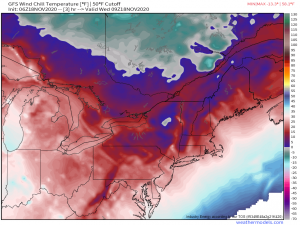
The east coast from about Tennessee northward is experiencing some of the coldest temperatures yet this season. To make matters worse (or better, if you’re a cold weather fan), it’s still a bit windy in places. So add in that wind chill factor and a decent portion of the Northeast “feels like” single-digit temperatures.
There’s even a small pocket of below-zero wind chills in upstate New York.
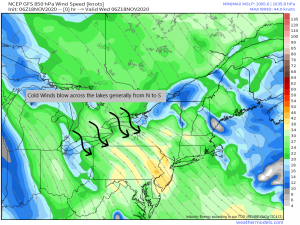
Winds from the northwest as part of a trough bringing us this, uh, festive? weather are also enabling Lake Effect snow yesterday and this morning across Ohio, Pennsylvania, and New York. Hold on to that concept, we’re going to talk about the mechanics of it in a bit. But first, back to the daily weather.
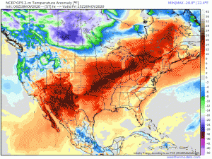
Our theme with this cold weather so far this season has been “it won’t last,” and the current cold shot is no exception. Changes begin happening today and will bring warmer weather for the foreseeable (forecastable) future.
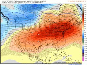
Check out the gif above and notice the ridge sitting over the middle of the country. That’s what’s been enabling the milder temperatures for the west coast over the last few days. The ridge will build in, pushing the trough you see over the northeast out. Temperatures will warm to above average, though not quite as crazy warm as the record-breaking levels we saw early in the month.
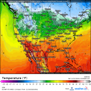
By Saturday, the south will be back to 60s and 70s. Even the mid-Atlantic will be brushing the 60s.
Take a look again at the gif depicting the ridge and trough set up. You’ll notice at the beginning the flow is is meridional (north to south in a wave-like pattern). That’s what enables the cool air to flow southward (troughs) and the warm air to flow northward (ridges). Toward the end of the gif, the flow becomes zonal (east to west, no, or only very shallow, waves).
Looking into the mid-range pattern, it stays that way with no anomalous troughs or ridges in sight until maybe next weekend, post-Thanksgiving. What does that mean, though? Well, basically what I wrote above. Without a trough digging down or a ridge building up, overly-cold and overly-warm air has no way to reach us. Temperatures across the States will more or less stagnate in this pattern.
Generally speaking, we won’t find any extremely above or below temperatures for the next week or so. Overall, we look to be very slightly above average in most places with the exception of the Midwest, as is typical of a La Nina pattern. More about that here if you missed that particular blog.
Enjoy the warmth while it’s here! Or, if you’re like me, hate every second of it and hope for snow later in the season (I really just want a little mountain snow).
Speaking of snow, let’s talk about Lake Effect snow. Those in proximity to the Great Lakes know it happens, but how?
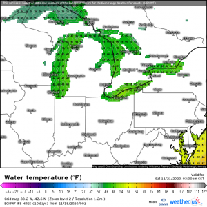
For starters, you need wind out of the north/northwest. These winds are common this time of year as numerous troughs pass through the region. Next, the lakes need to still be comparably warm. Water has a high heat capacity, meaning it takes longer to heat up and longer to cool down than air. So, after the summer warming, the water temperature of the lakes stays “warm” long after the air has cooled.
(link: https://weather.us/model-charts/euro/832-w-426-n/water-temperature-f/20201121-2100z.html)
The lakes, especially Erie and Ontario, are still well above freezing right now.
Once that cold air from the north blows across the warm water, magic happens.
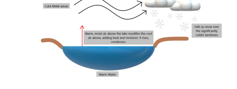
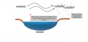
As the cold air blows over the warm lake water, the air directly above the lake, which is comparatively warm and moist, modifies the cold air mass from below. It warms the lower layer and also transfers it’s moisture. The newly warmed air then rises and the moisture in it condenses which forms clouds and eventually precipitation. The greater the temperature difference between the lake surface and air aloft (known as the lapse rate), the heavier the lake effect snow. The wind then blows the clouds containing the precipitation downstream, creating “bands” of snow.
There are two types of bands: multi-band and single band.
Multi-band is more common over Lakes Michigan and Huron as the wind tends to blow width-wise, known as a short fetch (fetch = length of the water over which the wind blows) across their surfaces.
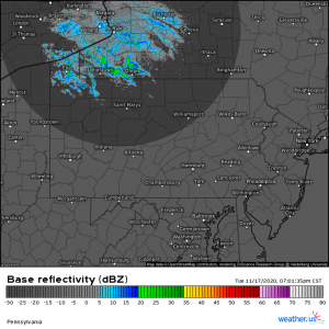
(link: https://weather.us/radar-us/pennsylvania/reflectivity/KBUF_20201118-010135z.html)
Yesterday, PA, OH, and NY saw a multi-band event as the winds blew in a short fetch across Erie and Ontario. It made for some pretty scenery, but not much in the way of accumulation. Multi-bands generally don’t carry huge totals.
Single-bands, however, do. These occur when the winds blow length-wise (long fetch) over the lake surface. This is commonly seen over Lakes Erie and Ontario due to their orientation. More available moisture = heavier snowfall = higher totals. It is common in these areas for multiple feet of snow to fall from a single-band event.
This process can continue until the lakes freeze over or until the thermal gradient (temperature difference) between the water and the air aloft is no longer sufficiently far apart.
So there’s a short weather lesson for you, since Lake Effect Snow is common this time of year. Hope you learned something new! Stay tuned to our blog throughout the week as we monitor the changes in the weather, any big events that arise, and even any possible developments in the tropics.
Have a wonderful day!



I was looking at your post on Lake Effect Snow.
I live in the Great Lakes area and wrote an extensive article entitled 14 Areas Around the Great Lakes With High Lake Effect Snow – How Does it Happen https://thumbwind.com/2021/03/07/great-lakes-lake-effect-snow/
You might find some information and resources to give your readers more background on just how much snow we get here around the Great Lakes. I hope you will consider it.
Mike