The West Chills Out as Eta Lurks in the Caribbean (again)
Good morning! It’s finally Friday. I don’t know about the rest of you but I’m pretty sure this week has lasted about 84 years. Hopefully you all have some fantastic weekend plans to balance out the craziness of this past week. I’m going camping for the first time (my son’s birthday request) so if you don’t see a blog from me on Monday, you’ll know I didn’t survive it.
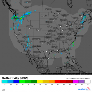
Let’s start with a look at the current radar:
(link: https://weather.us/radar-us/usa/20201106-130200z.html )
Still pretty quiet across the country but a change is occurring in the West. The precipitation you see on radar is mostly rain but changing to snow over the elevations of the Cascades. The trough we talked about earlier is beginning to slide in behind the ridge that has been providing us with the gorgeous, warm weather we’ve been experiencing for most of the week.
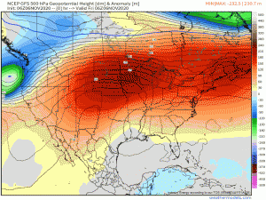
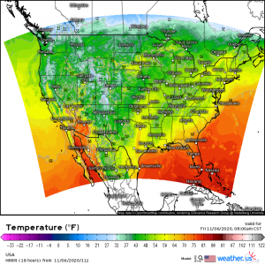
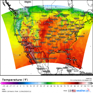
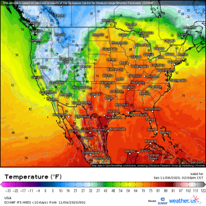
As seen in the gif above (ignore the tropical system; we’ll get to that in a bit), a fairly deep trough will take over much of the Western US, sending temperatures plummeting. Take a look at the current temperatures, today’s forecasted highs, and forecasted temperatures over the weekend:
(link: https://weather.us/model-charts/rapid-us)
(link: https://weather.us/model-charts/euro/usa/temperature-f/20201109-0500z.html)
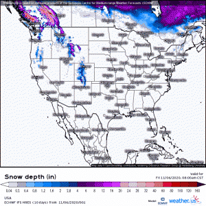
So, as you can see, the West is going to be downright frigid while the East remains warm for awhile longer. And yes, it will snow out west. Especially in the mountains.
(link: https://weather.us/model-charts/euro/usa/snow-depth-in/20201109-0500z.html)
As far as the long-range outlook goes, there isn’t much sign of the ridge over the East breaking down any time before maybe the middle of the month – or possibly longer – so people in the East: enjoy your warmth while the West takes one for the team (sorry, y’all).
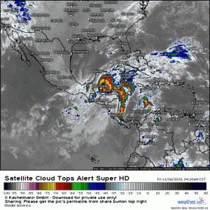
Meanwhile in the Caribbean, Eta has emerged from Central America and is back over warm waters.
(link: https://weather.us/satellite/middle-america/top-alert-superhd-15min/20201106-1320z.html)
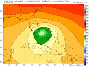
Eta is extremely ragged-looking and though a decent amount of convection is firing this morning, its interaction with land has basically destroyed it’s core. All of the current convection exists to the north/northeast of the center. Eta will essentially have to undergo cyclogenesis again to reorganize into a recognizable system. Is that possible? Maybe. Most of the models suggest Eta at least reaching tropical storm (albeit not a very pretty one) status before it reaches the Gulf next week. Some of the more aggressive models such as the HWRF suggest that Eta may reach low-end hurricane strength as it approaches south Florida.
(available in the model lab on weathermodels.com)
The HWRF is notoriously aggressive with forecast strength, however, it has managed to accurately predict some of the stronger hurricanes we have seen this year. So while it is likely that Eta will remain a messy tropical storm, this year has been full of surprises regarding tropical systems so… prepare accordingly. Before anyone takes that the wrong way: I’m not forecasting a cat 5 monster. All I’m saying is that Eta has the potential to be either a big sloppy mess or a slightly stronger mess.
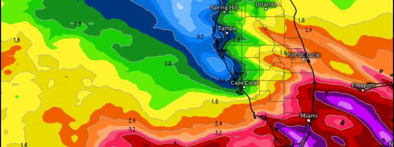
Regardless of eventual classification or category, Eta is still carrying a lot of moisture. South Florida in particular should see some hefty rain totals out of this system. 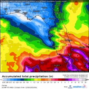
(link: https://weather.us/model-charts/euro/florida/acc-total-precipitation/20201111-0600z.html)
This particular run of the Euro suggests totals approaching 8 inches south of the Miami area by Tuesday night.
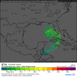
As for the future track of Eta….
(link: https://weather.us/cyclone-tracks/euro/902-w-263-n/2020110606-240-eta.html)
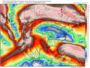
…once the core reforms a bit, we will have a more solid idea of Eta’s eventual destination. Generally, an initial pull northeast is expected. After that, Eta may be pulled into south Florida or possibly yanked back northwest into the southeastern Gulf. Should that happen, eventual landfall somewhere along the southeastern Gulf coast is a possibility. Your take-away here: South Florida will see hefty rainfall regardless of Eta’s reorganization and strength. The eastern Gulf states should keep an eye on the developing forecast and plan accordingly. Sea surface temperatures are still high in the Caribbean and the southern Gulf BUT Eta will have to build itself from the ground up again, survive any land interaction with Cuba, and …
…battle through wind shear in order to get itself together again. I would not expect a strong hurricane, or possibly not even a hurricane, based on what we’ve talked about but don’t let your guard down either. There will still be a lot of rain to contend with where ever Eta goes. A common misconception is that the winds are the most dangerous part of a tropical system. It is actually the water component. Fresh water flooding and storm surge kills significantly more people than wind does.
Look for Jacob’s blog tomorrow with more information on Eta as we see if it can get it’s act together.
Have a wonderful weekend!


Thank you! I hope you survive you camping trip. The updates are very informative.