Hurricane Lane Likely To Impact Hawaiian Islands Late This Week
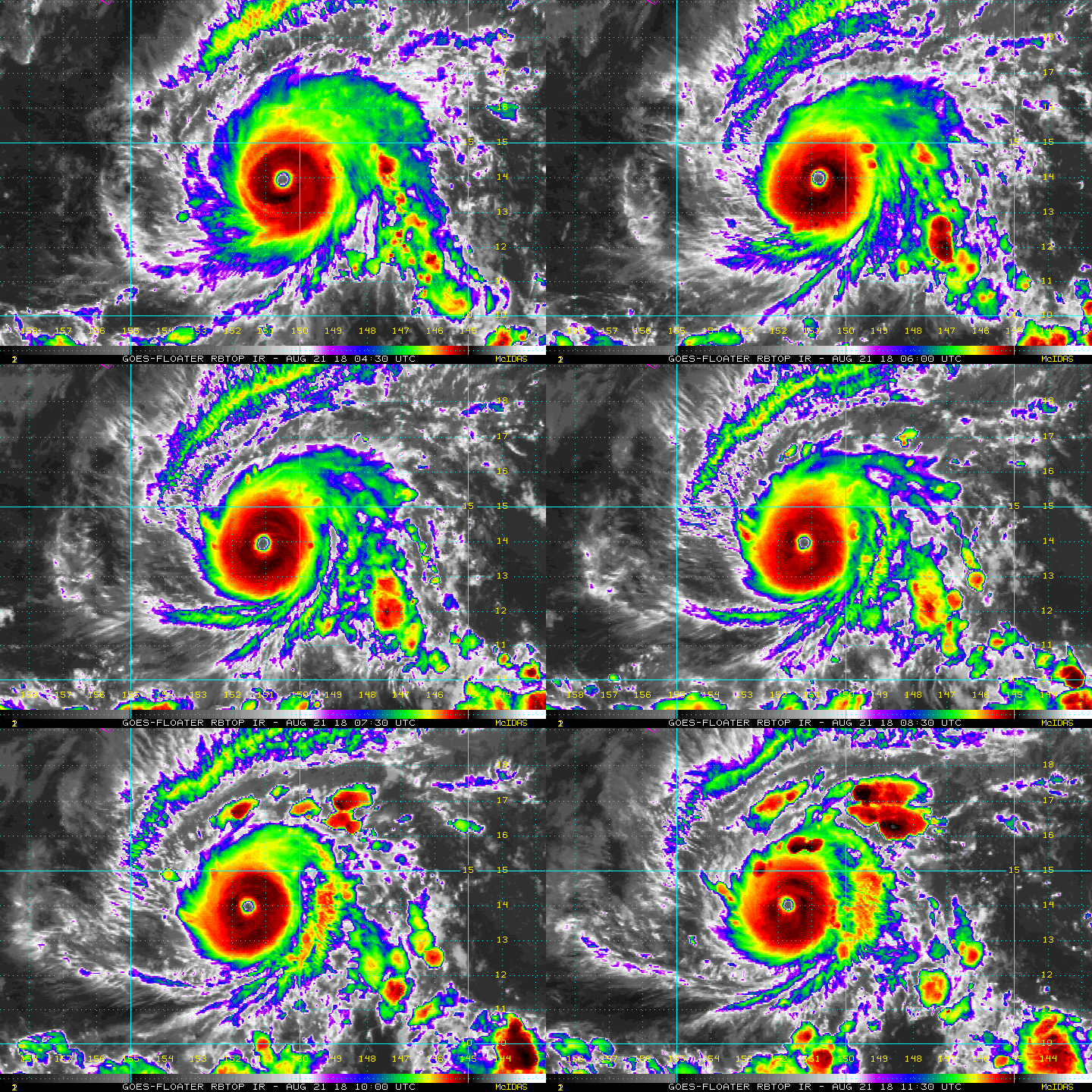
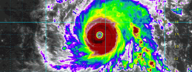
Morning satellite data and observations indicate that Hurricane Lane strengthened overnight into a high-end Category 4 storm. We note in the imagery below the concentric nature of the eyewall as well as convective episodes across the structure of the storm, overall, giving us insight on the health and strength of the storm.
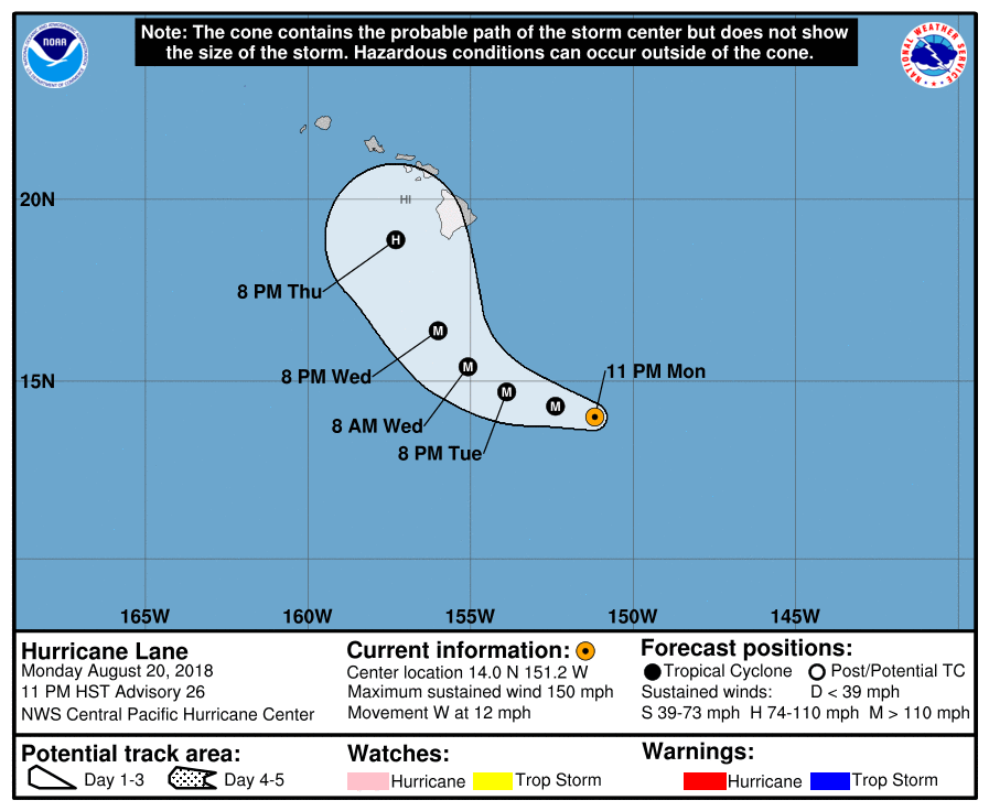
With the latest advisory package from the NHC, the track of Lane has a cone of uncertainty associated with it. Note that the cone of uncertainty envelopes much of the Hawaiian Island chain. This means that the exact track can shift anywhere within that cone of uncertainty. By Thursday/Friday, Lane will be uncomfortably near the islands. Hurricane Warnings and Watches will likely be issued at some point over the next 24-48 hours.
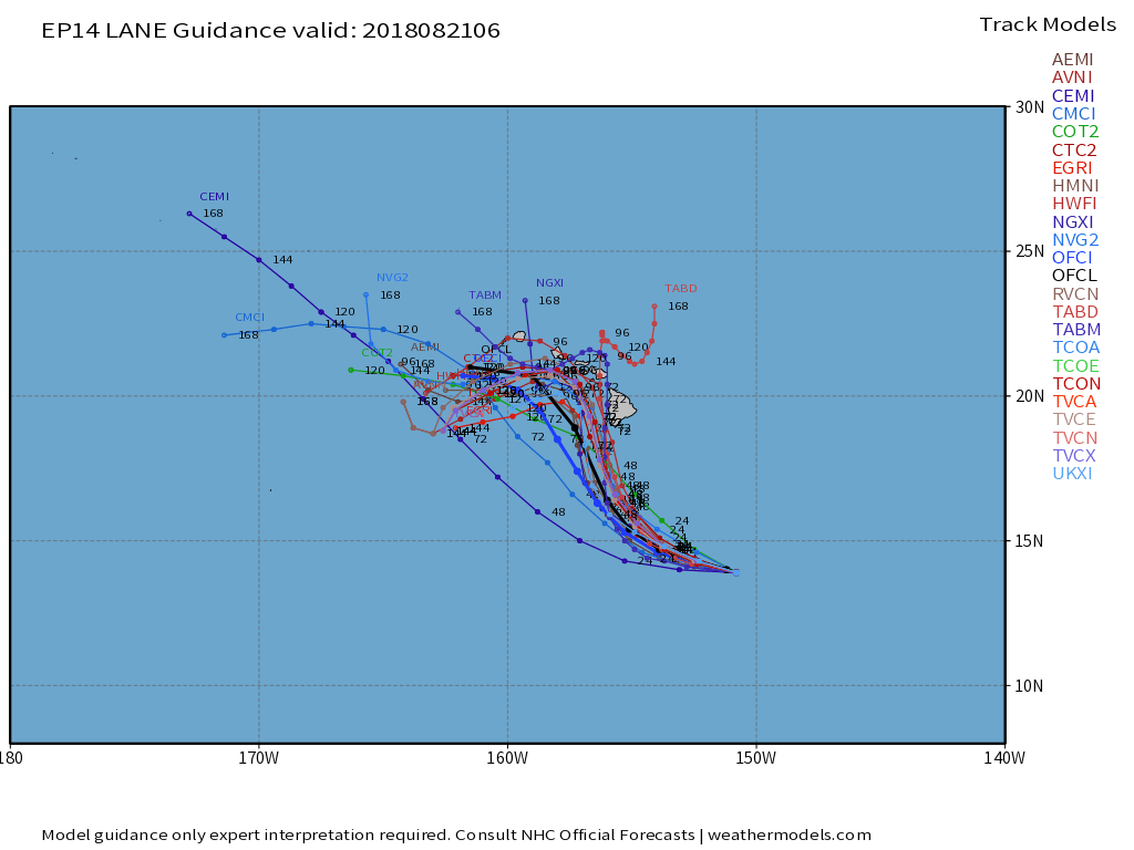
A majority of model tracks take Hurricane Lane into the Hawaiian Islands late in the week as a major hurricane (Cat 3/4 strength).
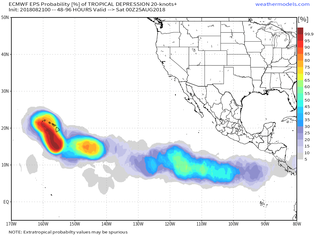
EPS data models a very high probability factor of Hurricane Lane having at least some impact to the Hawaiian Islands over the next 48-96 hours.
Interests in Hawaii and those with family or friends across the islands should keep a very close watch on the latest developments with Lane, remaining vigilant.
THREATS: Damaging winds, torrential downpours, rough surf, storm surge, mudslides
