Heavy Rains & Potential Flooding To Impact The Eastern US This Week
An active gulf stream will be the key driver in heavy rainfall across the east coast in the coming days. As we always say, models are simply tools that help us understand the state, fluidity and fickle nature of the atmosphere. A number of tools capture the atmospheric setup that we will be dealing with over the next few days that will push gulf moisture into the eastern seaboard, especially along and east of the Appalachians, mainly from the Mid-Atlantic on north.
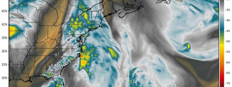
Guidance below illustrates precipitable water amounts along with water vapor. Both are measures of how much moisture is available in the atmosphere at a given point in time.


Below, we see through infrared data assimilation the amount of rainfall that is expected to impact the eastern US over the next 48 hours.
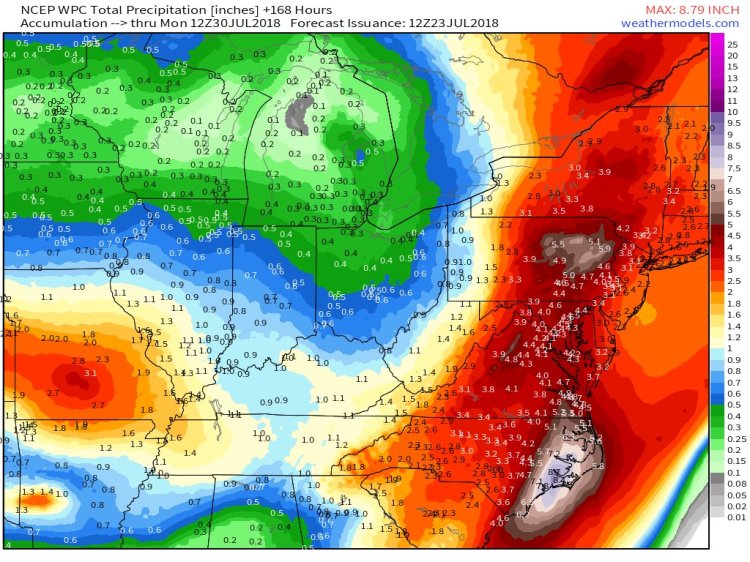
The Weather Prediction Center is suggesting rainfall amounts of generally 2-6″, while some places could locally see 6-8″+ over the next week.
The NWS Middle Atlantic River Forecast Center sent this statement out earlier today in regards to the gravity of the rain and flooding threat.
***A potentially dangerous, even life threatening, situation is setting up for much of the Mid-Atlantic.***
After a weekend of 2-7+” rain for much of the Mid-Atlantic, an additional 3-5+” of rain is expected over the next 3 (three) days. pic.twitter.com/XtfFjay56D— NWS MARFC (@NWSMARFC) July 23, 2018
Maps available for subscription at https://weathermodels.com — please take a Tour to see our features at https://weather.us/


