Some Thoughts On The 2018 Atlantic Hurricane Season
With today marking the official start of the Atlantic Hurricane season, there are three important factors to watch for as we progress through the season.
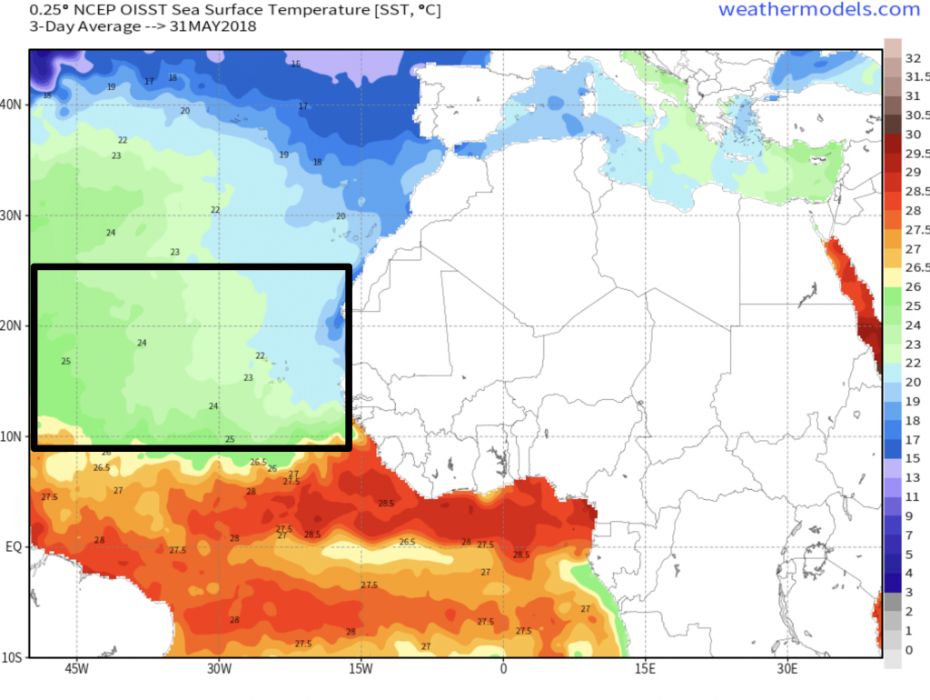
1. How warm (or cold) the SSTs (sea surface temperatures) are across the MDR (Main Development Region – which I outlined in the graphic below). The warmer the temperatures, the better the breeding ground for tropical cyclone development.
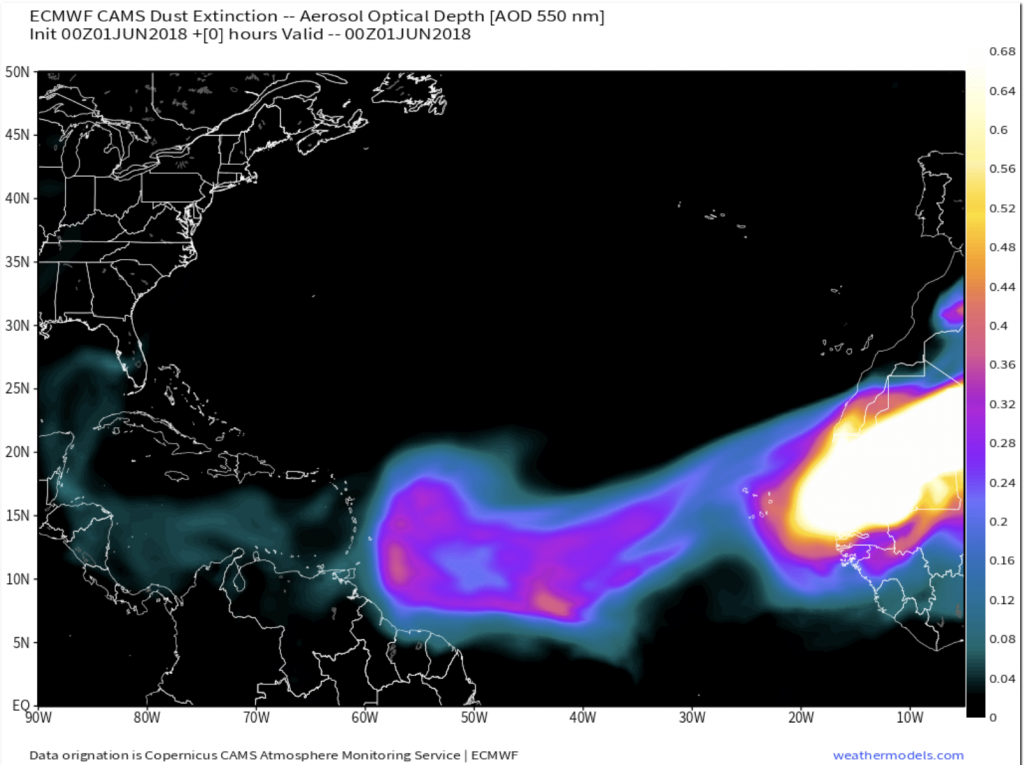
2. We need to keep a close watch on the SAL (Saharan Air Layer). This is the wave of dust that is ejected off the northwest coast of Africa from the Saharan Desert. This desert air will hinder any tropical cyclone development as it chokes off any moisture feed with dry, barren air. The greater the SAL, the less of a threat for tropical activity.
3. How much is shear is present in the MDR, the Gulf of Mexico, the Caribbean, etc. Shear can be directional as well as speed-driven. Shear is BAD for tropical development as it will generally tear most tropical systems apart. Few have survived, many have fallen to their demise because of shear.
Useful acronyms that may be used throughout hurricane season:
* MDR – Main Development Region
* SAL – Saharan Air Layer
* GOM – Gulf of Mexico
* TC – Tropical Cyclone
* TD – Tropical Depression
* TS – Tropical Storm
* PTS – Post-Tropical Storm
* ETS – Extra-Tropical Storm
* STS – Subtropical Storm
* Some others may pop up along the way.
Quick thoughts on the 2018 Atlantic Hurricane Season
Honestly, I’ve decided to approach hurricane season in a different light this year. Instead of dishing out predictions, they become moot as the “numbers” become strictly relative. What do I mean by “relative”? When talking about an active season, what exactly do we base our measurement off of? What may not be an active season for someone living along the Gulf Coast may be an active season for someone living along the coastline of Florida. Case in point: Andrew in 1992. It was a very quiet season, until Andrew. No one will ever remember the 1992 hurricane season as a quiet one because of Andrew and disaster and humanitarian crisis that followed. All it takes is one hurricane that impacts your town for that to be considered an active year for you. Hence, the term “relative”.
From what I have gathered, months of research have led me to suspect that this year will feature a number of tropical systems matching or falling slightly below climatological averages. BUT, keep in mind, if you have an all-around quiet season and another Harvey forms, the “average to below average” idea gets tossed out the window. This is why I feel it’s so difficult (on a scientific and psychological level) to quantify such an outlook. Tropical Outlooks are a beast of a different kind as compared to a winter outlook. I sincerely these notes have helped provide you with an idea tangibles and intangibles of a hurricane season. Take any hurricane outlook you may see on social media or the internet with a grain of salt. Use it as a guide, not gospel truth.


