99L, Threat to Gulf, Organizes Steadily
It’s August 25th, which means we’d be wise to expect intense tropical cyclones that could threaten population centers in the US. Still, forecasters have grown concerned by increasingly potent suggestions from several models on how 99L could evolve over the next week.
Sometimes, people act as if it’s a flaw to become invested in dramatic model runs that depict very strong hurricanes impacting major cities. While such output loops definitionally tell only part of the story, they are still extremely valuable tools in identifying medium-range threats, and the questions we should be asking about these threats.
That brings me to today’s realization, inspired by the day five GFS, that I would have to write a blog on an as-of-yet unassuming invest south of Jamaica.
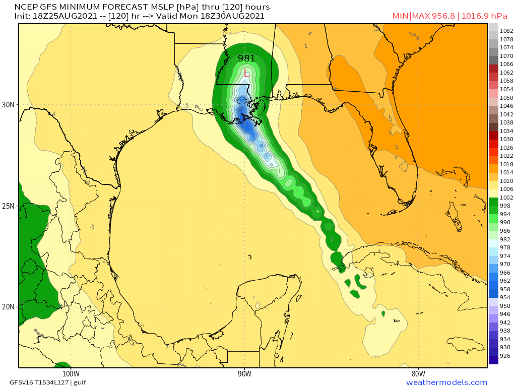
The model has leaned east and west all day, but has steadily depicted a major hurricane landfall along the northern Gulf from our weak mass of clouds. The latest run, taken literally, shows the storm strengthening to a perhaps category three intensity before striking New Orleans. Hopefully, by the end of this blog, I can convince you both that such a model run should not be taken literally, but that examination of the atmosphere behind it (and other model runs today) tells us that 99L is nonetheless a threat that should be taken very seriously.
Wherever we end up five days from today depends on, well, where we are today. When we deal with continental weather, we often have the advantage of airplanes, radar, balloons, satellite, and surface observations to construct very accurate real-time assumptions of what the atmosphere is doing in the present. Our skill in this regard falls off with the number of data points, and we typically don’t know as much as we wish we did about the structure, organization, and intensity of tropical cyclones over the open ocean.
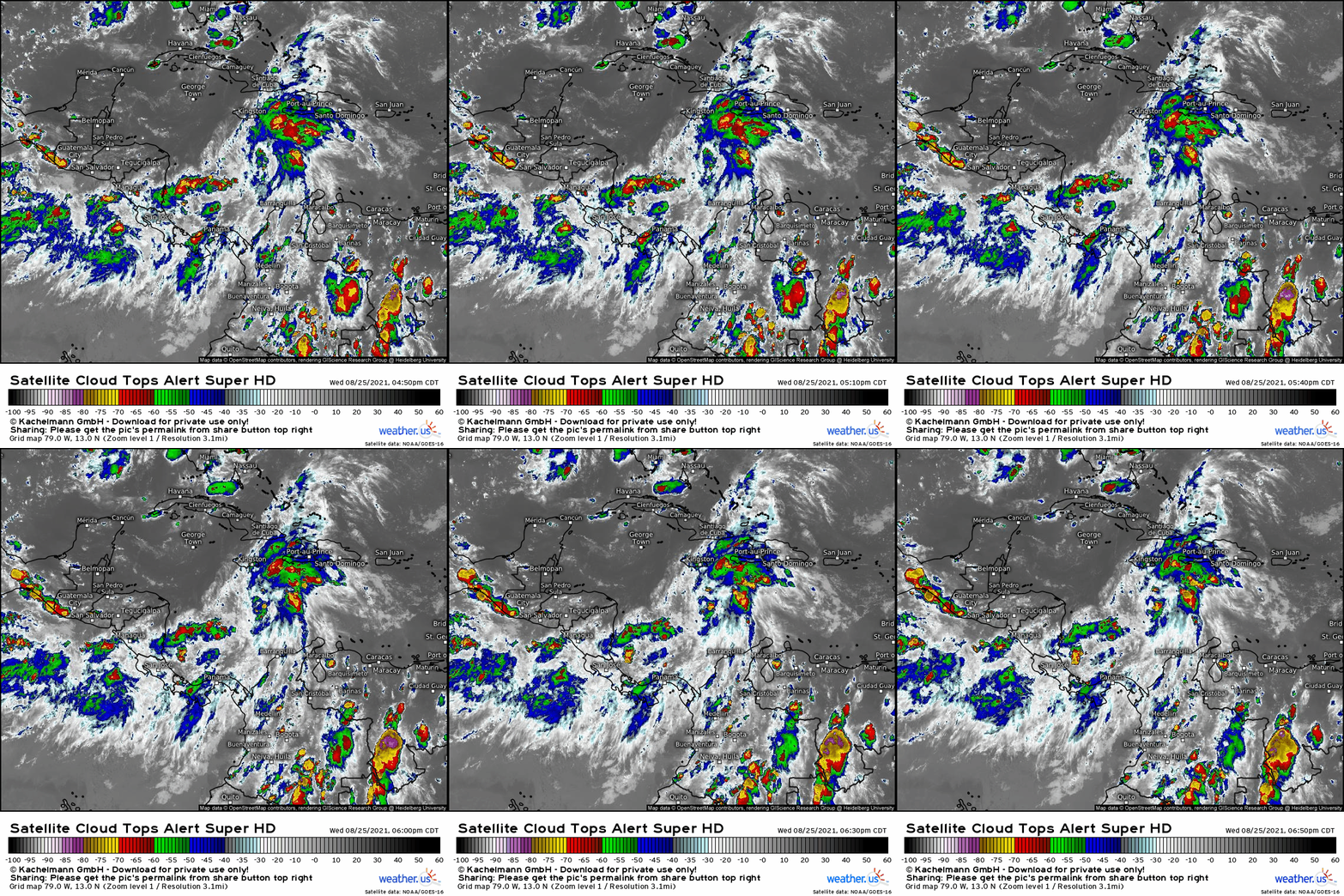
That brings us to 99L, a mass of thunderstorms over the southern Caribbean both disorganized and fairly anemic at this hour. A large gyre, our main source of uncertainty at the moment is where, exactly, the center actually develops.
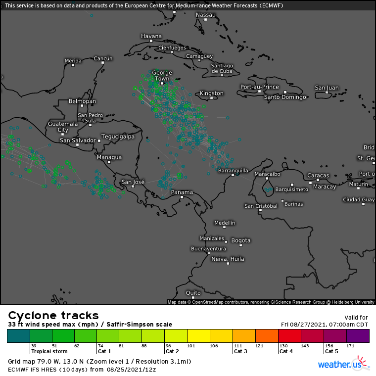
This uncertainty has led to a fair degree of spread amongst models and ensembles- how could it not? However, as thunderstorms increasingly cluster on the northern edge of the invest’s axis, it seems almost certain the storm will clear Central America to the north. This is still an assumption, but it is one supported by what little real-time data we have tonight.
With a large-scale anticyclone over the east US keeping steering currents locked towards the northwest, it seems quite likely that 99L will end up moving towards the Cuba/Mexico gap by day 3, no matter where (within our assumption) the storm’s center ends up over the next 12 hours.
Once here, 99L (probably a named TC by then) will have to thread a needle between mountainous landmasses to the east and west that could well disrupt the storm. But the system appears to be well-positioned to potentially avoid both countries, surging north into the bathtub waters of the Gulf.
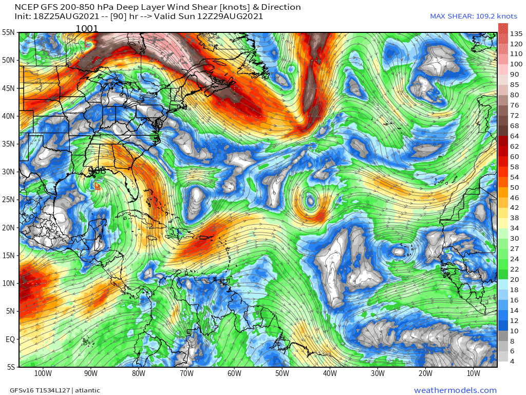
Besides SSTs, which are once again anomalously high this year, the TC will likely have a dramatically favorable environment to strengthen due to duel outflow that should increase in speed along streamline. This pattern is why many models depict rapid intensification into a major hurricane by Monday.
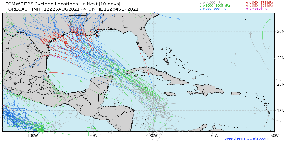
One thing we can’t even pretend to know yet is the eventual landfall location of the storm that should arise from 99L. Ensemble models show a wide spread due largely to runaway chaos from uncertainty in current position. Really, the entire Gulf from Tampa to northeast Mexico should watch the storm this week.
But don’t just watch- prepare. This could be a really dangerous situation, depending on how the dice fall- while a nothing burger is still on the table, so is a disaster more expensive than Katrina if this thing hits Houston dead on, and so is a scenario anywhere in the massive chasm between these two possibilities. This all means that now is the time to plan.
That’s all for now. See you all Friday.
